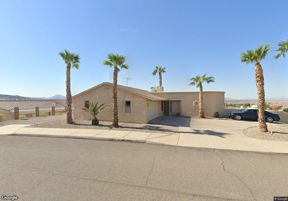
551 Roanoke Dr Lake Havasu City, AZ 86406
Estimated Value: $439,867 - $522,000
--
Bed
1
Bath
1,539
Sq Ft
$322/Sq Ft
Est. Value
About This Home
This home is located at 551 Roanoke Dr, Lake Havasu City, AZ 86406 and is currently estimated at $496,217, approximately $322 per square foot. 551 Roanoke Dr is a home located in Mohave County with nearby schools including Starline Elementary School, Thunderbolt Middle School, and Lake Havasu High School.
Ownership History
Date
Name
Owned For
Owner Type
Purchase Details
Closed on
Mar 5, 2021
Sold by
Horn Kevin J and Horn Nancy A
Bought by
Horn Kevin J and Horn Nancy A
Current Estimated Value
Home Financials for this Owner
Home Financials are based on the most recent Mortgage that was taken out on this home.
Original Mortgage
$151,000
Outstanding Balance
$135,361
Interest Rate
2.7%
Mortgage Type
New Conventional
Estimated Equity
$360,856
Purchase Details
Closed on
Feb 24, 2010
Sold by
Hale Dawn Michelle
Bought by
Pawasarat Horn Nancy and Horn Kevin
Purchase Details
Closed on
Jul 23, 2003
Sold by
Pawasarat Nancy
Bought by
Horn Kevin and Pawasarat Nancy
Home Financials for this Owner
Home Financials are based on the most recent Mortgage that was taken out on this home.
Original Mortgage
$95,000
Interest Rate
5.29%
Mortgage Type
Stand Alone Refi Refinance Of Original Loan
Purchase Details
Closed on
May 14, 2003
Sold by
Pawasarat Edward L and Pawasarat Mary E
Bought by
Pawasarat Nancy
Create a Home Valuation Report for This Property
The Home Valuation Report is an in-depth analysis detailing your home's value as well as a comparison with similar homes in the area
Home Values in the Area
Average Home Value in this Area
Purchase History
| Date | Buyer | Sale Price | Title Company |
|---|---|---|---|
| Horn Kevin J | -- | None Available | |
| Pawasarat Horn Nancy | -- | None Available | |
| Horn Kevin | -- | Capital Title Agency Inc | |
| Pawasarat Nancy | $112,500 | Capital Title Agency Inc |
Source: Public Records
Mortgage History
| Date | Status | Borrower | Loan Amount |
|---|---|---|---|
| Open | Horn Kevin J | $151,000 | |
| Previous Owner | Horn Kevin | $95,000 |
Source: Public Records
Tax History Compared to Growth
Tax History
| Year | Tax Paid | Tax Assessment Tax Assessment Total Assessment is a certain percentage of the fair market value that is determined by local assessors to be the total taxable value of land and additions on the property. | Land | Improvement |
|---|---|---|---|---|
| 2026 | $755 | -- | -- | -- |
| 2025 | $1,530 | $41,727 | $0 | $0 |
| 2024 | $1,530 | $40,648 | $0 | $0 |
| 2023 | $1,530 | $33,409 | $0 | $0 |
| 2022 | $1,464 | $25,263 | $0 | $0 |
| 2021 | $1,632 | $23,248 | $0 | $0 |
| 2019 | $1,551 | $19,520 | $0 | $0 |
| 2018 | $1,499 | $17,871 | $0 | $0 |
| 2017 | $1,485 | $16,897 | $0 | $0 |
| 2016 | $1,347 | $15,323 | $0 | $0 |
| 2015 | $1,291 | $13,083 | $0 | $0 |
Source: Public Records
Map
Nearby Homes
- 532 Roanoke Dr
- 2970 War Eagle Dr
- 3040 Gypsy Dr
- 2910 Coconino Dr
- 786 Powder Dr
- 3135 Cotati Dr
- 2951 Saddleback Dr
- 2997 Edgewood Dr
- 700 Apache Dr
- 2876 Plaza Del Oro
- 3150 Star Dr
- 680 Yosemite Dr
- 3651 Jamaica Blvd S
- 3066 Star Dr
- 2947 Jamaica Blvd S
- 670 Avenida Laredo
- 815 Rolling Hills Plaza N
- 677 Avenida Laredo
- 2750 Via Naranja
- 3235 Silverspoon Dr
- 2990 Coconino Dr
- 2991 War Eagle Dr
- 2981 War Eagle Dr
- 541 Roanoke Dr
- 528 Roanoke Dr
- 2980 Coconino Dr
- 536 Roanoke Dr
- 2971 War Eagle Dr
- 3000 Chemehuevi Blvd
- 2991 Coconino Dr
- 531 Roanoke Dr
- 2998 Chemehuevi Blvd
- 531 Roanoke Dr
- 2998 War Eagle Dr
- 3010 Chemehuevi Blvd
- 2990 War Eagle Dr
- 2970 Coconino Dr
- 540 War Eagle Plaza
- 576 War Eagle Plaza
- 2990 Chemehuevi Blvd