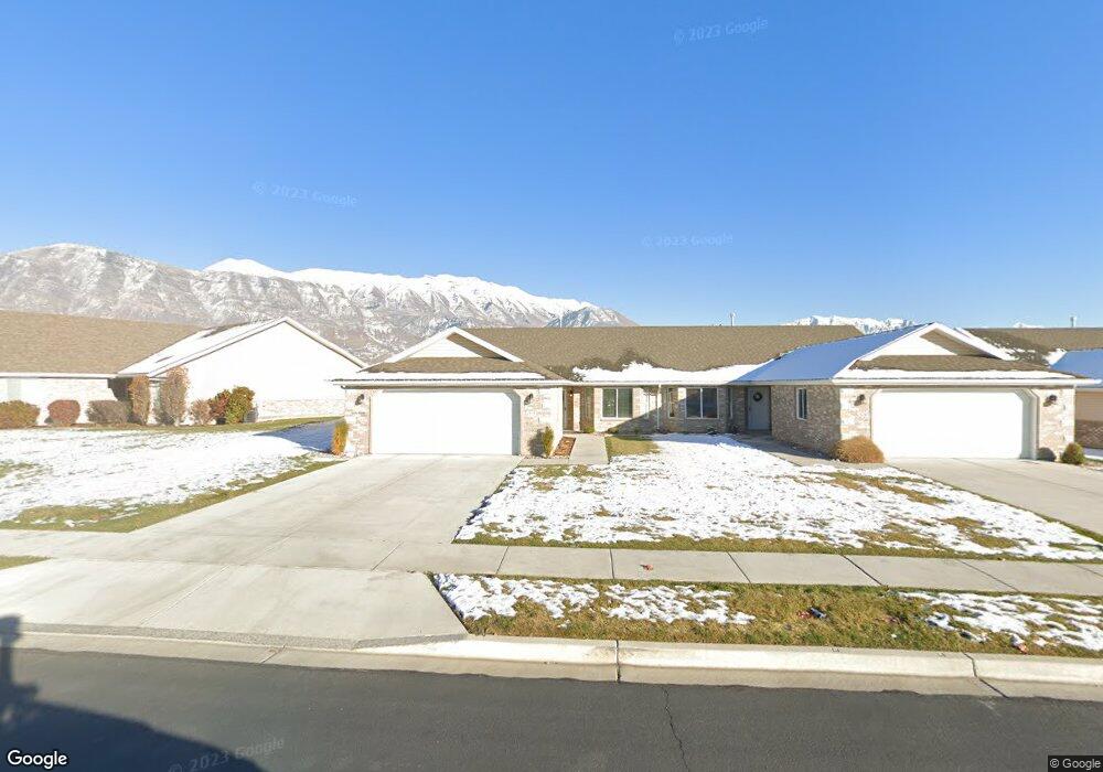
551 S 1040 E Unit 24 American Fork, UT 84003
Estimated Value: $422,000 - $464,000
3
Beds
2
Baths
1,450
Sq Ft
$303/Sq Ft
Est. Value
About This Home
This home is located at 551 S 1040 E Unit 24, American Fork, UT 84003 and is currently estimated at $439,787, approximately $303 per square foot. 551 S 1040 E Unit 24 is a home located in Utah County with nearby schools including Barratt Elementary School, American Fork Junior High School, and American Fork High School.
Ownership History
Date
Name
Owned For
Owner Type
Purchase Details
Closed on
Jan 22, 2020
Sold by
Turner Norman C and Turner Barbara H
Bought by
Turner Michelle and Michelle Turner Living Trust
Current Estimated Value
Purchase Details
Closed on
Apr 27, 2015
Sold by
Turner Norman C and Turner Barbara H
Bought by
Turner Norman C and Turner Barbara H
Purchase Details
Closed on
Dec 17, 2014
Sold by
Sb Smoot Construction Inc
Bought by
Turner Norman C and Turner Barbara H
Create a Home Valuation Report for This Property
The Home Valuation Report is an in-depth analysis detailing your home's value as well as a comparison with similar homes in the area
Home Values in the Area
Average Home Value in this Area
Purchase History
| Date | Buyer | Sale Price | Title Company |
|---|---|---|---|
| Turner Michelle | -- | None Available | |
| Turner Norman C | -- | None Available | |
| Turner Norman C | -- | Provo Land Title Co |
Source: Public Records
Tax History Compared to Growth
Tax History
| Year | Tax Paid | Tax Assessment Tax Assessment Total Assessment is a certain percentage of the fair market value that is determined by local assessors to be the total taxable value of land and additions on the property. | Land | Improvement |
|---|---|---|---|---|
| 2025 | $1,969 | $222,750 | $95,600 | $309,400 |
| 2024 | $1,969 | $218,735 | $0 | $0 |
| 2023 | $1,806 | $212,740 | $0 | $0 |
| 2022 | $1,950 | $226,655 | $0 | $0 |
| 2021 | $1,746 | $317,000 | $80,000 | $237,000 |
| 2020 | $1,698 | $299,100 | $80,000 | $219,100 |
| 2019 | $1,524 | $277,500 | $80,000 | $197,500 |
| 2018 | $1,414 | $246,300 | $80,000 | $166,300 |
| 2017 | $1,412 | $132,715 | $0 | $0 |
| 2016 | $1,480 | $129,250 | $0 | $0 |
| 2015 | $1,560 | $129,250 | $0 | $0 |
Source: Public Records
Map
Nearby Homes
- 502 S 1040 E Unit 252
- 502 S 1040 E Unit 221
- 502 S 1040 E Unit 137
- 502 S 1040 E Unit 243
- 502 S 1040 E Unit 226
- 477 S 850 E
- 1088 E 390 S
- 29 S 2000 W
- 796 E 500 S
- 782 E 500 S
- 407 S 740 St E
- 1795 W 120 S Unit 52
- 1775 W 120 S Unit 54
- 359 S 780 E
- The Hastings Plan at Tayside Farm - Townhome
- The Henley A Plan at Tayside Farm - Single Family Home
- The Denton Plan at Tayside Farm - Townhome
- The Henley B Plan at Tayside Farm - Single Family Home
- 293 N 1630 W
- 732 E 480 S
- 553 S 1040 E Unit 25
- 549 S 1040 E
- 565 S 1040 E Unit 26
- 547 S 1040 E
- 567 S 1040 E Unit 27
- 545 S 1040 E
- 545 S 1040 E Unit 387
- 544 S 1040 E
- 544 S 1040 E Unit 61
- 581 S 1040 E Unit 28
- 581 S 1040 E
- 543 S 1040 E
- 543 S 1040 E Unit 19
- 552 S 1040 E Unit 56
- 532 S 1040 E
- 546 S 1040 E Unit 60
- 583 S 1040 E
- 583 S 1040 E Unit 29
- 554 S 1040 E Unit 57
- 564 S 1040 E Unit 55