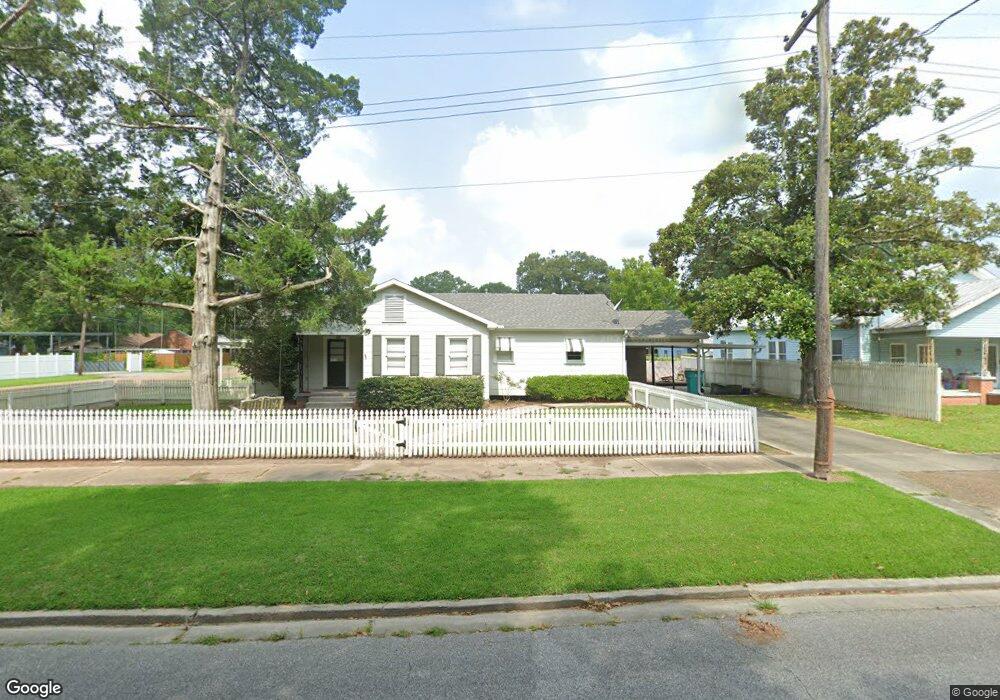
551 S 5th St Eunice, LA 70535
Estimated Value: $111,000 - $281,251
3
Beds
2
Baths
1,600
Sq Ft
$110/Sq Ft
Est. Value
About This Home
This home is located at 551 S 5th St, Eunice, LA 70535 and is currently estimated at $175,417, approximately $109 per square foot. 551 S 5th St is a home located in St. Landry Parish with nearby schools including Eunice Elementary School, Eunice Junior High School, and Central Middle School.
Ownership History
Date
Name
Owned For
Owner Type
Purchase Details
Closed on
Apr 11, 2025
Sold by
Michael Turner Trey and Borne Jessica
Bought by
Bergeron Holden Lane and Fuselier Caroline P
Current Estimated Value
Home Financials for this Owner
Home Financials are based on the most recent Mortgage that was taken out on this home.
Original Mortgage
$130,000
Outstanding Balance
$129,435
Interest Rate
6.76%
Mortgage Type
New Conventional
Estimated Equity
$45,982
Purchase Details
Closed on
May 14, 2010
Sold by
Feucht Robert and Feucht Faye Fruge
Bought by
Turner Trey Michael and Borne Jessica Michelle
Create a Home Valuation Report for This Property
The Home Valuation Report is an in-depth analysis detailing your home's value as well as a comparison with similar homes in the area
Purchase History
| Date | Buyer | Sale Price | Title Company |
|---|---|---|---|
| Bergeron Holden Lane | $130,000 | None Listed On Document | |
| Turner Trey Michael | $128,000 | -- |
Source: Public Records
Mortgage History
| Date | Status | Borrower | Loan Amount |
|---|---|---|---|
| Open | Bergeron Holden Lane | $130,000 |
Source: Public Records
Tax History
| Year | Tax Paid | Tax Assessment Tax Assessment Total Assessment is a certain percentage of the fair market value that is determined by local assessors to be the total taxable value of land and additions on the property. | Land | Improvement |
|---|---|---|---|---|
| 2024 | $4 | $8,710 | $980 | $7,730 |
| 2023 | $351 | $8,070 | $980 | $7,090 |
| 2022 | $351 | $8,070 | $980 | $7,090 |
| 2021 | $351 | $8,070 | $980 | $7,090 |
| 2020 | $347 | $8,070 | $980 | $7,090 |
| 2019 | $321 | $7,380 | $940 | $6,440 |
| 2018 | $321 | $6,910 | $470 | $6,440 |
| 2017 | $321 | $6,910 | $470 | $6,440 |
| 2015 | $294 | $6,810 | $940 | $5,870 |
| 2013 | $295 | $6,810 | $940 | $5,870 |
Source: Public Records
Map
Nearby Homes
Your Personal Tour Guide
Ask me questions while you tour the home.