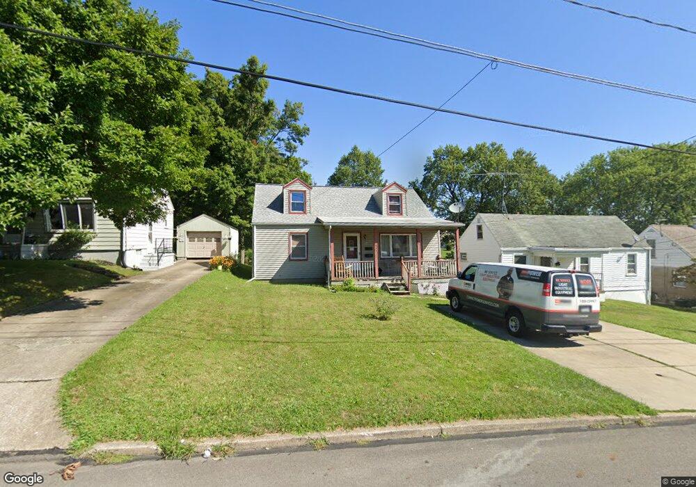
551 Spring St Struthers, OH 44471
Estimated Value: $128,588 - $153,000
3
Beds
1
Bath
1,248
Sq Ft
$115/Sq Ft
Est. Value
About This Home
This home is located at 551 Spring St, Struthers, OH 44471 and is currently estimated at $143,897, approximately $115 per square foot. 551 Spring St is a home located in Mahoning County with nearby schools including Struthers Elementary School, Struthers Middle School, and Struthers High School.
Ownership History
Date
Name
Owned For
Owner Type
Purchase Details
Closed on
Mar 6, 2023
Sold by
Benson Margaret
Bought by
Kannensohn Fredric A and Ohio Department Of Medicaid
Current Estimated Value
Purchase Details
Closed on
Dec 15, 2022
Bought by
Nanette J Mamounis
Purchase Details
Closed on
Jun 13, 2022
Sold by
Benson Margaret
Bought by
Mamounis Nanette J and Benson Michael
Purchase Details
Closed on
Feb 18, 1992
Bought by
Benson Edward and Benson Mgt
Create a Home Valuation Report for This Property
The Home Valuation Report is an in-depth analysis detailing your home's value as well as a comparison with similar homes in the area
Home Values in the Area
Average Home Value in this Area
Purchase History
| Date | Buyer | Sale Price | Title Company |
|---|---|---|---|
| Kannensohn Fredric A | -- | -- | |
| Nanette J Mamounis | -- | -- | |
| Mamounis Nanette J | -- | -- | |
| Benson Margaret | -- | -- | |
| Benson Edward | $24,000 | -- |
Source: Public Records
Tax History
| Year | Tax Paid | Tax Assessment Tax Assessment Total Assessment is a certain percentage of the fair market value that is determined by local assessors to be the total taxable value of land and additions on the property. | Land | Improvement |
|---|---|---|---|---|
| 2025 | $895 | $30,940 | $3,650 | $27,290 |
| 2024 | $910 | $30,940 | $3,650 | $27,290 |
| 2023 | $1,296 | $30,940 | $3,650 | $27,290 |
| 2022 | $544 | $18,780 | $3,730 | $15,050 |
| 2021 | $539 | $18,780 | $3,730 | $15,050 |
| 2020 | $542 | $18,780 | $3,730 | $15,050 |
| 2019 | $454 | $16,340 | $3,250 | $13,090 |
| 2018 | $433 | $16,340 | $3,250 | $13,090 |
| 2017 | $430 | $16,340 | $3,250 | $13,090 |
| 2016 | $627 | $20,100 | $4,060 | $16,040 |
| 2015 | $613 | $20,100 | $4,060 | $16,040 |
| 2014 | $615 | $20,100 | $4,060 | $16,040 |
| 2013 | $571 | $20,100 | $4,060 | $16,040 |
Source: Public Records
Map
Nearby Homes
- 612 Maplewood Ave
- 610 Elm St
- 611 W Wilson St
- 457 Sexton St
- 464 Elm St
- 587 Edison St
- 1962 Bancroft Ave
- 563 Geneva Ave
- 2001 Brownlee Ave
- 537 7th St
- 541 Lincoln St
- 1928 Palo Verde Dr
- 447 8th St
- 1913 Country Club Ave
- 795 5th St
- 414 10th St
- 0 Crescent Dr Unit 5124984
- 417 9th St
- 5007 Sheridan Rd
- 281 Sexton St
Your Personal Tour Guide
Ask me questions while you tour the home.