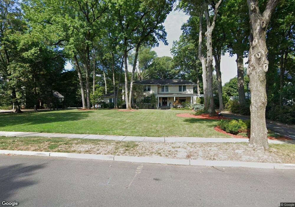
551 Summit Ave Hackensack, NJ 07601
Estimated Value: $1,167,000 - $1,594,000
About This Home
This home is located at 551 Summit Ave, Hackensack, NJ 07601 and is currently estimated at $1,435,099, approximately $281 per square foot. 551 Summit Ave is a home located in Bergen County with nearby schools including Hackensack High School and Bergen County Christian Academy.
Ownership History
We collect this data history from publicly available records. To have your information removed, we recommend requesting removal directly through your county’s website.
Purchase Details
Purchase Details
Home Financials for this Owner
Home Financials are based on the most recent Mortgage that was taken out on this home.Purchase Details
Purchase Details
Home Values in the Area
Average Home Value in this Area
Purchase History
We collect this data history from publicly available records. To have your information removed, we recommend requesting removal directly through your county’s website.
| Date | Buyer | Sale Price | Title Company |
|---|---|---|---|
| -- | -- | ||
| $1,100,000 | -- | ||
| $588,319 | -- | ||
| $220,000 | -- |
Mortgage History
We collect this data history from publicly available records. To have your information removed, we recommend requesting removal directly through your county’s website.
| Date | Status | Borrower | Loan Amount |
|---|---|---|---|
| Previous Owner | $700,000 |
Tax History
We collect this data history from publicly available records. To have your information removed, we recommend requesting removal directly through your county’s website.
| Year | Tax Paid | Tax Assessment Tax Assessment Total Assessment is a certain percentage of the fair market value that is determined by local assessors to be the total taxable value of land and additions on the property. | Land | Improvement |
|---|---|---|---|---|
| 2026 | $31,041 | $967,300 | $323,900 | $643,400 |
| 2025 | $29,561 | $967,300 | $323,900 | $643,400 |
| 2024 | $27,849 | $967,300 | $323,900 | $643,400 |
| 2023 | $28,084 | $967,300 | $323,900 | $643,400 |
| 2022 | $28,084 | $1,002,300 | $309,700 | $692,600 |
| 2021 | $28,090 | $836,500 | $286,700 | $549,800 |
| 2020 | $27,680 | $836,500 | $286,700 | $549,800 |
| 2019 | $27,689 | $824,800 | $283,700 | $541,100 |
| 2018 | $27,867 | $816,500 | $279,700 | $536,800 |
| 2017 | $27,501 | $805,300 | $277,200 | $528,100 |
| 2016 | $26,406 | $781,700 | $262,200 | $519,500 |
| 2015 | $26,775 | $765,000 | $330,800 | $434,200 |
| 2014 | $25,413 | $765,000 | $330,800 | $434,200 |
Map
- 409 W Anderson St
- 467 Summit Ave
- 518 W Anderson St
- 472 Passaic St
- 310 Lookout Ave Unit 501
- 77 Herman St
- 116 Woodland Ave
- 78 Herman St
- 163 Poplar Ave
- 446 Maple Hill Dr
- 418 Esplanade Unit 6
- 300 Lookout Ave Unit C4
- 465 Maple Hill Dr Unit 48
- 690 Garden St
- 743 Coles St
- 413 Maple Hill Dr
- 479 Maple Hill Dr Unit 42
- 290 Hamilton Place Unit 4
- 303 Hamilton Place Unit D4
- 303 Hamilton Place Unit B4
- 565 Summit Ave
- 547 Summit Ave
- 545 Summit Ave
- 569 Summit Ave
- 560 Summit Ave
- 541 Summit Ave
- 552 Summit Ave
- 568 Summit Ave
- 536 Summit Ave
- 577 Summit Ave
- 523 Summit Ave
- 534 Summit Ave
- 333 Euclid Ave S
- 10 Brook St
- 6 Brook St
- 340 Clinton Place
- 436 W Lookout Ave
- 440 W Lookout Ave
- 14 Brook St
- 432 W Lookout Ave
Ask me questions while you tour the home.