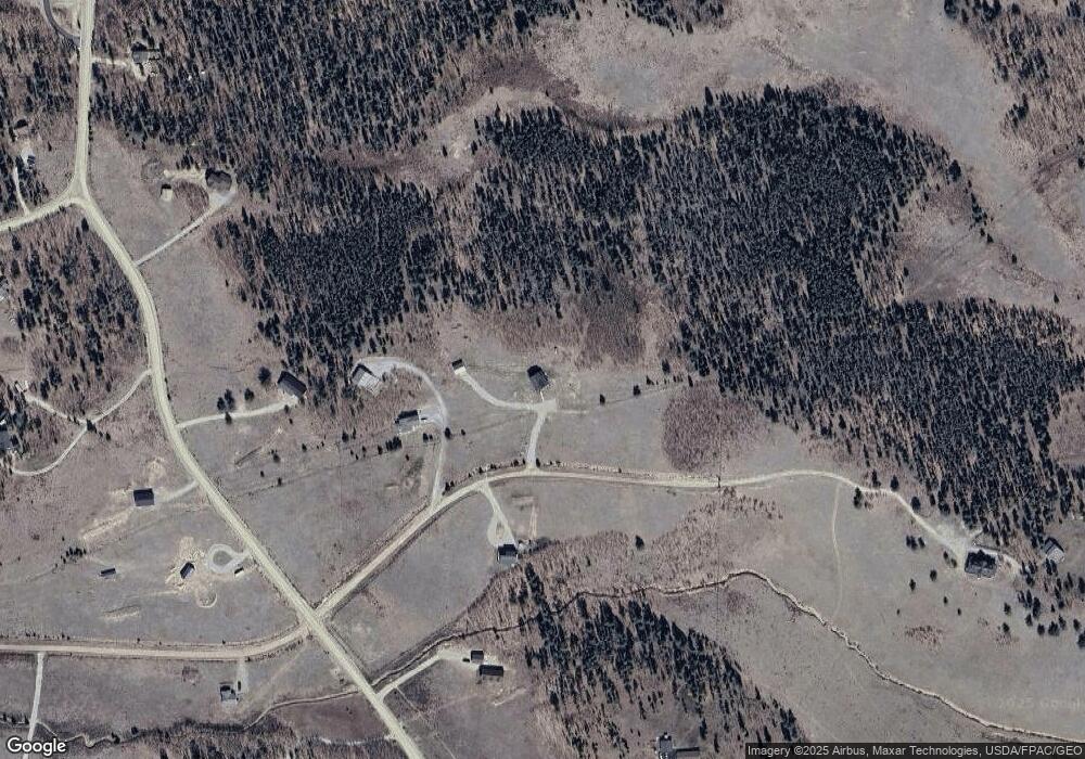
551 Thick Spike Rd Fairplay, CO 80440
Estimated Value: $854,000 - $1,122,000
3
Beds
3
Baths
1,728
Sq Ft
$571/Sq Ft
Est. Value
About This Home
This home is located at 551 Thick Spike Rd, Fairplay, CO 80440 and is currently estimated at $987,288, approximately $571 per square foot. 551 Thick Spike Rd is a home with nearby schools including Edith Teter Elementary School, South Park Middle School, and South Park High School.
Ownership History
Date
Name
Owned For
Owner Type
Purchase Details
Closed on
Dec 21, 2021
Sold by
Lee Templet John
Bought by
Revoc John and Revoc Deborah
Current Estimated Value
Purchase Details
Closed on
May 4, 2021
Sold by
Mccallum Gregory R and Vihstadt Mccallum Julie
Bought by
Templet John Lee and Templet Deborah Kay
Home Financials for this Owner
Home Financials are based on the most recent Mortgage that was taken out on this home.
Original Mortgage
$548,250
Interest Rate
3.1%
Mortgage Type
New Conventional
Purchase Details
Closed on
May 2, 2018
Sold by
Lueck Kevin and Lueck Tricia
Bought by
Vihstadt Mccallum Julie and Mccallum Gregory R
Create a Home Valuation Report for This Property
The Home Valuation Report is an in-depth analysis detailing your home's value as well as a comparison with similar homes in the area
Home Values in the Area
Average Home Value in this Area
Purchase History
| Date | Buyer | Sale Price | Title Company |
|---|---|---|---|
| Revoc John | -- | None Listed On Document | |
| Templet John Lee | $900,000 | Title Company Of The Rockies | |
| Vihstadt Mccallum Julie | $70,000 | Fidelity National Title |
Source: Public Records
Mortgage History
| Date | Status | Borrower | Loan Amount |
|---|---|---|---|
| Previous Owner | Templet John Lee | $548,250 |
Source: Public Records
Tax History Compared to Growth
Tax History
| Year | Tax Paid | Tax Assessment Tax Assessment Total Assessment is a certain percentage of the fair market value that is determined by local assessors to be the total taxable value of land and additions on the property. | Land | Improvement |
|---|---|---|---|---|
| 2024 | $3,663 | $60,260 | $7,010 | $53,250 |
| 2023 | $3,663 | $60,260 | $7,010 | $53,250 |
| 2022 | $2,191 | $34,233 | $5,072 | $29,161 |
| 2021 | $2,142 | $35,220 | $5,220 | $30,000 |
| 2020 | $1,927 | $30,690 | $3,950 | $26,740 |
| 2019 | $1,149 | $18,900 | $16,000 | $2,900 |
| 2018 | $1,129 | $18,900 | $18,900 | $0 |
| 2017 | $1,017 | $18,170 | $18,170 | $0 |
| 2016 | $1,023 | $18,880 | $18,880 | $0 |
| 2015 | $1,044 | $18,880 | $18,880 | $0 |
| 2014 | $908 | $0 | $0 | $0 |
Source: Public Records
Map
Nearby Homes
- 162 Thick Spike Rd
- 212 Wheat Way
- 160 S Wheat Way
- 237 Foxtail Ct
- 211 Foxtail Ct
- 0 Foxtail Ct Unit REC1607939
- 175 Coil Dr
- 133 Foxtail Ct
- 103 Foxtail Ct
- 1430 Coil Dr
- 188 June Grass Ct
- 1957 Coil Dr Unit 118
- 1957 Coil Dr
- 337 Busch Run
- 1224 Circle 73
- 0 Coil Dr Unit 40 REC2912411
- 757 Thompson Park Rd
- 2649 Coil Dr
- 2567 Coil Dr
- 1031 Bluestem Way
- 493 Thickspike
- 460 Thick Spike Rd
- 287 Thick Spike Rd
- 140 Vine Rd
- 170 Vine Rd
- 260 Vine Rd
- 0 Vine Rd Unit 4246524
- 26 Vine Rd Unit 21
- 73 Thick Spike Rd
- 73 Thick Spike Rd
- 73 Thick Spike Rd
- 0 Wheat Way Unit 4916304
- 0 Wheat Way Unit 861126
- 0 Wheat Way Unit 983060
- 0 Wheat Way Unit 1092184
- 0 Wheat Way Unit 9030106
- 0 Wheat Way Unit REC9892008
- 0 Wheat Way Unit S391029
- 0 Wheat Way Unit S391970
- 0 Wheat Way Unit 8141259
