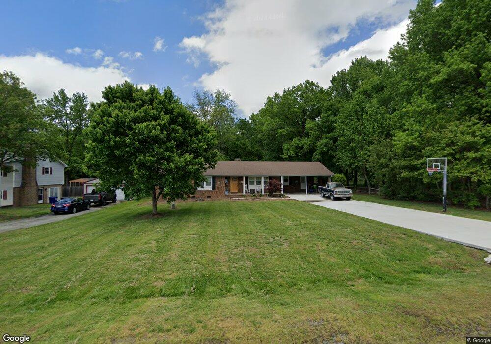
5510 Grove Forrest Dr High Point, NC 27263
Greater High Point NeighborhoodEstimated Value: $275,590 - $313,000
3
Beds
2
Baths
1,701
Sq Ft
$169/Sq Ft
Est. Value
About This Home
This home is located at 5510 Grove Forrest Dr, High Point, NC 27263 and is currently estimated at $287,648, approximately $169 per square foot. 5510 Grove Forrest Dr is a home located in Guilford County with nearby schools including Allen Jay Elementary School, Southern Guilford Middle, and Southern Guilford High School.
Ownership History
Date
Name
Owned For
Owner Type
Purchase Details
Closed on
Oct 24, 2024
Sold by
Mcclendon Jared Nathaniel and Mcclendon Crystal
Bought by
Mcclendon Jared N and Mcclendon Crystal
Current Estimated Value
Purchase Details
Closed on
Jun 27, 2006
Sold by
Marion Ronald Craig and Marion Judy Simmons
Bought by
Mcclendon Jared Nathaniel
Home Financials for this Owner
Home Financials are based on the most recent Mortgage that was taken out on this home.
Original Mortgage
$135,757
Interest Rate
6.55%
Mortgage Type
VA
Create a Home Valuation Report for This Property
The Home Valuation Report is an in-depth analysis detailing your home's value as well as a comparison with similar homes in the area
Home Values in the Area
Average Home Value in this Area
Purchase History
| Date | Buyer | Sale Price | Title Company |
|---|---|---|---|
| Mcclendon Jared N | -- | None Listed On Document | |
| Mcclendon Jared Nathaniel | $133,000 | None Available |
Source: Public Records
Mortgage History
| Date | Status | Borrower | Loan Amount |
|---|---|---|---|
| Previous Owner | Mcclendon Jared Nathaniel | $135,757 |
Source: Public Records
Tax History Compared to Growth
Tax History
| Year | Tax Paid | Tax Assessment Tax Assessment Total Assessment is a certain percentage of the fair market value that is determined by local assessors to be the total taxable value of land and additions on the property. | Land | Improvement |
|---|---|---|---|---|
| 2025 | $1,576 | $179,700 | $38,000 | $141,700 |
| 2024 | $1,576 | $179,700 | $38,000 | $141,700 |
| 2023 | $1,576 | $179,700 | $38,000 | $141,700 |
| 2022 | $1,576 | $179,700 | $38,000 | $141,700 |
| 2021 | $1,146 | $130,700 | $24,000 | $106,700 |
| 2020 | $1,146 | $130,700 | $24,000 | $106,700 |
| 2019 | $1,146 | $130,700 | $0 | $0 |
| 2018 | $1,141 | $130,700 | $0 | $0 |
| 2017 | $1,112 | $130,700 | $0 | $0 |
| 2016 | $965 | $110,300 | $0 | $0 |
| 2015 | $971 | $110,300 | $0 | $0 |
| 2014 | $982 | $110,300 | $0 | $0 |
Source: Public Records
Map
Nearby Homes
- 6955 Harlow Dr
- 6007 Checker Rd
- 0 Waterbury Dr
- 6534 Frazier Marsh Rd
- 301 Oak Ridge Dr
- 108 Willow Terrace
- 105 Willow Terrace
- 202 Oak Ridge Dr
- 105 Oak Ridge Dr
- 6318 Gray Farm Rd
- 1843 Weant Rd
- 0 Harlow Rd
- 6071 Weant Rd
- 107 Autumn Hill Ct
- 104 Autumn Hill Ct
- 5988 Weant Rd
- 115 Lindsay Dr
- 1640 Kersey Valley Rd
- 100 Lindsay Dr
- 0-C Us Highway 311
- 5512 Grove Forrest Dr
- 5506 Grove Forrest Dr
- 5509 Grove Forrest Dr
- 5504 Grove Forrest Dr
- 5516 Grove Forrest Dr
- 5515 Grove Forrest Dr
- 5505 Grove Forrest Dr
- 7104 Wincrest Dr
- 7130 Harlow Dr
- 7103 Wincrest Dr
- 7100 Sleepy Hollow Dr
- 7106 Wincrest Dr
- 7134 Harlow Dr
- 7105 Wincrest Dr
- 7105 Sleepy Hollow Dr
- 7104 Sleepy Hollow Dr
- 2908 Ebb Shore Dr
- 7138 Harlow Dr
- 7107 Wincrest Dr
- 2938 Ebb Shore Dr