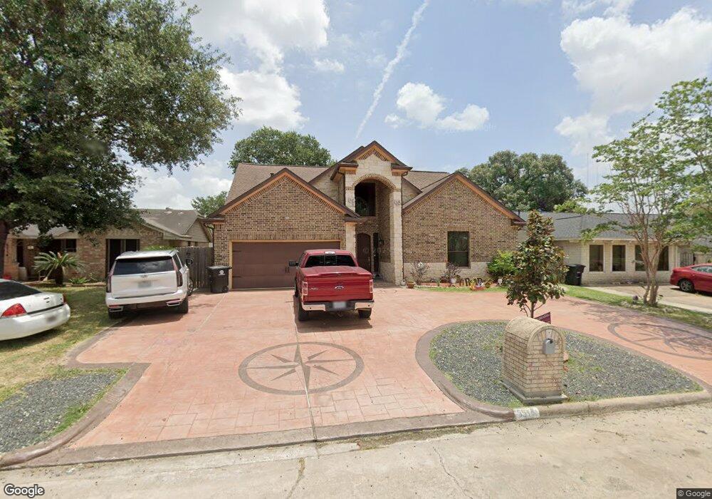
5510 Rollins St Houston, TX 77091
Acres Homes NeighborhoodEstimated Value: $212,000 - $415,000
3
Beds
2
Baths
1,147
Sq Ft
$284/Sq Ft
Est. Value
About This Home
This home is located at 5510 Rollins St, Houston, TX 77091 and is currently estimated at $325,309, approximately $283 per square foot. 5510 Rollins St is a home located in Harris County with nearby schools including Frank Black Middle School, Scarborough High School, and Brazos School For Inquiry And Crea.
Ownership History
Date
Name
Owned For
Owner Type
Purchase Details
Closed on
May 19, 2025
Sold by
Padilla Fabiola Arzate and Almazan Cesar Maldenado
Bought by
Maldonado Emily
Current Estimated Value
Purchase Details
Closed on
Feb 20, 2011
Sold by
Manrrquez Jesus
Bought by
Padilla Fabiola Arzate and Almazan Cesar Maldonado
Purchase Details
Closed on
Nov 30, 2010
Sold by
Wells Fargo Bank Na
Bought by
Manrrquez Jesus
Purchase Details
Closed on
Jul 6, 2010
Sold by
Johnson Cecil N and Love Brenda
Bought by
Wells Fargo Bank Na
Purchase Details
Closed on
Mar 5, 1996
Sold by
Spencer Lionel and Spencer Doretha
Bought by
Johnson Cecil N and Love Brenda
Home Financials for this Owner
Home Financials are based on the most recent Mortgage that was taken out on this home.
Original Mortgage
$40,850
Interest Rate
7.03%
Create a Home Valuation Report for This Property
The Home Valuation Report is an in-depth analysis detailing your home's value as well as a comparison with similar homes in the area
Home Values in the Area
Average Home Value in this Area
Purchase History
| Date | Buyer | Sale Price | Title Company |
|---|---|---|---|
| Maldonado Emily | -- | None Listed On Document | |
| Padilla Fabiola Arzate | -- | None Available | |
| Manrrquez Jesus | -- | Chicago Title | |
| Wells Fargo Bank Na | $75,457 | None Available | |
| Johnson Cecil N | -- | American Title Company |
Source: Public Records
Mortgage History
| Date | Status | Borrower | Loan Amount |
|---|---|---|---|
| Previous Owner | Johnson Cecil N | $40,850 |
Source: Public Records
Tax History Compared to Growth
Tax History
| Year | Tax Paid | Tax Assessment Tax Assessment Total Assessment is a certain percentage of the fair market value that is determined by local assessors to be the total taxable value of land and additions on the property. | Land | Improvement |
|---|---|---|---|---|
| 2025 | $6,855 | $352,198 | $85,680 | $266,518 |
| 2024 | $6,855 | $327,598 | $85,680 | $241,918 |
| 2023 | $6,855 | $417,470 | $48,960 | $368,510 |
| 2022 | $7,552 | $342,988 | $42,840 | $300,148 |
| 2021 | $6,460 | $277,181 | $36,720 | $240,461 |
| 2020 | $6,270 | $258,902 | $30,600 | $228,302 |
| 2019 | $5,365 | $212,037 | $30,600 | $181,437 |
| 2018 | $5,735 | $226,642 | $30,600 | $196,042 |
| 2017 | $3,171 | $125,401 | $30,600 | $94,801 |
| 2016 | $2,430 | $96,095 | $30,600 | $65,495 |
| 2015 | $1,939 | $96,095 | $30,600 | $65,495 |
| 2014 | $1,939 | $75,418 | $16,830 | $58,588 |
Source: Public Records
Map
Nearby Homes
- 5503 Goldspier St
- 2598 W Tidwell Rd
- 2592 W Tidwell Rd
- 2582 W Tidwell Rd
- 2591 Paul Quinn St
- 2593 Paul Quinn St
- 2589 Paul Quinn St
- 2587 Paul Quinn St
- 2583 Paul Quinn St
- 2595 Paul Quinn St
- 2599 Paul Quinn St
- 2581 Paul Quinn St
- 4206 Oak Shadows Dr
- 5616 Bertellis Ln
- 2602 Paul Quinn St
- 2504 W Tidwell Rd Unit C
- 2504 W Tidwell Rd Unit F
- 2632 Paul Quinn
- 4440 W Tidwell
- 5314 Teodoro Ln
- 5514 Rollins St
- 5506 Rollins St
- 5511 Goldspier St
- 5515 Goldspier St
- 5507 Goldspier St
- 5502 Rollins St
- 5518 Rollins St
- 5519 Goldspier St
- 5511 Rollins St
- 5515 Rollins St
- 5507 Rollins St
- 5523 Goldspier St
- 5503 Rollins St
- 5522 Rollins St
- 5519 Rollins St
- 5531 Goldspier St
- 5523 Rollins St
- 5510 Karelian Dr
- 5627 Rolling Mill Dr
- 5514 Karelian Dr