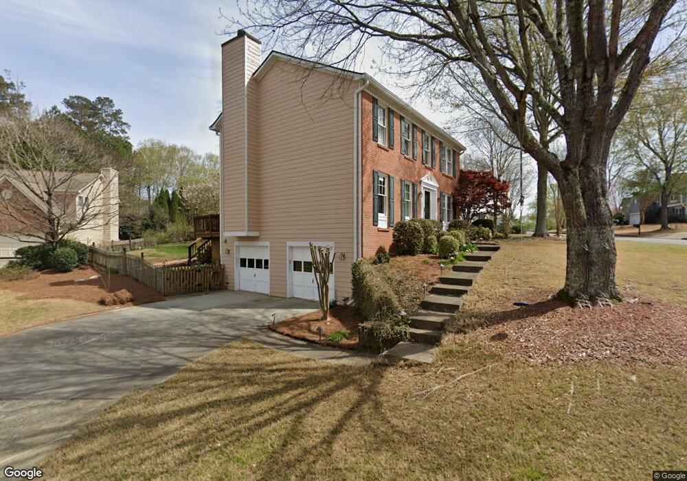
5510 Taylor Rd Unit 2 Alpharetta, GA 30022
Estimated Value: $514,000 - $562,000
4
Beds
3
Baths
2,312
Sq Ft
$234/Sq Ft
Est. Value
About This Home
This home is located at 5510 Taylor Rd Unit 2, Alpharetta, GA 30022 and is currently estimated at $541,358, approximately $234 per square foot. 5510 Taylor Rd Unit 2 is a home located in Fulton County with nearby schools including State Bridge Crossing Elementary School, Taylor Road Middle School, and Chattahoochee High School.
Ownership History
Date
Name
Owned For
Owner Type
Purchase Details
Closed on
Dec 14, 2021
Sold by
Saurino Claudia
Bought by
Saurino David
Current Estimated Value
Purchase Details
Closed on
Jul 23, 1998
Sold by
Smith Kenneth R and Smith Pamela C
Bought by
Mccallum Michael and Mccallum Janette E
Home Financials for this Owner
Home Financials are based on the most recent Mortgage that was taken out on this home.
Original Mortgage
$155,700
Interest Rate
6.94%
Mortgage Type
New Conventional
Purchase Details
Closed on
Nov 30, 1993
Sold by
Ryland Group Inc The
Bought by
Smith Kenneth R Pamela C
Home Financials for this Owner
Home Financials are based on the most recent Mortgage that was taken out on this home.
Original Mortgage
$123,200
Interest Rate
7.14%
Create a Home Valuation Report for This Property
The Home Valuation Report is an in-depth analysis detailing your home's value as well as a comparison with similar homes in the area
Home Values in the Area
Average Home Value in this Area
Purchase History
| Date | Buyer | Sale Price | Title Company |
|---|---|---|---|
| Saurino David | -- | -- | |
| Mccallum Michael | $163,900 | -- | |
| Smith Kenneth R Pamela C | $129,200 | -- |
Source: Public Records
Mortgage History
| Date | Status | Borrower | Loan Amount |
|---|---|---|---|
| Previous Owner | Mccallum Michael | $155,700 | |
| Previous Owner | Smith Kenneth R Pamela C | $123,200 |
Source: Public Records
Tax History Compared to Growth
Tax History
| Year | Tax Paid | Tax Assessment Tax Assessment Total Assessment is a certain percentage of the fair market value that is determined by local assessors to be the total taxable value of land and additions on the property. | Land | Improvement |
|---|---|---|---|---|
| 2025 | $2,703 | $225,160 | $36,320 | $188,840 |
| 2023 | $4,629 | $164,000 | $20,000 | $144,000 |
| 2022 | $2,606 | $174,560 | $20,440 | $154,120 |
| 2021 | $2,556 | $121,840 | $24,040 | $97,800 |
| 2020 | $2,585 | $129,800 | $24,480 | $105,320 |
| 2019 | $301 | $127,480 | $24,040 | $103,440 |
| 2018 | $3,086 | $111,360 | $21,680 | $89,680 |
| 2017 | $2,381 | $82,120 | $13,600 | $68,520 |
| 2016 | $2,339 | $82,120 | $13,600 | $68,520 |
| 2015 | $2,323 | $80,920 | $13,600 | $67,320 |
| 2014 | $2,394 | $80,920 | $13,600 | $67,320 |
Source: Public Records
Map
Nearby Homes
- 5425 Taylor Rd Unit 2
- 425 Mikasa Dr
- 465 Mikasa Dr
- 11035 Parsons Rd
- 11041 Parsons Rd
- 11125 Linbrook Ln
- 5121 Anclote Dr
- 5765 Bailey Ridge Ct
- 11235 Surrey Park Trail
- 6365 Murets Rd
- 11130 Touraine Ct
- 5022 Anclote Dr
- 5680 Abbotts Bridge Rd
- 4935 Tanners Spring Dr
- 4965 Cinnabar Dr
- 5690 Abbotts Bridge Rd
- 225 Morton Creek Cir
- 10595 Highgate Manor Ct
- 10530 Branham Fields Rd
- 4815 Tanners Spring Dr
- 510 Windswept Way Unit II
- 5500 Taylor Rd
- 520 Windswept Way
- 515 Windswept Way
- 515 Windswept Way Unit II
- 505 Windswept Way Unit 2
- 5490 Taylor Rd
- 5435 Taylor Rd
- 5445 Taylor Rd
- 530 Windswept Way
- 525 Windswept Way
- 5480 Taylor Rd
- 5415 Taylor Rd
- 5455 Taylor Rd
- W Windswept Way
- 5540 Taylor Rd Unit 2
- 540 Windswept Way Unit II
- 5465 Taylor Rd
- 5465 Taylor Rd Unit 5465
- 5470 Taylor Rd Unit 2