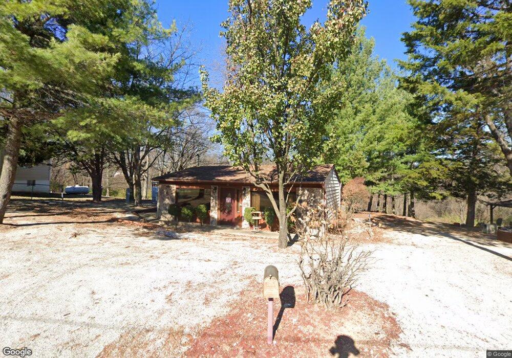
5511 Sassafras Ln High Ridge, MO 63049
Estimated Value: $182,000 - $226,000
--
Bed
2
Baths
3,060
Sq Ft
$66/Sq Ft
Est. Value
About This Home
This home is located at 5511 Sassafras Ln, High Ridge, MO 63049 and is currently estimated at $202,080, approximately $66 per square foot. 5511 Sassafras Ln is a home located in Jefferson County with nearby schools including Northwest High School and St. Anthony School.
Ownership History
Date
Name
Owned For
Owner Type
Purchase Details
Closed on
Aug 21, 2025
Sold by
Edmonds Rickey
Bought by
M Ramsey Holdings Llc
Current Estimated Value
Purchase Details
Closed on
Sep 28, 2023
Sold by
Rocklin Group Llc
Bought by
Edmonds Rickey
Home Financials for this Owner
Home Financials are based on the most recent Mortgage that was taken out on this home.
Original Mortgage
$152,000
Interest Rate
7.09%
Mortgage Type
New Conventional
Purchase Details
Closed on
Jun 30, 2000
Sold by
Graff Glenn G and Graff Clara E
Bought by
Blase Gerard H
Home Financials for this Owner
Home Financials are based on the most recent Mortgage that was taken out on this home.
Original Mortgage
$82,950
Interest Rate
8.66%
Create a Home Valuation Report for This Property
The Home Valuation Report is an in-depth analysis detailing your home's value as well as a comparison with similar homes in the area
Home Values in the Area
Average Home Value in this Area
Purchase History
| Date | Buyer | Sale Price | Title Company |
|---|---|---|---|
| M Ramsey Holdings Llc | -- | Investors Title Company | |
| Edmonds Rickey | -- | None Listed On Document | |
| Blase Gerard H | -- | Commonwealth Title |
Source: Public Records
Mortgage History
| Date | Status | Borrower | Loan Amount |
|---|---|---|---|
| Previous Owner | Edmonds Rickey | $152,000 | |
| Previous Owner | Blase Gerard H | $82,950 |
Source: Public Records
Tax History Compared to Growth
Tax History
| Year | Tax Paid | Tax Assessment Tax Assessment Total Assessment is a certain percentage of the fair market value that is determined by local assessors to be the total taxable value of land and additions on the property. | Land | Improvement |
|---|---|---|---|---|
| 2025 | $1,321 | $19,500 | $2,700 | $16,800 |
| 2024 | $1,321 | $18,300 | $2,700 | $15,600 |
| 2023 | $1,321 | $18,300 | $2,700 | $15,600 |
| 2022 | $1,307 | $18,300 | $2,700 | $15,600 |
| 2021 | $1,307 | $18,300 | $2,700 | $15,600 |
| 2020 | $1,222 | $16,700 | $2,500 | $14,200 |
| 2019 | $1,221 | $16,700 | $2,500 | $14,200 |
| 2018 | $1,237 | $16,700 | $2,500 | $14,200 |
| 2017 | $1,130 | $16,700 | $2,500 | $14,200 |
| 2016 | $1,058 | $15,500 | $2,500 | $13,000 |
| 2015 | $1,087 | $15,500 | $2,500 | $13,000 |
| 2013 | -- | $14,800 | $2,300 | $12,500 |
Source: Public Records
Map
Nearby Homes
- 5416 Terry Dr
- 3020 Ridgetop Ct
- 9 Amber Ridge Ct
- 3008 High Ridge Dr
- 3022 Timber View Dr
- 5800 5800 St Rd Pp
- 6029 Timber Hollow Ln
- 2908 Elderwood Cir
- 2905 Carol Ln
- 2909 Hilgert Dr
- 2801 High Ridge Blvd
- 3717 Carol Park Rd
- 3734 Carol Park Rd
- 5707 Werner Dr
- 5324 Brinridge Dr
- 2705 Cathy Ann Dr
- 5814 Mayfair Ct
- 3833 Dorchester Ct
- TBD State Route 30
- 0 High Ridge Manor Resub Lot 6 Unit MIS25065011
- 5513 Sassafras Ln
- 5517 Sassafras Ln
- 5505 Sassafras Ln
- 5501 Sassafras Ln
- 5508 Sassafras Ln
- 5521 Sassafras Ln
- 5516 Jo Mar Dr
- 5500 Sassafras Ln
- 5538 Jo Mar Dr
- 3332 Rock Creek Rd
- 3346 Rock Creek Rd
- 3328 Rock Creek Rd
- 3414 Rock Creek Rd
- 5518 Jo Mar Dr
- 5549 Jo Mar Dr
- 5545 Jo Mar Dr
- 5559 Jo Mar Dr
- 3424 Rock Creek Rd
- 3324 Rock Creek Rd
- 3228 Orchard Dr