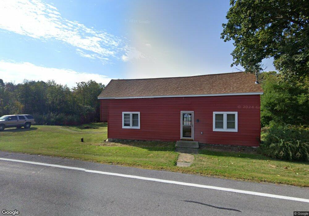
5511 State Route 10 Cobleskill, NY 12043
Estimated Value: $129,000 - $251,000
4
Beds
1
Bath
1,750
Sq Ft
$101/Sq Ft
Est. Value
About This Home
This home is located at 5511 State Route 10, Cobleskill, NY 12043 and is currently estimated at $177,509, approximately $101 per square foot. 5511 State Route 10 is a home located in Schoharie County with nearby schools including George D Ryder Elementary School, Cobleskill Richmondville High School, and Joseph B Radez Elementary School.
Ownership History
Date
Name
Owned For
Owner Type
Purchase Details
Closed on
Sep 18, 2013
Sold by
Smyer Raymond
Bought by
Smyer Michelle
Current Estimated Value
Purchase Details
Closed on
Jun 14, 2007
Sold by
Gage Thomas
Bought by
Smyer Raymond B
Home Financials for this Owner
Home Financials are based on the most recent Mortgage that was taken out on this home.
Original Mortgage
$55,000
Interest Rate
6.73%
Mortgage Type
Purchase Money Mortgage
Purchase Details
Closed on
Dec 9, 1999
Create a Home Valuation Report for This Property
The Home Valuation Report is an in-depth analysis detailing your home's value as well as a comparison with similar homes in the area
Home Values in the Area
Average Home Value in this Area
Purchase History
| Date | Buyer | Sale Price | Title Company |
|---|---|---|---|
| Smyer Michelle | -- | None | |
| Smyer Raymond B | $58,300 | None | |
| -- | $2,500 | -- |
Source: Public Records
Mortgage History
| Date | Status | Borrower | Loan Amount |
|---|---|---|---|
| Previous Owner | Smyer Raymond B | $55,000 |
Source: Public Records
Tax History Compared to Growth
Tax History
| Year | Tax Paid | Tax Assessment Tax Assessment Total Assessment is a certain percentage of the fair market value that is determined by local assessors to be the total taxable value of land and additions on the property. | Land | Improvement |
|---|---|---|---|---|
| 2024 | $2,358 | $46,000 | $11,000 | $35,000 |
| 2023 | $2,333 | $46,000 | $11,000 | $35,000 |
| 2022 | $2,303 | $46,000 | $11,000 | $35,000 |
| 2021 | $2,281 | $46,000 | $11,000 | $35,000 |
| 2020 | $2,517 | $46,000 | $11,000 | $35,000 |
| 2019 | $1,556 | $46,000 | $11,000 | $35,000 |
| 2018 | $1,556 | $46,000 | $11,000 | $35,000 |
| 2017 | $2,035 | $46,000 | $11,000 | $35,000 |
| 2016 | $1,433 | $46,000 | $11,000 | $35,000 |
| 2015 | -- | $46,000 | $11,000 | $35,000 |
| 2014 | -- | $46,000 | $11,000 | $35,000 |
Source: Public Records
Map
Nearby Homes
- 840 Clove Rd
- 427 Patrick Rd
- 5754 State Route 10
- 179 Patrick Rd
- 110 Madison Terrace
- 122 Lincoln Ave
- 172 Elm St
- 162 Elm St
- 150 Washington Ave
- 113 Harder Ave
- 109 High St
- 242 N Grand St
- 111 Park Place
- L7 Harroway Rd
- 125 Prospect St
- 573 E Main St
- 5214 New York 145
- 5214 State Route 145
- 616 E Main St
- L14 New York 7
- 5511 State Route 10
- 5511 New York 10
- 5520 State Route 10
- 5503 State Route 10
- 5523 State Route 10
- 5491 State Route 10
- 282 Hill Rd
- 0 Hill Rd Unit 138721
- 156-1 Hill Rd
- 0 Hill Rd Unit 2218774
- 0 Hill Rd Unit 9832075
- 0 Hill Rd Unit 9633573
- 0 Hill Rd
- 211 Hill Rd
- 306 Hill Rd
- Lot 1 Hill Rd
- 000 Hill Rd
- 259 Hill Rd
- 5599 State Route 10
- 5541 State Route 10