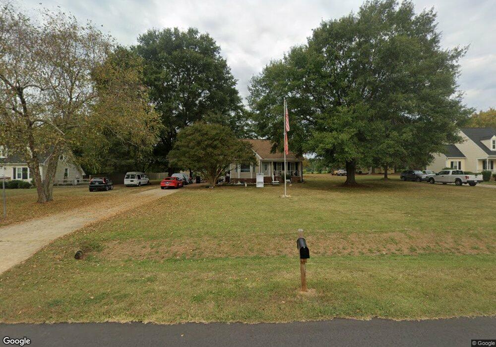
5512 Dunallie Dr Fuquay Varina, NC 27526
Estimated Value: $298,000 - $326,000
--
Bed
3
Baths
1,221
Sq Ft
$254/Sq Ft
Est. Value
About This Home
This home is located at 5512 Dunallie Dr, Fuquay Varina, NC 27526 and is currently estimated at $310,341, approximately $254 per square foot. 5512 Dunallie Dr is a home located in Wake County with nearby schools including Banks Road Elementary School and West Lake Middle.
Ownership History
Date
Name
Owned For
Owner Type
Purchase Details
Closed on
Sep 8, 2003
Sold by
Harlow James P and Harlow Tiffany
Bought by
Smith Robert J and Smith Donna
Current Estimated Value
Home Financials for this Owner
Home Financials are based on the most recent Mortgage that was taken out on this home.
Original Mortgage
$98,500
Outstanding Balance
$44,749
Interest Rate
5.94%
Mortgage Type
Purchase Money Mortgage
Estimated Equity
$265,592
Create a Home Valuation Report for This Property
The Home Valuation Report is an in-depth analysis detailing your home's value as well as a comparison with similar homes in the area
Home Values in the Area
Average Home Value in this Area
Purchase History
| Date | Buyer | Sale Price | Title Company |
|---|---|---|---|
| Smith Robert J | $123,500 | -- |
Source: Public Records
Mortgage History
| Date | Status | Borrower | Loan Amount |
|---|---|---|---|
| Open | Smith Robert J | $98,500 |
Source: Public Records
Tax History Compared to Growth
Tax History
| Year | Tax Paid | Tax Assessment Tax Assessment Total Assessment is a certain percentage of the fair market value that is determined by local assessors to be the total taxable value of land and additions on the property. | Land | Improvement |
|---|---|---|---|---|
| 2025 | $1,736 | $268,312 | $90,000 | $178,312 |
| 2024 | $1,686 | $268,312 | $90,000 | $178,312 |
| 2023 | $1,380 | $174,418 | $45,000 | $129,418 |
| 2022 | $1,280 | $174,418 | $45,000 | $129,418 |
| 2021 | $1,246 | $174,418 | $45,000 | $129,418 |
| 2020 | $1,225 | $174,418 | $45,000 | $129,418 |
| 2019 | $1,130 | $135,882 | $40,000 | $95,882 |
| 2018 | $1,040 | $135,882 | $40,000 | $95,882 |
| 2017 | $986 | $135,882 | $40,000 | $95,882 |
| 2016 | $966 | $135,882 | $40,000 | $95,882 |
| 2015 | $958 | $135,023 | $40,000 | $95,023 |
| 2014 | -- | $135,023 | $40,000 | $95,023 |
Source: Public Records
Map
Nearby Homes
- 3324 Air Park Rd
- 1601 Malcus Ct Unit 65
- 4313 Darius Ln
- 1504 Malcus Ct Unit 52
- 4313 Darius Ln Unit 25
- Macon Plan at Rowland's Grant
- Knox Plan at Rowland's Grant
- Leland Plan at Rowland's Grant
- Jordan Plan at Rowland's Grant
- Camden Plan at Rowland's Grant
- Finley Plan at Rowland's Grant
- Alexis Plan at Rowland's Grant
- Madison Plan at Rowland's Grant
- 2417 Ridgeford Ct
- 6208 Silver Spring Ct
- 4306 Emeline Way
- 4306 Emeline Way Unit 17
- 1404 Malcus Ct Unit 56
- 3320 Highgate Rd
- 4412 Darius Ln
- 5508 Dunallie Dr
- 5516 Dunallie Dr
- 5504 Dunallie Dr
- 5520 Dunallie Dr
- 5513 Dunallie Dr
- 5513 Dunnalie Dr
- 5517 Dunallie Dr
- 5509 Dunallie Dr
- 5524 Dunallie Dr
- 5500 Dunallie Dr
- 5505 Dunallie Dr
- 5521 Dunallie Dr
- 5525 Dunallie Dr
- 5501 Dunallie Dr
- 5528 Dunallie Dr
- 2116 Stone Pasture Rd
- 2112 Stone Pasture Rd
- 3602 Air Park Rd
- 2120 Stone Pasture Rd
- 2108 Stone Pasture Rd