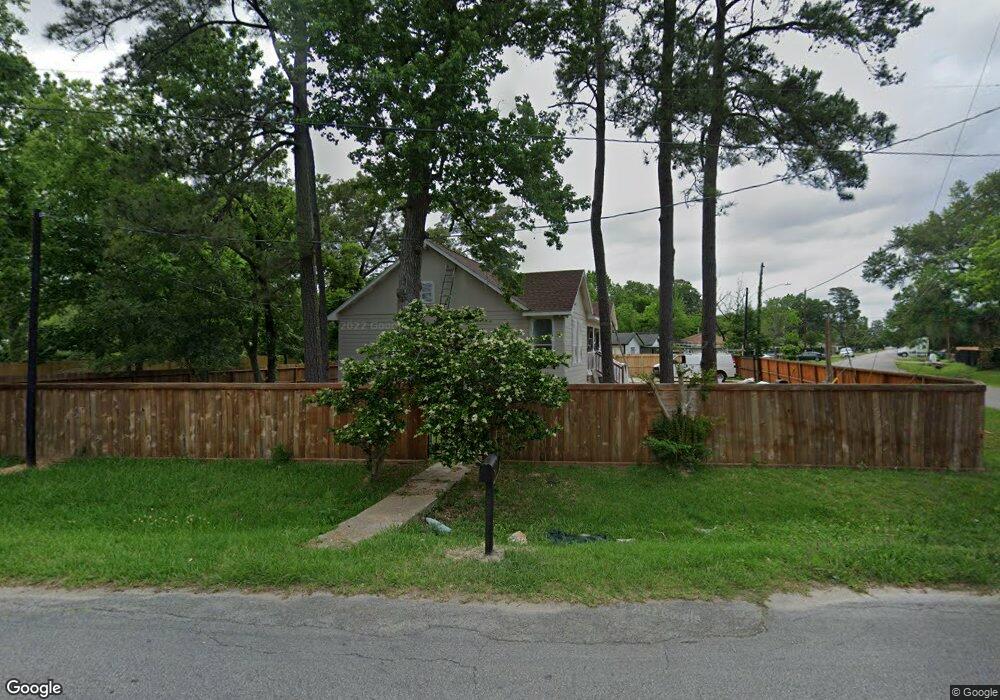
5513 Bretshire Dr Houston, TX 77016
East Little York NeighborhoodEstimated Value: $201,000 - $239,060
3
Beds
2
Baths
1,550
Sq Ft
$144/Sq Ft
Est. Value
About This Home
This home is located at 5513 Bretshire Dr, Houston, TX 77016 and is currently estimated at $222,765, approximately $143 per square foot. 5513 Bretshire Dr is a home located in Harris County with nearby schools including Shadydale Elementary School, Forest Brook Middle, and North Forest High School.
Ownership History
Date
Name
Owned For
Owner Type
Purchase Details
Closed on
Nov 20, 2019
Sold by
Salazar Heaven S
Bought by
Dela Torre Bravo Rafael
Current Estimated Value
Purchase Details
Closed on
Feb 24, 2015
Sold by
Mae Fanie
Bought by
Guevara Jose and Guevara Melvin A
Purchase Details
Closed on
Oct 30, 2014
Sold by
Wells Fargo Bank Na
Bought by
Federal National Mortgage Association
Purchase Details
Closed on
Sep 2, 2014
Sold by
Mcdonald Ruby
Bought by
Wells Fargo Bank Na
Purchase Details
Closed on
May 14, 2008
Sold by
Jack James E
Bought by
Jack Ruby Jewel and Mcdonald Ruby
Create a Home Valuation Report for This Property
The Home Valuation Report is an in-depth analysis detailing your home's value as well as a comparison with similar homes in the area
Home Values in the Area
Average Home Value in this Area
Purchase History
| Date | Buyer | Sale Price | Title Company |
|---|---|---|---|
| Dela Torre Bravo Rafael | -- | None Available | |
| Guevara Jose | -- | Brahma Title & Escrow | |
| Federal National Mortgage Association | -- | None Available | |
| Wells Fargo Bank Na | $59,671 | None Available | |
| Jack Ruby Jewel | -- | None Available |
Source: Public Records
Tax History Compared to Growth
Tax History
| Year | Tax Paid | Tax Assessment Tax Assessment Total Assessment is a certain percentage of the fair market value that is determined by local assessors to be the total taxable value of land and additions on the property. | Land | Improvement |
|---|---|---|---|---|
| 2025 | $2,936 | $226,089 | $60,380 | $165,709 |
| 2024 | $2,936 | $226,856 | $60,380 | $166,476 |
| 2023 | $2,936 | $241,572 | $37,293 | $204,279 |
| 2022 | $5,322 | $241,722 | $24,862 | $216,860 |
| 2021 | $722 | $30,987 | $24,862 | $6,125 |
| 2020 | $464 | $19,179 | $19,179 | $0 |
| 2019 | $324 | $12,786 | $12,786 | $0 |
| 2018 | $324 | $12,786 | $12,786 | $0 |
| 2017 | $323 | $12,786 | $12,786 | $0 |
| 2016 | $571 | $22,569 | $12,786 | $9,783 |
| 2015 | $1,367 | $25,446 | $12,786 | $12,660 |
| 2014 | $1,367 | $53,186 | $12,786 | $40,400 |
Source: Public Records
Map
Nearby Homes
- 6001 Bretshire Dr
- 10221 Bretton Dr
- 5621 Haywood St
- 10434 Envoy St
- 5123 Francine Ln
- 5413 Glen Nook Dr
- 5130 Farb Dr
- 10430 Royal Oaks Dr
- 10122 Rockaway Dr
- 5022 Bretshire Dr
- 5418 Parker Rd
- 10201 Homestead Rd
- 5618 Briarwick Ln
- 10535 Hollyglen Dr
- 10526 Hollyglen Dr
- 5905 Langley Rd
- 5914 Breland St
- 10806 Bird of Paradise Ln
- 10808 Bird of Paradise Ln
- 10810 Bird of Paradise Ln
- 10317 Onslow St
- 5601 Bretshire Dr
- 10321 Onslow St
- 5518 Bretshire Dr
- 10310 Wicklowe St
- 10318 Wicklowe St
- 5514 Bretshire Dr
- 5510 Bretshire Dr
- 10325 Onslow St
- 5501 Bretshire Dr
- 5605 Bretshire Dr
- 10322 Onslow St
- 0 Wicklowe St Unit 3205371
- 0 Wicklowe St Unit 7522346
- 0 Wicklowe St Unit 4476440
- 0 Wicklowe St Unit 36494214
- 0 Wicklowe St Unit 21583655
- 0 Wicklowe St Unit 96591262
- 0 Wicklowe St Unit 38561485
- 5602 Bretshire Dr