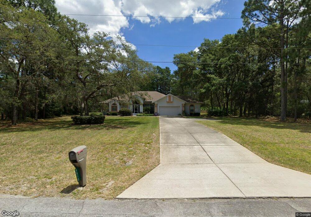
5513 N Range Way Beverly Hills, FL 34465
Estimated Value: $491,845 - $574,000
3
Beds
3
Baths
2,784
Sq Ft
$191/Sq Ft
Est. Value
About This Home
This home is located at 5513 N Range Way, Beverly Hills, FL 34465 and is currently estimated at $530,461, approximately $190 per square foot. 5513 N Range Way is a home located in Citrus County with nearby schools including Central Ridge Elementary School, Crystal River High School, and Crystal River Middle School.
Ownership History
Date
Name
Owned For
Owner Type
Purchase Details
Closed on
Sep 22, 2021
Sold by
Barr Ronald A and Barr Diana Lynn
Bought by
Barr Ronald A
Current Estimated Value
Home Financials for this Owner
Home Financials are based on the most recent Mortgage that was taken out on this home.
Original Mortgage
$199,500
Outstanding Balance
$180,904
Interest Rate
2.86%
Estimated Equity
$349,557
Purchase Details
Closed on
Apr 1, 1996
Bought by
Barr Ronald A and Barr Diana L
Purchase Details
Closed on
Oct 1, 1990
Bought by
Barr Ronald A and Barr Diana L
Create a Home Valuation Report for This Property
The Home Valuation Report is an in-depth analysis detailing your home's value as well as a comparison with similar homes in the area
Home Values in the Area
Average Home Value in this Area
Purchase History
| Date | Buyer | Sale Price | Title Company |
|---|---|---|---|
| Barr Ronald A | -- | Stewart Title Guaranty Co | |
| Barr Ronald A | $12,500 | -- | |
| Barr Ronald A | $14,100 | -- |
Source: Public Records
Mortgage History
| Date | Status | Borrower | Loan Amount |
|---|---|---|---|
| Open | Barr Ronald A | $199,500 |
Source: Public Records
Tax History Compared to Growth
Tax History
| Year | Tax Paid | Tax Assessment Tax Assessment Total Assessment is a certain percentage of the fair market value that is determined by local assessors to be the total taxable value of land and additions on the property. | Land | Improvement |
|---|---|---|---|---|
| 2025 | $2,954 | $238,004 | -- | -- |
| 2024 | $2,881 | $231,296 | -- | -- |
| 2023 | $2,881 | $224,559 | $0 | $0 |
| 2022 | $2,761 | $218,018 | $0 | $0 |
| 2021 | $2,657 | $211,668 | $0 | $0 |
| 2020 | $2,559 | $278,310 | $21,640 | $256,670 |
| 2019 | $2,528 | $257,632 | $21,350 | $236,282 |
| 2018 | $2,503 | $258,428 | $19,480 | $238,948 |
| 2017 | $2,497 | $196,129 | $15,630 | $180,499 |
| 2016 | $2,531 | $192,095 | $15,800 | $176,295 |
| 2015 | $2,628 | $190,760 | $16,140 | $174,620 |
| 2014 | $2,628 | $189,246 | $17,997 | $171,249 |
Source: Public Records
Map
Nearby Homes
- 5432 N Pecos Terrace
- 4930 W Pinto Loop
- 5485 N Pecos Terrace
- 5527 N Sierra Terrace
- 5070 W Wichita Dr
- 4930 W West Pinto Loop
- 4091 W Pinto Loop
- 5807 N Bridle Terrace
- 5235 N Sonora Terrace
- 5621 N Flagstaff Ave
- 5400 W Conestoga St
- 4395 W Alamo
- 5338 W Corral Place
- 5932 N Flagstaff Ave
- 4464 W Horseshoe Dr
- 4881 W Phoenix Dr
- 4923 W Phoenix Dr
- 4757 W Casper Ln
- 5849 N Killeen Terrace
- 5664 W Chino Dr
- 5469 N Range Way
- 4960 W Pinto Loop
- 5526 N Pecos Terrace
- 5486 N Pecos Terrace
- 5524 N Range Way
- 5470 N Range Way
- 5431 N Range Way
- 5558 N Pecos Terrace
- 5594 N Pecos Terrace
- 5406 N Pecos Terrace
- 5559 N Pecos Terrace
- 4931 W Pinto Loop
- 4957 W Pinto Loop
- 5011 W Pinto Loop
- 4894 W Custer Dr
- 5525 N Pecos Terrace
- 5050 W Pinto Loop
- 4905 W Pinto Loop
- 4859 W Custer Dr
- 4984 W Custer Dr