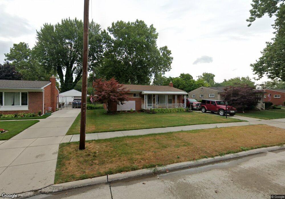
5513 W Brookside Dr Dearborn Heights, MI 48125
Estimated Value: $177,464 - $194,000
3
Beds
1
Bath
999
Sq Ft
$187/Sq Ft
Est. Value
About This Home
This home is located at 5513 W Brookside Dr, Dearborn Heights, MI 48125 and is currently estimated at $186,366, approximately $186 per square foot. 5513 W Brookside Dr is a home located in Wayne County with nearby schools including Polk Elementary School, Bedford School, and Pardee School.
Ownership History
Date
Name
Owned For
Owner Type
Purchase Details
Closed on
Sep 19, 2017
Sold by
Stevens James F and Stecki Caroline M
Bought by
Stevens James F
Current Estimated Value
Home Financials for this Owner
Home Financials are based on the most recent Mortgage that was taken out on this home.
Original Mortgage
$58,700
Interest Rate
3.85%
Mortgage Type
New Conventional
Purchase Details
Closed on
Aug 4, 2004
Sold by
Stevens James F and Stecki Stevens Caroline M
Bought by
Stevens James F
Create a Home Valuation Report for This Property
The Home Valuation Report is an in-depth analysis detailing your home's value as well as a comparison with similar homes in the area
Home Values in the Area
Average Home Value in this Area
Purchase History
| Date | Buyer | Sale Price | Title Company |
|---|---|---|---|
| Stevens James F | -- | None Available | |
| Stevens James F | -- | -- |
Source: Public Records
Mortgage History
| Date | Status | Borrower | Loan Amount |
|---|---|---|---|
| Closed | Stevens James F | $58,700 |
Source: Public Records
Tax History
| Year | Tax Paid | Tax Assessment Tax Assessment Total Assessment is a certain percentage of the fair market value that is determined by local assessors to be the total taxable value of land and additions on the property. | Land | Improvement |
|---|---|---|---|---|
| 2025 | $1,652 | $80,600 | $0 | $0 |
| 2024 | $1,471 | $74,600 | $0 | $0 |
| 2023 | $1,390 | $66,100 | $0 | $0 |
| 2022 | $1,928 | $59,500 | $0 | $0 |
| 2021 | $1,929 | $55,500 | $0 | $0 |
| 2019 | $1,874 | $43,600 | $0 | $0 |
| 2018 | $1,259 | $38,200 | $0 | $0 |
| 2017 | $1,133 | $36,200 | $0 | $0 |
| 2016 | $1,783 | $34,400 | $0 | $0 |
| 2015 | $3,190 | $32,000 | $0 | $0 |
| 2013 | $3,320 | $33,900 | $0 | $0 |
| 2010 | -- | $42,500 | $0 | $0 |
Source: Public Records
Map
Nearby Homes
- 5578 Grindley Park St
- 22823 N Brookside Dr
- 4652 Parker St
- 000 Hanover St
- 4696 Syracuse St
- 4901 Cornell St
- 4457 Grindley Park St
- 5008 Mckinley St
- 4910 Westpoint St
- 4474 Syracuse St
- 4216 Syracuse St
- 4987 Roosevelt Blvd
- 4155 Syracuse St
- 5656 Monroe St
- 24117 Eton Ave
- 5871 Cooper St
- 4170 Lincoln Blvd
- 4116 Syracuse St
- 21919 Powers Ave
- 5614 Katherine St
- 5525 W Brookside Dr
- 5501 W Brookside Dr
- 5526 Cranbrook St
- 5537 W Brookside Dr
- 5538 Cranbrook St
- 5489 W Brookside Dr
- 5514 Cranbrook St
- 5550 Cranbrook St
- 5502 Cranbrook St
- 5512 W Brookside Dr
- 5477 W Brookside Dr
- 5549 W Brookside Dr
- 5524 W Brookside Dr
- 5500 W Brookside Dr
- 5536 W Brookside Dr
- 5490 Cranbrook St
- 5562 Cranbrook St
- 5488 W Brookside Dr
- 10571 N Brookside Dr
- 5465 W Brookside Dr
Your Personal Tour Guide
Ask me questions while you tour the home.