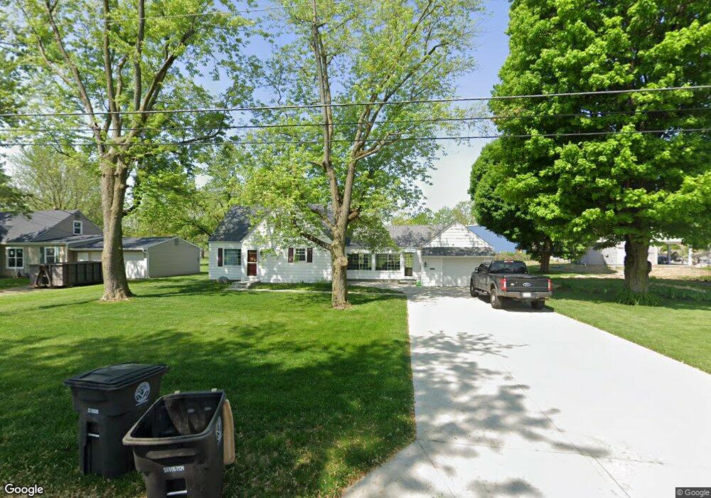
5514 Mason Dr Fort Wayne, IN 46809
Sand Point NeighborhoodEstimated Value: $177,000 - $228,000
3
Beds
2
Baths
1,972
Sq Ft
$104/Sq Ft
Est. Value
About This Home
This home is located at 5514 Mason Dr, Fort Wayne, IN 46809 and is currently estimated at $204,258, approximately $103 per square foot. 5514 Mason Dr is a home located in Allen County with nearby schools including Waynedale Elementary School, Portage Middle School, and Wayne High School.
Ownership History
Date
Name
Owned For
Owner Type
Purchase Details
Closed on
Dec 5, 2011
Sold by
Hipskind Patrick D and Hipskind Janice M
Bought by
Hipskind Janice M
Current Estimated Value
Purchase Details
Closed on
Dec 15, 2005
Sold by
Mcquade Heather A
Bought by
Hipskind Patrick D and Hipskind Janice M
Home Financials for this Owner
Home Financials are based on the most recent Mortgage that was taken out on this home.
Original Mortgage
$60,000
Interest Rate
6.48%
Mortgage Type
Fannie Mae Freddie Mac
Purchase Details
Closed on
May 11, 2001
Sold by
Davis Paul E and Davis Amy L
Bought by
Mcquade Heather A
Home Financials for this Owner
Home Financials are based on the most recent Mortgage that was taken out on this home.
Original Mortgage
$84,671
Interest Rate
6.99%
Mortgage Type
FHA
Create a Home Valuation Report for This Property
The Home Valuation Report is an in-depth analysis detailing your home's value as well as a comparison with similar homes in the area
Home Values in the Area
Average Home Value in this Area
Purchase History
| Date | Buyer | Sale Price | Title Company |
|---|---|---|---|
| Hipskind Janice M | -- | None Available | |
| Hipskind Patrick D | -- | -- | |
| Mcquade Heather A | -- | Commonwealth/Dreibelbiss Tit |
Source: Public Records
Mortgage History
| Date | Status | Borrower | Loan Amount |
|---|---|---|---|
| Previous Owner | Hipskind Patrick D | $60,000 | |
| Previous Owner | Mcquade Heather A | $84,671 |
Source: Public Records
Tax History
| Year | Tax Paid | Tax Assessment Tax Assessment Total Assessment is a certain percentage of the fair market value that is determined by local assessors to be the total taxable value of land and additions on the property. | Land | Improvement |
|---|---|---|---|---|
| 2025 | $2,044 | $132,300 | $26,100 | $106,200 |
| 2024 | $2,577 | $89,400 | $13,400 | $76,000 |
| 2022 | $1,146 | $51,000 | $7,100 | $43,900 |
| 2021 | $1,127 | $50,300 | $5,900 | $44,400 |
| 2020 | $1,062 | $48,300 | $6,000 | $42,300 |
| 2019 | $893 | $40,800 | $5,300 | $35,500 |
| 2018 | $906 | $41,100 | $5,400 | $35,700 |
| 2017 | $890 | $40,000 | $5,100 | $34,900 |
| 2016 | $1,018 | $46,500 | $6,500 | $40,000 |
| 2014 | $794 | $38,200 | $5,600 | $32,600 |
| 2013 | $507 | $24,400 | $3,500 | $20,900 |
Source: Public Records
Map
Nearby Homes
- 5510 Kimberley Rd
- 2621 Belle Vista Blvd
- 4716 Liggett Dr
- 3715 Three Oaks Dr
- 2807 Witchwood Dr
- 6612 Bradbury Ave
- 5018 Knollfield Place
- 2710 Waynewood Dr
- 2515 Fairoak Dr
- 4106 Elmcrest Dr
- 5033 Rocky Knoll Dr
- 4338 Knoll Rd
- 7016 Beaty Ave
- 3325 Lower Huntington Rd
- 4009 Mound Pass
- 7101 Baer Rd
- 2222 Opechee Way
- 7302 Bradbury Ave
- 7309 Bradbury Ave
- 2600 Blk Timbers Dr
Your Personal Tour Guide
Ask me questions while you tour the home.