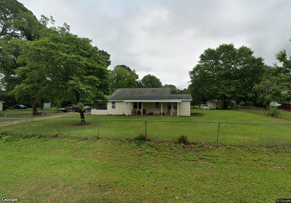
5518 Paulk Dr Albany, GA 31721
Estimated Value: $20,901 - $111,000
2
Beds
1
Bath
1,554
Sq Ft
$48/Sq Ft
Est. Value
About This Home
This home is located at 5518 Paulk Dr, Albany, GA 31721 and is currently estimated at $74,225, approximately $47 per square foot. 5518 Paulk Dr is a home located in Dougherty County with nearby schools including Alice Coachman Elementary School, Southside Middle School, and Monroe High School.
Ownership History
Date
Name
Owned For
Owner Type
Purchase Details
Closed on
Sep 12, 2014
Sold by
Nix Florrie Lee
Bought by
Fallin Daniel Christopher
Current Estimated Value
Purchase Details
Closed on
Nov 7, 2001
Sold by
Betts Annelle
Bought by
Nix Florrie L
Purchase Details
Closed on
Oct 3, 2001
Sold by
Betts Annelle
Bought by
Nix Florrie L
Purchase Details
Closed on
Sep 10, 2001
Sold by
Nix Wallace B Sr U/W By Admin Of Est
Bought by
Nix Florrie Etal
Purchase Details
Closed on
Sep 1, 1982
Sold by
Meccison Ruby
Bought by
F Nix W and F L
Create a Home Valuation Report for This Property
The Home Valuation Report is an in-depth analysis detailing your home's value as well as a comparison with similar homes in the area
Home Values in the Area
Average Home Value in this Area
Purchase History
| Date | Buyer | Sale Price | Title Company |
|---|---|---|---|
| Fallin Daniel Christopher | $10,600 | -- | |
| Nix Florrie L | -- | -- | |
| Nix Florrie L | -- | -- | |
| Nix Florrie Etal | -- | -- | |
| Nix Florrie Etal | -- | -- | |
| F Nix W | -- | -- |
Source: Public Records
Tax History Compared to Growth
Tax History
| Year | Tax Paid | Tax Assessment Tax Assessment Total Assessment is a certain percentage of the fair market value that is determined by local assessors to be the total taxable value of land and additions on the property. | Land | Improvement |
|---|---|---|---|---|
| 2024 | $832 | $18,012 | $2,240 | $15,772 |
| 2023 | $833 | $18,012 | $2,240 | $15,772 |
| 2022 | $835 | $18,012 | $2,240 | $15,772 |
| 2021 | $773 | $18,012 | $2,240 | $15,772 |
| 2020 | $774 | $18,012 | $2,240 | $15,772 |
| 2019 | $776 | $18,012 | $2,240 | $15,772 |
| 2018 | $778 | $18,012 | $2,240 | $15,772 |
| 2017 | $724 | $18,012 | $2,240 | $15,772 |
| 2016 | $724 | $18,012 | $2,240 | $15,772 |
| 2015 | $171 | $18,012 | $2,240 | $15,772 |
| 2014 | $688 | $17,332 | $1,560 | $15,772 |
Source: Public Records
Map
Nearby Homes
- 5404 Paulk Dr
- 2316 Oak Haven Dr
- 2206 Willingham Dr
- 5618 Newton Rd
- 5616 Newton Rd
- 1610 Lily Pond Rd
- 5902 Woodcliff St
- 000 Lily Pond Rd
- 1503 Lily Pond Rd
- 2101 Goldendale Ln
- 2307 Evergreen Dr
- 2124 Longleaf Dr
- 2613 Lonesome Rd
- 6224 Newton Rd
- 0000 Hamilton Dr
- 3610 Slade Ave
- 2610 North Ave
- 6413 Newton Rd
- 6102 Newton Rd
- 3211 Higgins Dr
- 0 Paulk Dr Unit 7282263
- 5506 Paulk Dr
- 5618 Paulk Dr
- 5523 Paulk Dr
- 2312 Willingham Dr
- 2308 Willingham Dr
- 5620 Paulk Dr
- 5416 Paulk Dr
- 5501 Paulk Dr
- 5622 Paulk Dr
- 5414 Paulk Dr
- 2304 Willingham Dr
- 2319 Howard Dr
- 5413 Paulk Dr
- 2307 Howard Dr
- 2307 Willingham Dr
- 5623 Paulk Dr
- 5411 Paulk Dr
- 2305 Howard Dr
- 2303 Willingham Dr