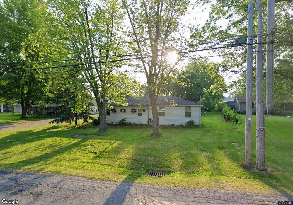
5519 Linn Dr Amherst, OH 44001
Estimated Value: $159,000 - $220,000
3
Beds
2
Baths
848
Sq Ft
$225/Sq Ft
Est. Value
About This Home
This home is located at 5519 Linn Dr, Amherst, OH 44001 and is currently estimated at $190,775, approximately $224 per square foot. 5519 Linn Dr is a home located in Lorain County with nearby schools including Powers Elementary School, Walter G. Nord Middle School, and Amherst Junior High School.
Ownership History
Date
Name
Owned For
Owner Type
Purchase Details
Closed on
Jan 7, 2002
Sold by
Smarsh Kevin J
Bought by
Garn Kevin R
Current Estimated Value
Home Financials for this Owner
Home Financials are based on the most recent Mortgage that was taken out on this home.
Original Mortgage
$89,195
Outstanding Balance
$36,967
Interest Rate
7.24%
Mortgage Type
FHA
Estimated Equity
$153,808
Purchase Details
Closed on
May 19, 2000
Sold by
Griggs Kellie K and Smarsh Kellie K
Bought by
Smarsh Kevin J
Purchase Details
Closed on
Mar 27, 1999
Sold by
Griggs Kellie K
Bought by
Smarsh Kevin and Smarsh Kevin J
Purchase Details
Closed on
Dec 7, 1994
Sold by
Hardwick Bobby K
Bought by
Griggs Kellie K
Home Financials for this Owner
Home Financials are based on the most recent Mortgage that was taken out on this home.
Original Mortgage
$51,000
Interest Rate
9.06%
Mortgage Type
New Conventional
Create a Home Valuation Report for This Property
The Home Valuation Report is an in-depth analysis detailing your home's value as well as a comparison with similar homes in the area
Home Values in the Area
Average Home Value in this Area
Purchase History
| Date | Buyer | Sale Price | Title Company |
|---|---|---|---|
| Garn Kevin R | $89,900 | -- | |
| Smarsh Kevin J | -- | -- | |
| Smarsh Kevin | -- | Midland Title | |
| Griggs Kellie K | $57,000 | -- |
Source: Public Records
Mortgage History
| Date | Status | Borrower | Loan Amount |
|---|---|---|---|
| Open | Garn Kevin R | $89,195 | |
| Previous Owner | Griggs Kellie K | $51,000 |
Source: Public Records
Tax History Compared to Growth
Tax History
| Year | Tax Paid | Tax Assessment Tax Assessment Total Assessment is a certain percentage of the fair market value that is determined by local assessors to be the total taxable value of land and additions on the property. | Land | Improvement |
|---|---|---|---|---|
| 2024 | $1,802 | $44,615 | $16,905 | $27,710 |
| 2023 | $1,824 | $38,049 | $12,656 | $25,393 |
| 2022 | $1,749 | $38,049 | $12,656 | $25,393 |
| 2021 | $1,753 | $38,049 | $12,656 | $25,393 |
| 2020 | $1,719 | $33,120 | $11,020 | $22,100 |
| 2019 | $1,684 | $33,120 | $11,020 | $22,100 |
| 2018 | $1,621 | $33,120 | $11,020 | $22,100 |
| 2017 | $1,550 | $28,470 | $9,690 | $18,780 |
| 2016 | $1,562 | $28,470 | $9,690 | $18,780 |
| 2015 | $1,554 | $28,470 | $9,690 | $18,780 |
| 2014 | $1,459 | $26,610 | $9,060 | $17,550 |
| 2013 | $1,464 | $26,610 | $9,060 | $17,550 |
Source: Public Records
Map
Nearby Homes
- 1415 Shaffer Dr
- 1519 Shaffer Dr
- 1423 Narragansett Blvd
- 5614 S Nantucket Dr
- 1819 Gloucester Dr
- 1519 Westwood Dr
- 1321 Westwood Dr
- 1711 N Nantucket Dr
- 4977-4985 Oberlin Ave
- 4859 Oberlin Ave
- Pine—End Unit Plan at Quarry Creek
- Ivy Plan at Quarry Creek
- Pine w/ Full Basement Plan at Quarry Creek
- 117 Caesars Cir
- 1310 Lindenwood Dr
- 359 Rockridge Dr
- 351 Rockridge Dr
- 116 Rockridge Dr
- 60 Flamingo Ave
- 1273 Spruce Tree Ln
- 5513 Linn Dr
- 5525 Linn Dr
- 5507 Linn Dr
- 5531 Linn Dr
- 5528 Linn Dr
- 5524 Linn Dr
- 5501 Linn Dr
- 5532 Linn Dr
- 5536 Linn Dr
- 5535 Linn Dr
- 5506 Linn Dr
- 5542 Linn Dr
- 5537 Linn Dr
- 5502 Linn Dr
- 5546 Linn Dr
- 1491 Cooper Foster Park Rd
- 1477 Cooper Foster Park Rd
- 5549 Linn Dr
- 1473 1475 Cooper Foster Park
- 1473 Cooper Foster Park Rd