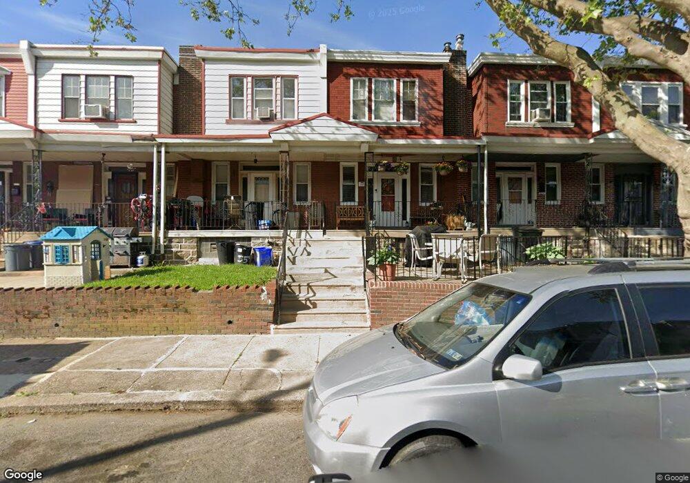
552 Anchor St Philadelphia, PA 19120
Lawncrest NeighborhoodEstimated Value: $188,000 - $207,000
3
Beds
1
Bath
1,102
Sq Ft
$178/Sq Ft
Est. Value
About This Home
This home is located at 552 Anchor St, Philadelphia, PA 19120 and is currently estimated at $196,426, approximately $178 per square foot. 552 Anchor St is a home located in Philadelphia County with nearby schools including Benjamin Franklin Elementary School, Samuel Fels High School, and University Creighton Charter School.
Ownership History
Date
Name
Owned For
Owner Type
Purchase Details
Closed on
Aug 8, 2024
Sold by
Jacobs-Williams Derrick R and Williams Derrick
Bought by
Jacobs Nicole and Smalls Vincent
Current Estimated Value
Home Financials for this Owner
Home Financials are based on the most recent Mortgage that was taken out on this home.
Original Mortgage
$46,750
Outstanding Balance
$46,229
Interest Rate
6.95%
Mortgage Type
New Conventional
Estimated Equity
$150,197
Purchase Details
Closed on
Jul 30, 2002
Sold by
Copestick Michael and Copestick Caroline
Bought by
Jacobs Derrick
Home Financials for this Owner
Home Financials are based on the most recent Mortgage that was taken out on this home.
Original Mortgage
$50,110
Interest Rate
6.58%
Mortgage Type
FHA
Create a Home Valuation Report for This Property
The Home Valuation Report is an in-depth analysis detailing your home's value as well as a comparison with similar homes in the area
Home Values in the Area
Average Home Value in this Area
Purchase History
| Date | Buyer | Sale Price | Title Company |
|---|---|---|---|
| Jacobs Nicole | $75,000 | Metropolitan Abstract | |
| Jacobs Derrick | $49,995 | Lawyers Title Insurance Corp |
Source: Public Records
Mortgage History
| Date | Status | Borrower | Loan Amount |
|---|---|---|---|
| Open | Jacobs Nicole | $46,750 | |
| Previous Owner | Jacobs Derrick | $50,110 |
Source: Public Records
Tax History Compared to Growth
Tax History
| Year | Tax Paid | Tax Assessment Tax Assessment Total Assessment is a certain percentage of the fair market value that is determined by local assessors to be the total taxable value of land and additions on the property. | Land | Improvement |
|---|---|---|---|---|
| 2025 | $1,786 | $168,200 | $33,640 | $134,560 |
| 2024 | $1,786 | $168,200 | $33,640 | $134,560 |
| 2023 | $1,786 | $127,600 | $25,520 | $102,080 |
| 2022 | $1,249 | $127,600 | $25,520 | $102,080 |
| 2021 | $1,249 | $0 | $0 | $0 |
| 2020 | $1,249 | $0 | $0 | $0 |
| 2019 | $1,198 | $0 | $0 | $0 |
| 2018 | $1,229 | $0 | $0 | $0 |
| 2017 | $1,229 | $0 | $0 | $0 |
| 2016 | $1,229 | $0 | $0 | $0 |
| 2015 | $1,177 | $0 | $0 | $0 |
| 2014 | -- | $87,800 | $13,987 | $73,813 |
| 2012 | -- | $12,672 | $876 | $11,796 |
Source: Public Records
Map
Nearby Homes
- 569 E Sanger St
- 554 E Carver St
- 5724 Colgate St
- 615 Brill St
- 619 Brill St
- 561 E Cheltenham Ave
- 539 E Godfrey Ave
- 588 E Godfrey Ave
- 578 Rosalie St Unit A
- 517 E Cheltenham Ave
- 644 E Cheltenham Ave
- 604 Alcott St
- 508 E Godfrey Ave
- 539 Van Kirk St
- 504 E Godfrey Ave
- 5915 Palmetto St
- 5922 Elsinore St
- 5934 Palmetto St
- 5939 Malta St
- 5920 Lawndale St
- 550 Anchor St
- 554 Anchor St
- 548 Anchor St
- 556 Anchor St
- 546 Anchor St
- 558 Anchor St
- 544 Anchor St Unit REAR
- 544 Anchor St
- 560 Anchor St
- 553 E Carver St
- 551 E Carver St
- 549 E Carver St
- 542 Anchor St
- 555 E Carver St
- 562 Anchor St
- 557 E Carver St
- 547 E Carver St
- 540 Anchor St
- 559 E Carver St
- 545 E Carver St