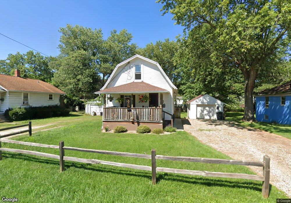
552 Burns St Mansfield, OH 44903
Estimated Value: $66,000 - $72,000
3
Beds
1
Bath
1,190
Sq Ft
$57/Sq Ft
Est. Value
About This Home
This home is located at 552 Burns St, Mansfield, OH 44903 and is currently estimated at $68,062, approximately $57 per square foot. 552 Burns St is a home located in Richland County with nearby schools including Foundation Academy, Mansfield Elective Academy, and Goal Digital Academy.
Ownership History
Date
Name
Owned For
Owner Type
Purchase Details
Closed on
Aug 10, 2016
Sold by
Stackhouse Jerry L and Stackhouse Janet S
Bought by
Dashkovitz David A and Dashkiovitz Robin L
Current Estimated Value
Purchase Details
Closed on
Sep 9, 1992
Bought by
First Federal Savings & Loan
Purchase Details
Closed on
Jun 29, 1992
Sold by
Cha Hang Yol
Bought by
First Federal Savings & Loan
Purchase Details
Closed on
Aug 1, 1985
Create a Home Valuation Report for This Property
The Home Valuation Report is an in-depth analysis detailing your home's value as well as a comparison with similar homes in the area
Home Values in the Area
Average Home Value in this Area
Purchase History
| Date | Buyer | Sale Price | Title Company |
|---|---|---|---|
| Dashkovitz David A | $26,500 | Chicago Title | |
| First Federal Savings & Loan | $19,000 | -- | |
| First Federal Savings & Loan | $12,000 | -- | |
| -- | $26,000 | -- |
Source: Public Records
Tax History Compared to Growth
Tax History
| Year | Tax Paid | Tax Assessment Tax Assessment Total Assessment is a certain percentage of the fair market value that is determined by local assessors to be the total taxable value of land and additions on the property. | Land | Improvement |
|---|---|---|---|---|
| 2024 | $811 | $17,310 | $2,050 | $15,260 |
| 2023 | $811 | $17,310 | $2,050 | $15,260 |
| 2022 | $497 | $8,900 | $1,860 | $7,040 |
| 2021 | $501 | $8,900 | $1,860 | $7,040 |
| 2020 | $512 | $8,900 | $1,860 | $7,040 |
| 2019 | $568 | $8,900 | $1,860 | $7,040 |
| 2018 | $560 | $8,900 | $1,860 | $7,040 |
| 2017 | $427 | $8,900 | $1,860 | $7,040 |
| 2016 | $309 | $4,900 | $2,950 | $1,950 |
| 2015 | $309 | $4,900 | $2,950 | $1,950 |
| 2014 | $654 | $10,990 | $2,950 | $8,040 |
| 2012 | $498 | $10,990 | $3,100 | $7,890 |
Source: Public Records
Map
Nearby Homes
- 512 Burns St
- 0 State Route 314 Unit 9069650
- 0 State Route 314 Unit 9067316
- 0 State Route 314 Unit 225021979
- 0 Highway 30
- 426 Mcpherson St
- 269 Parkway Dr
- 0 Voegele Ave Unit Lot 6048, 6049, 6
- 283 Bulkley Ave
- 237 Helen Ave
- 371 Bell St
- 641 Averill Ave
- 212 Penn Ave
- 362-364 W 6th St
- 526 Bowman St
- 185 Rowland Ave
- 170 Western Ave
- 743 Bowman St
- 156 Buckingham Ave Unit 158
- 120 Gettings Place