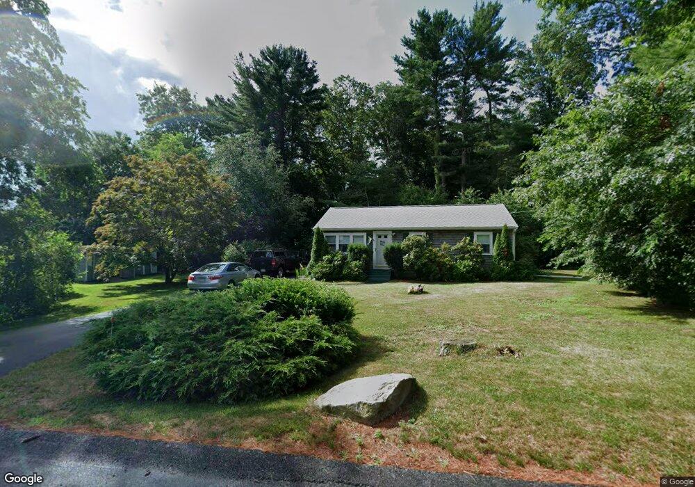
552 County Rd Hanson, MA 02341
Estimated Value: $459,039 - $550,000
2
Beds
1
Bath
912
Sq Ft
$556/Sq Ft
Est. Value
About This Home
This home is located at 552 County Rd, Hanson, MA 02341 and is currently estimated at $506,760, approximately $555 per square foot. 552 County Rd is a home located in Plymouth County.
Ownership History
Date
Name
Owned For
Owner Type
Purchase Details
Closed on
Nov 30, 1998
Sold by
Richmond Dana M
Bought by
Clancy Timothy J and Clancy Candice L
Current Estimated Value
Home Financials for this Owner
Home Financials are based on the most recent Mortgage that was taken out on this home.
Original Mortgage
$116,400
Outstanding Balance
$26,554
Interest Rate
6.83%
Mortgage Type
Purchase Money Mortgage
Estimated Equity
$480,206
Create a Home Valuation Report for This Property
The Home Valuation Report is an in-depth analysis detailing your home's value as well as a comparison with similar homes in the area
Home Values in the Area
Average Home Value in this Area
Purchase History
| Date | Buyer | Sale Price | Title Company |
|---|---|---|---|
| Clancy Timothy J | $146,400 | -- |
Source: Public Records
Mortgage History
| Date | Status | Borrower | Loan Amount |
|---|---|---|---|
| Open | Clancy Timothy J | $116,400 | |
| Previous Owner | Clancy Timothy J | $100,000 | |
| Previous Owner | Clancy Timothy J | $50,000 | |
| Previous Owner | Clancy Timothy J | $10,000 |
Source: Public Records
Tax History
| Year | Tax Paid | Tax Assessment Tax Assessment Total Assessment is a certain percentage of the fair market value that is determined by local assessors to be the total taxable value of land and additions on the property. | Land | Improvement |
|---|---|---|---|---|
| 2025 | $5,012 | $374,600 | $162,900 | $211,700 |
| 2024 | $4,830 | $361,000 | $158,200 | $202,800 |
| 2023 | $4,784 | $337,400 | $158,200 | $179,200 |
| 2022 | $4,628 | $306,700 | $143,800 | $162,900 |
| 2021 | $4,051 | $268,300 | $138,300 | $130,000 |
| 2020 | $3,987 | $261,100 | $133,600 | $127,500 |
| 2019 | $3,837 | $247,100 | $131,000 | $116,100 |
| 2018 | $3,764 | $237,800 | $126,000 | $111,800 |
| 2017 | $3,645 | $228,100 | $120,000 | $108,100 |
| 2016 | $3,697 | $223,400 | $120,000 | $103,400 |
| 2015 | $3,517 | $220,900 | $120,000 | $100,900 |
Source: Public Records
Map
Nearby Homes
- Lot 6 Way
- Lot 2 Harvard Rd
- 361 County Rd
- 161 Winter St Unit 11
- 361A County Rd
- 84 Liberty St
- Lot 5 Princeton Way
- 127 Crescent Place
- 134 Crescent St
- 61 Sawmill Ln
- 61 Sawmill Ln Unit 61
- 724 Whitman St
- 139 Fairwood Dr
- 80 Phillips St
- 72 Phillips St
- 430 Brook Bend Rd
- 269 Lakeside Rd
- 1054 Main St
- 23 Live Oak Way
- 108 Waterford Dr
Your Personal Tour Guide
Ask me questions while you tour the home.