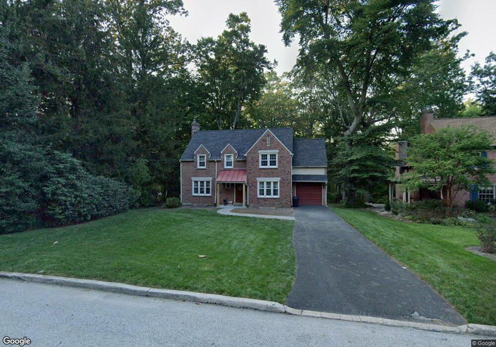
552 Custis Rd Glenside, PA 19038
Estimated Value: $542,000 - $573,000
3
Beds
2
Baths
1,816
Sq Ft
$309/Sq Ft
Est. Value
About This Home
This home is located at 552 Custis Rd, Glenside, PA 19038 and is currently estimated at $561,999, approximately $309 per square foot. 552 Custis Rd is a home located in Montgomery County with nearby schools including Elkins Park School, Cedarbrook Middle School, and Cheltenham High School.
Ownership History
Date
Name
Owned For
Owner Type
Purchase Details
Closed on
Mar 31, 2011
Sold by
Carabba Richard F
Bought by
Mcnamara Kevin J and Mcnamara Katrina M
Current Estimated Value
Home Financials for this Owner
Home Financials are based on the most recent Mortgage that was taken out on this home.
Original Mortgage
$32,000
Outstanding Balance
$21,851
Interest Rate
4.89%
Estimated Equity
$540,148
Purchase Details
Closed on
Aug 30, 2010
Sold by
Cross Charles and Macatee Phyllis C
Bought by
Carabba Richard F
Create a Home Valuation Report for This Property
The Home Valuation Report is an in-depth analysis detailing your home's value as well as a comparison with similar homes in the area
Home Values in the Area
Average Home Value in this Area
Purchase History
| Date | Buyer | Sale Price | Title Company |
|---|---|---|---|
| Mcnamara Kevin J | $320,000 | None Available | |
| Carabba Richard F | $110,000 | None Available |
Source: Public Records
Mortgage History
| Date | Status | Borrower | Loan Amount |
|---|---|---|---|
| Open | Mcnamara Kevin J | $32,000 | |
| Open | Mcnamara Kevin J | $256,000 |
Source: Public Records
Tax History
| Year | Tax Paid | Tax Assessment Tax Assessment Total Assessment is a certain percentage of the fair market value that is determined by local assessors to be the total taxable value of land and additions on the property. | Land | Improvement |
|---|---|---|---|---|
| 2025 | $11,024 | $165,060 | $58,090 | $106,970 |
| 2024 | $11,024 | $165,060 | $58,090 | $106,970 |
| 2023 | $10,900 | $165,060 | $58,090 | $106,970 |
| 2022 | $10,712 | $165,060 | $58,090 | $106,970 |
| 2021 | $10,419 | $165,060 | $58,090 | $106,970 |
| 2020 | $10,119 | $165,060 | $58,090 | $106,970 |
| 2019 | $9,917 | $165,060 | $58,090 | $106,970 |
Source: Public Records
Map
Nearby Homes
- 513 Waln Rd
- 505 Station Ave
- 910 Edann Rd
- 208 Limekiln Pike
- 57 Chelfield Rd
- 65 Limekiln Pike
- 776 Brooke Rd
- 523 W Glenside Ave
- 2543 Gypsy Ln
- 323 W Waverly Rd
- 152 Egerton Ave
- 358 Oak Rd
- 514 Kingston Rd
- 302 Garth Rd
- 404 Enfield Rd
- 250 Logan Ave
- 3009 Limekiln Pike
- 257 Girard Ave
- 221 S Easton Rd
- 2718 Hawthorne Rd
Your Personal Tour Guide
Ask me questions while you tour the home.