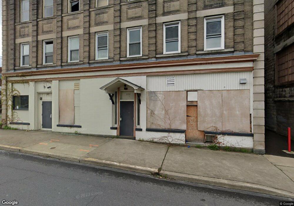
552 Front St Scranton, PA 18505
South Side NeighborhoodEstimated Value: $157,574
--
Bed
4
Baths
6,513
Sq Ft
$24/Sq Ft
Est. Value
About This Home
This home is located at 552 Front St, Scranton, PA 18505 and is currently estimated at $157,574, approximately $24 per square foot. 552 Front St is a home located in Lackawanna County with nearby schools including Jackson Davis Elementary School, Longdale Elementary School, and Pinchbeck Elementary School.
Ownership History
Date
Name
Owned For
Owner Type
Purchase Details
Closed on
Aug 27, 2021
Sold by
Kearney Kevin P and Kearney Natalie M
Bought by
552 554 Front St Llc
Current Estimated Value
Purchase Details
Closed on
Dec 13, 2016
Sold by
Peoples Security Bank & Trust Company
Bought by
Kearney Kevin P and Kearney Natalie M
Home Financials for this Owner
Home Financials are based on the most recent Mortgage that was taken out on this home.
Original Mortgage
$110,000
Interest Rate
3.94%
Mortgage Type
Commercial
Create a Home Valuation Report for This Property
The Home Valuation Report is an in-depth analysis detailing your home's value as well as a comparison with similar homes in the area
Home Values in the Area
Average Home Value in this Area
Purchase History
| Date | Buyer | Sale Price | Title Company |
|---|---|---|---|
| 552 554 Front St Llc | $125,000 | None Available | |
| Kearney Kevin P | $140,000 | None Available |
Source: Public Records
Mortgage History
| Date | Status | Borrower | Loan Amount |
|---|---|---|---|
| Previous Owner | Kearney Kevin P | $110,000 |
Source: Public Records
Tax History Compared to Growth
Tax History
| Year | Tax Paid | Tax Assessment Tax Assessment Total Assessment is a certain percentage of the fair market value that is determined by local assessors to be the total taxable value of land and additions on the property. | Land | Improvement |
|---|---|---|---|---|
| 2025 | $7,057 | $23,000 | $1,920 | $21,080 |
| 2024 | $6,427 | $23,000 | $1,920 | $21,080 |
| 2023 | $6,427 | $23,000 | $1,920 | $21,080 |
| 2022 | $6,285 | $23,000 | $1,920 | $21,080 |
| 2021 | $6,285 | $23,000 | $1,920 | $21,080 |
| 2020 | $6,161 | $23,000 | $1,920 | $21,080 |
| 2019 | $5,788 | $23,000 | $1,920 | $21,080 |
| 2018 | $5,788 | $23,000 | $1,920 | $21,080 |
| 2017 | $5,680 | $23,000 | $1,920 | $21,080 |
| 2016 | $0 | $23,000 | $1,920 | $21,080 |
| 2015 | -- | $23,000 | $1,920 | $21,080 |
| 2014 | -- | $23,000 | $1,920 | $21,080 |
Source: Public Records
Map
Nearby Homes
- 610 Moosic St
- 228 Pittston Ave
- 227 Stephen Ave
- 538 Orchard St
- 321 Prospect Ave
- 522 524 River St
- 409 Prospect Ave
- 506 Prospect Ave
- 501-503 Cedar Ave
- 439 Alder St
- 741 River St
- 527 Cedar Ave
- 615 Pittston Ave
- 824 Hemlock St
- 618 Alder St
- 421 Willow St
- 316 Taylor Ave
- 710 Pittston Ave
- 728 Alder St
- 228 Prescott Ave
- 554 Front St
- 552-554 Front St
- 522 Moosic St
- 101 Pittston Ave
- 523 Quinan Place
- 520 Moosic St
- 528 Moosic St
- 526 Moosic St
- 523 Hemlock St
- 531 Hemlock St Unit L17
- 530 Moosic St
- 527 Hemlock St
- 535 Hemlock St
- 201 Pittston Ave Unit 1
- 201 Pittston Ave
- 201 Pittston Ave Unit 2nd floor
- 201 Pittston Ave Unit 1st floor
- 533 Hemlock St
- 533R Hemlock St
- 514 Hemlock St