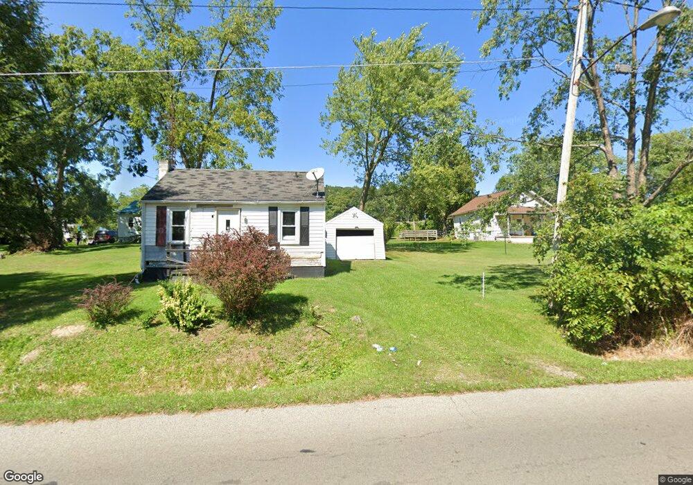
552 King St Mansfield, OH 44903
Estimated Value: $54,769 - $84,000
2
Beds
1
Bath
580
Sq Ft
$123/Sq Ft
Est. Value
About This Home
This home is located at 552 King St, Mansfield, OH 44903 and is currently estimated at $71,192, approximately $122 per square foot. 552 King St is a home located in Richland County with nearby schools including Foundation Academy, Mansfield Elective Academy, and Goal Digital Academy.
Ownership History
Date
Name
Owned For
Owner Type
Purchase Details
Closed on
Oct 28, 2016
Sold by
Freeman Rentals Llc
Bought by
Strouse Steven
Current Estimated Value
Purchase Details
Closed on
Sep 21, 2009
Sold by
Federal Home Loan Mortgage Corporation
Bought by
Ira Services Trust Company
Purchase Details
Closed on
Jul 10, 2009
Sold by
Garrett Kenneth L
Bought by
Federal Home Loan Mortgage Corp
Purchase Details
Closed on
Jul 13, 2001
Sold by
Mertler Stephen B
Bought by
Garrett Kenneth L
Home Financials for this Owner
Home Financials are based on the most recent Mortgage that was taken out on this home.
Original Mortgage
$23,000
Interest Rate
7.27%
Mortgage Type
New Conventional
Create a Home Valuation Report for This Property
The Home Valuation Report is an in-depth analysis detailing your home's value as well as a comparison with similar homes in the area
Home Values in the Area
Average Home Value in this Area
Purchase History
| Date | Buyer | Sale Price | Title Company |
|---|---|---|---|
| Strouse Steven | $3,214 | Chicago Title Agency Of N Ce | |
| Ira Services Trust Company | $5,500 | Barrister Lawyers Title | |
| Federal Home Loan Mortgage Corp | $12,667 | None Available | |
| Garrett Kenneth L | $15,000 | -- |
Source: Public Records
Mortgage History
| Date | Status | Borrower | Loan Amount |
|---|---|---|---|
| Previous Owner | Garrett Kenneth L | $23,000 |
Source: Public Records
Tax History Compared to Growth
Tax History
| Year | Tax Paid | Tax Assessment Tax Assessment Total Assessment is a certain percentage of the fair market value that is determined by local assessors to be the total taxable value of land and additions on the property. | Land | Improvement |
|---|---|---|---|---|
| 2024 | $395 | $8,250 | $1,750 | $6,500 |
| 2023 | $395 | $8,250 | $1,750 | $6,500 |
| 2022 | $481 | $8,420 | $1,590 | $6,830 |
| 2021 | $484 | $8,420 | $1,590 | $6,830 |
| 2020 | $495 | $8,420 | $1,590 | $6,830 |
| 2019 | $549 | $8,420 | $1,590 | $6,830 |
| 2018 | $542 | $8,420 | $1,590 | $6,830 |
| 2017 | $527 | $8,420 | $1,590 | $6,830 |
| 2016 | $1,110 | $8,450 | $2,520 | $5,930 |
| 2015 | $521 | $8,450 | $2,520 | $5,930 |
| 2014 | $514 | $8,450 | $2,520 | $5,930 |
| 2012 | $394 | $8,440 | $2,650 | $5,790 |
Source: Public Records
Map
Nearby Homes
- 512 Burns St
- 0 Highway 30
- 0 State Route 314 Unit 9069650
- 0 State Route 314 Unit 9067316
- 0 State Route 314 Unit 225021979
- 426 Mcpherson St
- 674 Averill Ave
- 641 Averill Ave
- 283 Bulkley Ave
- 269 Parkway Dr
- 0 Voegele Ave Unit Lot 6048, 6049, 6
- 237 Helen Ave
- 371 Bell St
- 526 Bowman St
- 743 Bowman St
- 212 Penn Ave
- 362-364 W 6th St
- 185 Rowland Ave
- 741 Burger Ave
- 170 Western Ave
- 559 Arnold Ave
- 543 Arnold Ave
- 565 Arnold Ave
- 556 Arnold Ave
- 0 Arnold Ave 556 Richland Unit 5411256-8052177
- 557 King St
- 532 King St
- 573 Arnold Ave
- 560 Arnold Ave
- 560 Arnold Ave
- 541 King St
- 541 King St
- 566 Arnold Ave
- 522 King St
- 537 King St
- 531 King St
- 576 Arnold Ave
- 576 Arnold Ave
- 583 Arnold Ave
- 527 King St