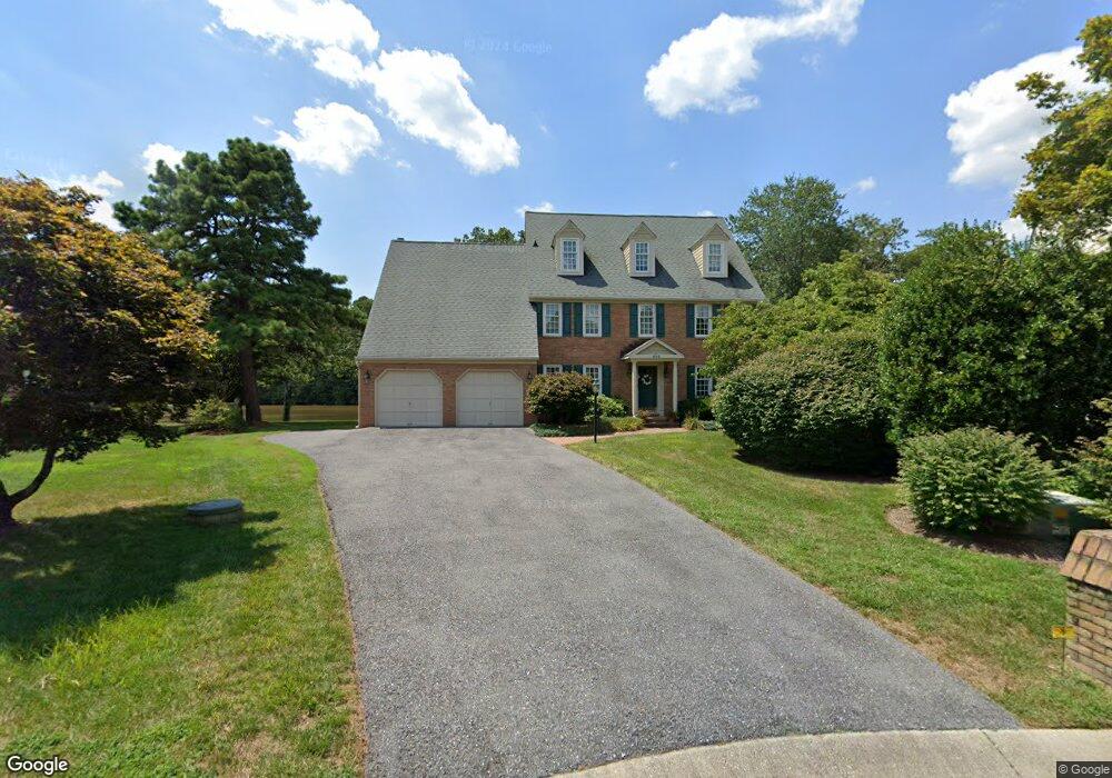
552 Point Field Dr Millersville, MD 21108
Estimated Value: $1,156,000 - $1,687,632
--
Bed
4
Baths
3,179
Sq Ft
$422/Sq Ft
Est. Value
About This Home
This home is located at 552 Point Field Dr, Millersville, MD 21108 and is currently estimated at $1,341,908, approximately $422 per square foot. 552 Point Field Dr is a home located in Anne Arundel County with nearby schools including Benfield Elementary School, Severna Park Middle School, and Severna Park High School.
Ownership History
Date
Name
Owned For
Owner Type
Purchase Details
Closed on
Jul 5, 2006
Sold by
Whittle Thomas L
Bought by
Whittle Thomas L and Whittle Carol J
Current Estimated Value
Purchase Details
Closed on
May 23, 2006
Sold by
Whittle Thomas L
Bought by
Whittle Thomas L and Whittle Carol J
Purchase Details
Closed on
Jan 24, 1986
Sold by
Dodge Robert P
Bought by
Whittle Thomas L
Home Financials for this Owner
Home Financials are based on the most recent Mortgage that was taken out on this home.
Original Mortgage
$200,000
Interest Rate
10.97%
Create a Home Valuation Report for This Property
The Home Valuation Report is an in-depth analysis detailing your home's value as well as a comparison with similar homes in the area
Home Values in the Area
Average Home Value in this Area
Purchase History
| Date | Buyer | Sale Price | Title Company |
|---|---|---|---|
| Whittle Thomas L | -- | -- | |
| Whittle Thomas L | -- | -- | |
| Whittle Thomas L | $344,000 | -- |
Source: Public Records
Mortgage History
| Date | Status | Borrower | Loan Amount |
|---|---|---|---|
| Previous Owner | Whittle Thomas L | $200,000 |
Source: Public Records
Tax History Compared to Growth
Tax History
| Year | Tax Paid | Tax Assessment Tax Assessment Total Assessment is a certain percentage of the fair market value that is determined by local assessors to be the total taxable value of land and additions on the property. | Land | Improvement |
|---|---|---|---|---|
| 2025 | $11,282 | $1,380,567 | -- | -- |
| 2024 | $11,282 | $1,322,000 | $950,000 | $372,000 |
| 2023 | $11,014 | $1,295,833 | $0 | $0 |
| 2022 | $10,335 | $1,269,667 | $0 | $0 |
| 2021 | $20,279 | $1,243,500 | $836,000 | $407,500 |
| 2020 | $9,895 | $1,201,000 | $0 | $0 |
| 2019 | $9,696 | $1,158,500 | $0 | $0 |
| 2018 | $11,316 | $1,116,000 | $766,000 | $350,000 |
| 2017 | $9,021 | $1,043,333 | $0 | $0 |
| 2016 | -- | $970,667 | $0 | $0 |
| 2015 | -- | $898,000 | $0 | $0 |
| 2014 | -- | $898,000 | $0 | $0 |
Source: Public Records
Map
Nearby Homes
- 610 Echo Cove Dr
- 405 Ben Oaks Dr W
- 1158 Blue Bird Ln
- 626 Evergreen Rd
- 762 Cougar Dr
- 771 Generals Hwy
- 8201 Longford Rd
- 1220 Indian Landing Rd
- 518 Lakeland Rd S
- 302 Blue Cedar Ct
- 513 Old Pasture Ln
- 439A Lakeland Rd N
- 717 Whitneys Landing Dr
- 738 Whitneys Landing Dr
- 1304 North Rd
- 983 Wayside Dr
- 596 West Dr
- 1013 Waterbury Heights Dr
- 1610 Hog Farm Rd
- 680 Shore Rd
- 550 Point Field Dr
- 554 Point Field Dr
- 548 Point Field Dr
- 547 Point Field Dr
- 545 Point Field Dr
- 543 Point Field Dr
- 541 Point Field Dr
- 546 Point Field Dr
- 539 Point Field Dr
- 544 Point Field Dr
- 537 Point Field Dr
- 542 Point Field Dr
- 535 Point Field Dr
- 540 Point Field Dr
- 533 Point Field Dr
- 538 Point Field Dr
- 531 Point Field Dr
- 536 Point Field Dr
- 529 Point Field Dr
- 527 Point Field Dr