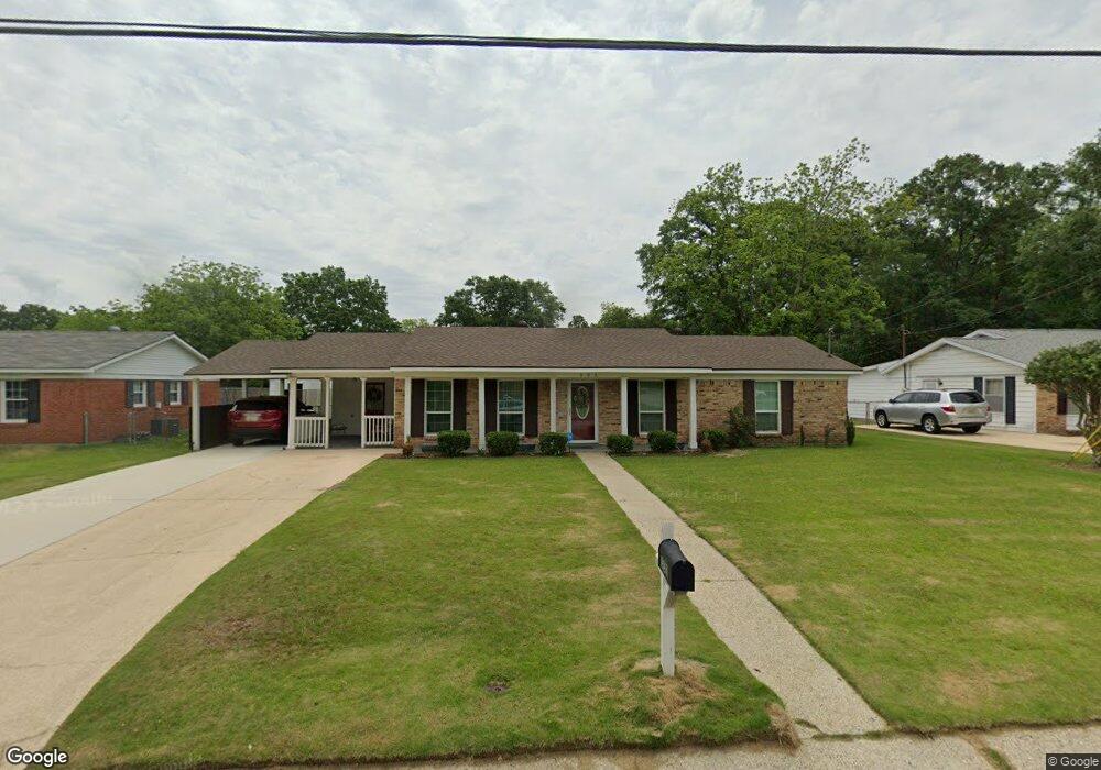
552 Scott Dr Saraland, AL 36571
Estimated Value: $159,000 - $219,000
3
Beds
2
Baths
1,350
Sq Ft
$144/Sq Ft
Est. Value
About This Home
This home is located at 552 Scott Dr, Saraland, AL 36571 and is currently estimated at $194,039, approximately $143 per square foot. 552 Scott Dr is a home located in Mobile County with nearby schools including Saraland Elementary School, Nelson Leon Adams Middle School/Saraland Middle School, and Saraland High School.
Ownership History
Date
Name
Owned For
Owner Type
Purchase Details
Closed on
Jul 15, 2005
Sold by
Rowell Kavin and Rowell Susan W
Bought by
Mcdonald Gloria Ann
Current Estimated Value
Home Financials for this Owner
Home Financials are based on the most recent Mortgage that was taken out on this home.
Original Mortgage
$94,900
Outstanding Balance
$49,154
Interest Rate
5.54%
Mortgage Type
Fannie Mae Freddie Mac
Estimated Equity
$144,885
Purchase Details
Closed on
May 9, 2003
Sold by
Godfrey Perry L and Godfrey Jennifer A
Bought by
Rowell Kavin and Rowell Susan W
Home Financials for this Owner
Home Financials are based on the most recent Mortgage that was taken out on this home.
Original Mortgage
$62,100
Interest Rate
5.76%
Purchase Details
Closed on
Nov 12, 1998
Sold by
Harold Culpepper Jerry and Harold Virginia
Bought by
Godfrey Perry L and Godfrey Jennifer A
Home Financials for this Owner
Home Financials are based on the most recent Mortgage that was taken out on this home.
Original Mortgage
$57,000
Interest Rate
4.62%
Create a Home Valuation Report for This Property
The Home Valuation Report is an in-depth analysis detailing your home's value as well as a comparison with similar homes in the area
Home Values in the Area
Average Home Value in this Area
Purchase History
| Date | Buyer | Sale Price | Title Company |
|---|---|---|---|
| Mcdonald Gloria Ann | $95,400 | -- | |
| Rowell Kavin | -- | -- | |
| Godfrey Perry L | -- | -- |
Source: Public Records
Mortgage History
| Date | Status | Borrower | Loan Amount |
|---|---|---|---|
| Open | Mcdonald Gloria Ann | $94,900 | |
| Previous Owner | Rowell Kavin | $62,100 | |
| Previous Owner | Godfrey Perry L | $57,000 |
Source: Public Records
Tax History Compared to Growth
Tax History
| Year | Tax Paid | Tax Assessment Tax Assessment Total Assessment is a certain percentage of the fair market value that is determined by local assessors to be the total taxable value of land and additions on the property. | Land | Improvement |
|---|---|---|---|---|
| 2024 | -- | $16,340 | $3,000 | $13,340 |
| 2023 | $0 | $12,800 | $2,640 | $10,160 |
| 2022 | $0 | $12,160 | $2,420 | $9,740 |
| 2021 | $0 | $10,600 | $2,200 | $8,400 |
| 2020 | $0 | $10,600 | $2,200 | $8,400 |
| 2019 | $0 | $10,000 | $0 | $0 |
| 2018 | $0 | $10,000 | $0 | $0 |
| 2017 | $0 | $9,240 | $0 | $0 |
| 2016 | -- | $9,120 | $0 | $0 |
| 2013 | $452 | $9,880 | $0 | $0 |
Source: Public Records
Map
Nearby Homes
- 159 Courtaulds Ave
- 832 Shelton Beach Rd
- 205 Stauffer Ave
- 0 Shelton Beach Rd Unit 7618795
- 503 Shelton Beach Rd
- 711 Ann St
- 0 Joaneen Dr Unit 7576451
- 804 Myron Ave
- 129 Melinda Dr
- 1019 Joaneen Dr
- 30 Melinda Dr
- 253 Autumn Dr
- 234 Autumn Dr
- 20 Robbie Ln
- 0 Lincoln St
- 820 James St
- 325 Bryant Ct
- 827 James St
- 1121 Joaneen Dr
- 410 Allen Cir