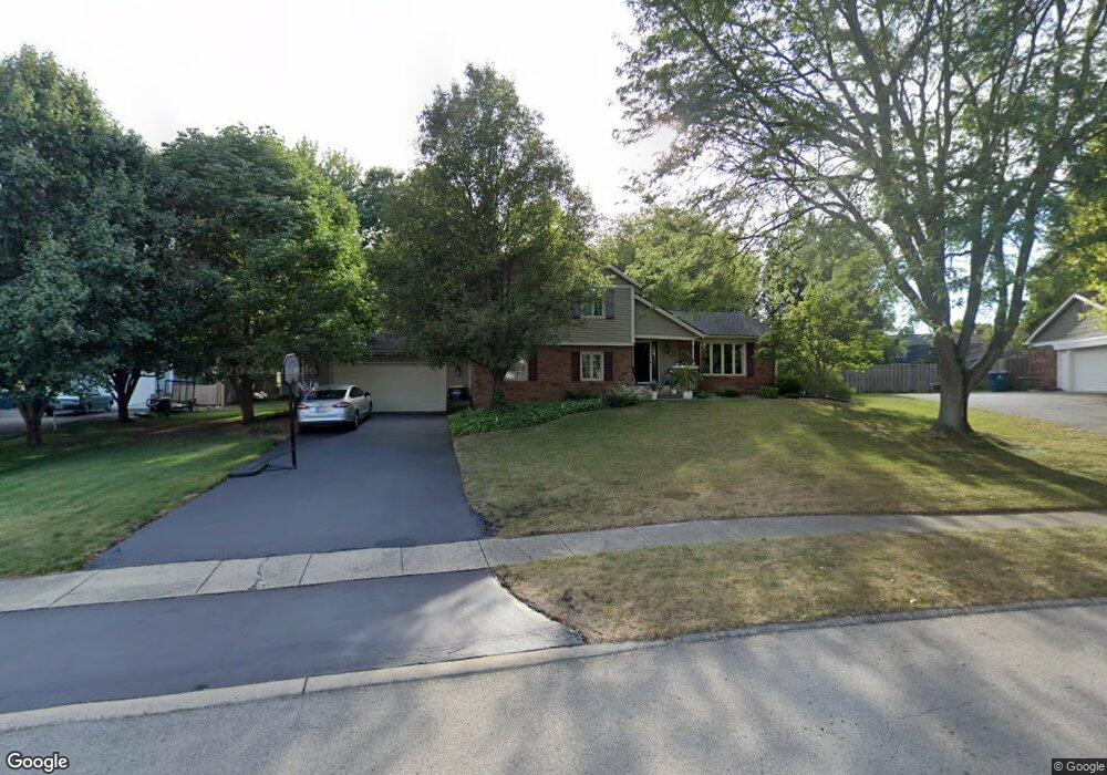
552 Smokey Row Ct Carmel, IN 46033
East Carmel NeighborhoodEstimated Value: $497,000 - $564,000
4
Beds
3
Baths
2,246
Sq Ft
$239/Sq Ft
Est. Value
About This Home
This home is located at 552 Smokey Row Ct, Carmel, IN 46033 and is currently estimated at $536,277, approximately $238 per square foot. 552 Smokey Row Ct is a home located in Hamilton County with nearby schools including Mohawk Trails Elementary School, Clay Middle School, and Carmel High School.
Ownership History
Date
Name
Owned For
Owner Type
Purchase Details
Closed on
Mar 17, 2021
Sold by
Ballone Carol A
Bought by
Carol A Ballone Revocable Trust and Ballone
Current Estimated Value
Purchase Details
Closed on
Jul 29, 2010
Sold by
Ballone Carol A
Bought by
Ballone Carol A
Home Financials for this Owner
Home Financials are based on the most recent Mortgage that was taken out on this home.
Original Mortgage
$223,416
Interest Rate
4.63%
Mortgage Type
FHA
Purchase Details
Closed on
Oct 22, 2008
Sold by
Ballone Carol A
Bought by
Ballone Carol A
Purchase Details
Closed on
Mar 20, 2006
Sold by
Ballone Kenneth M
Bought by
Ballone Carol A
Create a Home Valuation Report for This Property
The Home Valuation Report is an in-depth analysis detailing your home's value as well as a comparison with similar homes in the area
Home Values in the Area
Average Home Value in this Area
Purchase History
| Date | Buyer | Sale Price | Title Company |
|---|---|---|---|
| Carol A Ballone Revocable Trust | -- | None Listed On Document | |
| Ballone Carol A | -- | None Available | |
| Ballone Carol A | -- | None Available | |
| Ballone Carol A | -- | None Available | |
| Ballone Carol A | -- | None Available |
Source: Public Records
Mortgage History
| Date | Status | Borrower | Loan Amount |
|---|---|---|---|
| Previous Owner | Ballone Carol A | $223,416 |
Source: Public Records
Tax History Compared to Growth
Tax History
| Year | Tax Paid | Tax Assessment Tax Assessment Total Assessment is a certain percentage of the fair market value that is determined by local assessors to be the total taxable value of land and additions on the property. | Land | Improvement |
|---|---|---|---|---|
| 2024 | $5,021 | $471,400 | $133,700 | $337,700 |
| 2023 | $5,021 | $462,100 | $124,400 | $337,700 |
| 2022 | $4,128 | $362,000 | $124,400 | $237,600 |
| 2021 | $3,670 | $324,900 | $124,400 | $200,500 |
| 2020 | $3,283 | $289,600 | $124,400 | $165,200 |
| 2019 | $3,235 | $287,600 | $67,500 | $220,100 |
| 2018 | $2,984 | $270,300 | $67,500 | $202,800 |
| 2017 | $2,947 | $268,200 | $67,500 | $200,700 |
| 2016 | $2,845 | $261,400 | $67,500 | $193,900 |
| 2014 | $2,491 | $245,200 | $53,500 | $191,700 |
| 2013 | $2,491 | $234,000 | $53,500 | $180,500 |
Source: Public Records
Map
Nearby Homes
- 651 Hawthorne Dr
- 781 Dayton Dr
- 128 1st Ct
- 1816 Spruce Dr
- 1483 Spruce Dr
- 13615 Smokey Hollow Place
- 13233 Hazelwood Dr
- 1983 Woodbine Ct
- 1910 Spruce Dr
- 3248 Smokey Ridge Way
- 1504 Dorchester Place
- 3172 Smokey Ridge Ln
- 14011 Grisham Dr
- 2913 Twain Dr
- 728 E Main St
- 1129 Fairbanks Dr
- 2945 Millgate Dr
- 12705 Brookshire Pkwy
- 4952 Jennings Dr
- 12669 Brookshire Pkwy
- 570 Smokey Row Ct
- 534 Smokey Row Ct
- 469 Hawthorne Dr
- 527 Hawthorne Dr
- 435 Hawthorne Dr
- 555 Hawthorne Dr
- 543 Smokey Row Ct
- 588 Smokey Row Ct
- 516 Smokey Row Ct
- 369 4th Ct E
- 579 Smokey Row Ct
- 361 4th Ct E
- 525 Smokey Row Ct
- 353 4th Ct E
- 598 Smokey Row Ct
- 507 Smokey Row Ct
- 512 Hawthorne Dr
- 496 Hawthorne Dr
- 452 Hawthorne Dr
- 593 Smokey Row Ct