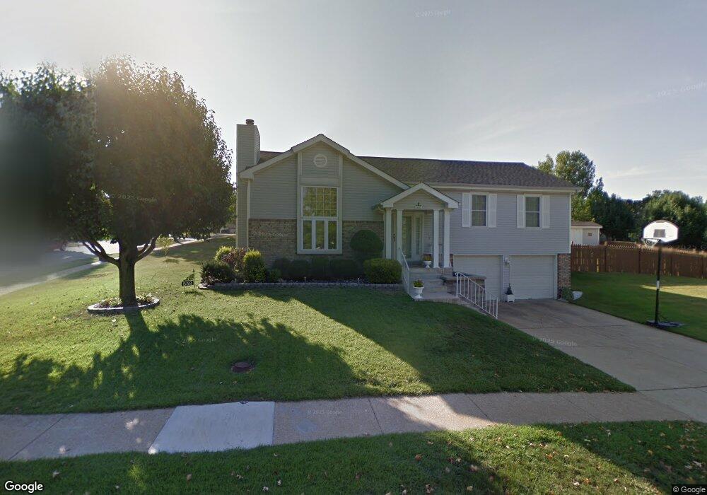
552 Summit View Dr Fenton, MO 63026
Estimated Value: $304,000 - $327,000
3
Beds
2
Baths
1,332
Sq Ft
$236/Sq Ft
Est. Value
About This Home
This home is located at 552 Summit View Dr, Fenton, MO 63026 and is currently estimated at $314,720, approximately $236 per square foot. 552 Summit View Dr is a home located in St. Louis County with nearby schools including Bowles Elementary School, Rockwood South Middle School, and Rockwood Summit Senior High School.
Ownership History
Date
Name
Owned For
Owner Type
Purchase Details
Closed on
Nov 22, 2002
Sold by
Orrick F William and Orrick Dorothy J
Bought by
Tucci Frank and Tucci Elizabeth M
Current Estimated Value
Home Financials for this Owner
Home Financials are based on the most recent Mortgage that was taken out on this home.
Original Mortgage
$155,800
Outstanding Balance
$65,786
Interest Rate
6.13%
Estimated Equity
$248,934
Create a Home Valuation Report for This Property
The Home Valuation Report is an in-depth analysis detailing your home's value as well as a comparison with similar homes in the area
Home Values in the Area
Average Home Value in this Area
Purchase History
| Date | Buyer | Sale Price | Title Company |
|---|---|---|---|
| Tucci Frank | $164,000 | -- |
Source: Public Records
Mortgage History
| Date | Status | Borrower | Loan Amount |
|---|---|---|---|
| Open | Tucci Frank | $155,800 |
Source: Public Records
Tax History Compared to Growth
Tax History
| Year | Tax Paid | Tax Assessment Tax Assessment Total Assessment is a certain percentage of the fair market value that is determined by local assessors to be the total taxable value of land and additions on the property. | Land | Improvement |
|---|---|---|---|---|
| 2025 | $3,699 | $54,380 | $25,230 | $29,150 |
| 2024 | $3,699 | $49,560 | $19,080 | $30,480 |
| 2023 | $3,695 | $49,560 | $19,080 | $30,480 |
| 2022 | $3,323 | $41,500 | $19,080 | $22,420 |
| 2021 | $3,298 | $41,500 | $19,080 | $22,420 |
| 2020 | $3,278 | $39,660 | $15,870 | $23,790 |
| 2019 | $3,287 | $39,660 | $15,870 | $23,790 |
| 2018 | $3,045 | $35,230 | $11,950 | $23,280 |
| 2017 | $3,021 | $35,230 | $11,950 | $23,280 |
| 2016 | $2,578 | $30,320 | $10,050 | $20,270 |
| 2015 | $2,525 | $30,320 | $10,050 | $20,270 |
| 2014 | $2,612 | $30,590 | $9,200 | $21,390 |
Source: Public Records
Map
Nearby Homes
- 1248 Green Knoll Dr
- 260 Trueman Heritage Pkwy
- 818 Mary Lee Ct
- 678 Greensleeves Dr
- 683 Greenholme Ct
- The Westhampton Plan at Bowles Crossing
- The Rockport Plan at Bowles Crossing
- The Richmond Plan at Bowles Crossing
- The Liberty Plan at Bowles Crossing
- The Brookfield Plan at Bowles Crossing
- The Arlington Plan at Bowles Crossing
- 82 May Valley Ln
- 811 Mary Lee Ct
- The Westhampton Plan at Hawkins Point
- The Rockport Plan at Hawkins Point
- The Brookfield Plan at Hawkins Point
- The Liberty Plan at Hawkins Point
- The Arlington Plan at Hawkins Point
- 840 Fall Crown Ln
- 800 Mary Lee Ct
- 1149 Summit Meadows Dr
- 556 Summit View Dr
- 1159 Summit Meadows Dr
- 560 Summit View Dr
- 541 May Valley Dr
- 545 May Valley Dr
- 1152 Summit Meadows Dr
- 557 Summit View Dr
- 1148 Summit Meadows Dr
- 549 May Valley Dr
- 1144 Summit Meadows Dr
- 1163 Summit Meadows Dr
- 568 Summit View Dr
- 561 Summit View Ct
- 1140 Summit Meadows Dr
- 553 May Valley Dr
- 1167 Summit Meadows Dr
- 584 Summit View Dr
- 565 Summit View Ct
- 542 May Valley Dr