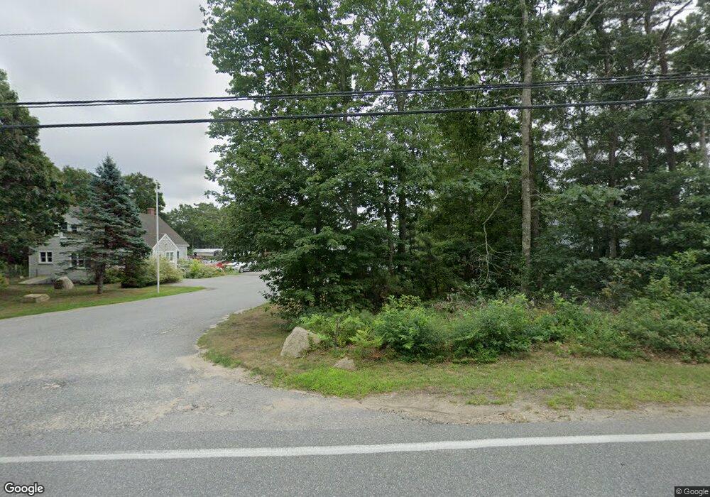
552 Thomas b Landers Rd East Falmouth, MA 2536
--
Bed
--
Bath
4,688
Sq Ft
1.17
Acres
About This Home
This home is located at 552 Thomas b Landers Rd, East Falmouth, MA 2536. 552 Thomas b Landers Rd is a home located in Barnstable County with nearby schools including Mullen-Hall School, Morse Pond School, and Lawrence School.
Ownership History
Date
Name
Owned For
Owner Type
Purchase Details
Closed on
May 5, 2022
Sold by
Lfc Rt
Bought by
Route 28A Llc
Purchase Details
Closed on
Nov 3, 2000
Sold by
Fuccillo Louis J
Bought by
Loud Fuel Co Inc
Create a Home Valuation Report for This Property
The Home Valuation Report is an in-depth analysis detailing your home's value as well as a comparison with similar homes in the area
Home Values in the Area
Average Home Value in this Area
Purchase History
| Date | Buyer | Sale Price | Title Company |
|---|---|---|---|
| Route 28A Llc | -- | None Available | |
| Route 28A Llc | -- | None Available | |
| Loud Fuel Co Inc | $117,000 | -- | |
| Loud Fuel Co Inc | $117,000 | -- |
Source: Public Records
Mortgage History
| Date | Status | Borrower | Loan Amount |
|---|---|---|---|
| Previous Owner | Loud Fuel Co Inc | $112,000 | |
| Previous Owner | Loud Fuel Co Inc | $432,000 | |
| Previous Owner | Loud Fuel Co Inc | $432,000 |
Source: Public Records
Tax History Compared to Growth
Tax History
| Year | Tax Paid | Tax Assessment Tax Assessment Total Assessment is a certain percentage of the fair market value that is determined by local assessors to be the total taxable value of land and additions on the property. | Land | Improvement |
|---|---|---|---|---|
| 2025 | $5,202 | $886,200 | $492,800 | $393,400 |
| 2024 | $5,161 | $821,800 | $447,800 | $374,000 |
| 2023 | $4,993 | $721,500 | $393,800 | $327,700 |
| 2022 | $5,187 | $644,400 | $339,800 | $304,600 |
| 2021 | $5,280 | $621,200 | $325,400 | $295,800 |
| 2020 | $5,259 | $612,200 | $325,400 | $286,800 |
| 2019 | $5,132 | $599,500 | $325,400 | $274,100 |
| 2018 | $5,073 | $586,400 | $315,300 | $271,100 |
| 2017 | $4,854 | $569,000 | $302,700 | $266,300 |
| 2016 | $4,763 | $569,000 | $302,700 | $266,300 |
| 2015 | $4,660 | $569,000 | $302,700 | $266,300 |
| 2014 | $4,559 | $559,400 | $287,200 | $272,200 |
Source: Public Records
Map
Nearby Homes
- 77 Highwood Ln
- 234 Cairn Ridge Rd
- 308 Falmouth Woods Rd
- 793 Blacksmith Shop Rd
- 908 W Falmouth Hwy
- 11 Shallow Pond Ln
- 121 Streeter Hill Rd
- 121 Streeter Hill Rd
- 104 Streeter Hill Rd
- 104 Streeter Hill Rd
- 850 W Falmouth Hwy Unit 11
- 126 Ambleside Dr
- 106 Ambleside Dr
- 213 N Falmouth Hwy Unit 5A
- 213 N Falmouth Hwy Unit 5B
- 213 N Falmouth Hwy Unit 5 A
- 61 Mckenna Ridge Dr
- 70 Westmoreland Dr
- 248 N Falmouth Hwy
- 570 Thomas b Landers Rd
- 548 Thomas b Landers Rd
- 561 Thomas b Landers Rd
- 541 Thomas b Landers Rd
- 590 Thomas b Landers Rd
- 536 Thomas b Landers Rd
- 571 Thomas b Landers Rd
- 0 Thomas b Landers Rd Unit 20501405
- 0 Thomas b Landers Rd Unit 2013366
- 0 Thomas b Landers Rd Unit 2031367
- 0 Thomas b Landers Rd Unit 2024330
- 0 Thomas b Landers Rd Unit 2003576
- 0 Thomas b Landers Rd Unit 21300067
- 0 Thomas b Landers Rd Unit 21300802
- 0 Thomas b Landers Rd Unit 21304737
- 0 Thomas b Landers Rd Unit 21305011
- 0 Thomas b Landers Rd Unit 21402081
- 0 Thomas b Landers Rd Unit 21403381
- 0 Thomas b Landers Rd Unit 21502063
- 0 Thomas b Landers Rd Unit 22101965
