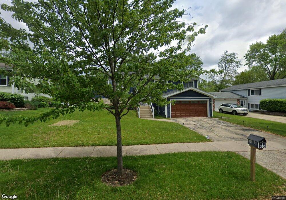
552 W Briarcliff Rd Bolingbrook, IL 60440
East Bolingbrook NeighborhoodEstimated Value: $305,000 - $390,000
3
Beds
2
Baths
2,220
Sq Ft
$161/Sq Ft
Est. Value
About This Home
This home is located at 552 W Briarcliff Rd, Bolingbrook, IL 60440 and is currently estimated at $357,027, approximately $160 per square foot. 552 W Briarcliff Rd is a home located in Will County with nearby schools including Oak View Elementary School, Bolingbrook High School, and Midwest Christian Montessori Academy.
Ownership History
Date
Name
Owned For
Owner Type
Purchase Details
Closed on
Aug 8, 2016
Sold by
Malik Syed Abdul and Malik Safia
Bought by
Malik Hina and Barakath Revocable Trust
Current Estimated Value
Purchase Details
Closed on
Oct 30, 2002
Sold by
Khan Meher
Bought by
Malik Syed Abdul and Malik Safia
Purchase Details
Closed on
Aug 2, 2002
Sold by
Bloomingdale Bank & Trust Bloomingdale
Bought by
Khan Meher
Purchase Details
Closed on
Nov 25, 1997
Sold by
Khan Mohammed K and Khan Meher
Bought by
Bloomingdale Bank & Trust and Trust #1003B
Purchase Details
Closed on
Jan 31, 1997
Sold by
Mudhar Ranjit Singh and Mudhar Jaspal Kaur
Bought by
Khan Mohammed K and Khan Meher
Home Financials for this Owner
Home Financials are based on the most recent Mortgage that was taken out on this home.
Original Mortgage
$121,500
Interest Rate
10.25%
Create a Home Valuation Report for This Property
The Home Valuation Report is an in-depth analysis detailing your home's value as well as a comparison with similar homes in the area
Home Values in the Area
Average Home Value in this Area
Purchase History
| Date | Buyer | Sale Price | Title Company |
|---|---|---|---|
| Malik Hina | -- | Attorney | |
| Malik Syed Abdul | $138,000 | -- | |
| Khan Meher | -- | -- | |
| Bloomingdale Bank & Trust | -- | -- | |
| Khan Mohammed K | $130,000 | -- |
Source: Public Records
Mortgage History
| Date | Status | Borrower | Loan Amount |
|---|---|---|---|
| Previous Owner | Khan Mohammed K | $121,500 |
Source: Public Records
Tax History Compared to Growth
Tax History
| Year | Tax Paid | Tax Assessment Tax Assessment Total Assessment is a certain percentage of the fair market value that is determined by local assessors to be the total taxable value of land and additions on the property. | Land | Improvement |
|---|---|---|---|---|
| 2024 | $9,023 | $105,702 | $20,374 | $85,328 |
| 2023 | $9,023 | $95,107 | $18,332 | $76,775 |
| 2022 | $7,635 | $83,247 | $16,046 | $67,201 |
| 2021 | $7,232 | $77,837 | $15,003 | $62,834 |
| 2020 | $7,007 | $75,278 | $14,510 | $60,768 |
| 2019 | $6,778 | $71,693 | $13,819 | $57,874 |
| 2018 | $6,364 | $67,273 | $12,967 | $54,306 |
| 2017 | $6,054 | $63,766 | $12,291 | $51,475 |
| 2016 | $4,661 | $60,700 | $11,700 | $49,000 |
| 2015 | $4,817 | $58,200 | $11,200 | $47,000 |
| 2014 | $4,817 | $58,200 | $11,200 | $47,000 |
| 2013 | $4,817 | $54,400 | $10,500 | $43,900 |
Source: Public Records
Map
Nearby Homes
- 565 Cottonwood Cir
- 534 Cottonwood Cir
- 530 Cottonwood Cir
- 117 Galewood Dr
- 118 Springleaf Dr Unit 5
- 129 Galewood Dr
- 164 Galewood Dr
- 461 Cumberland Ln
- 210 Mill Stream Dr
- 207 Hampdon Ct
- 228 Elkhorn Ct Unit B
- 224 Radcliff Dr
- 141 N Lancaster Dr
- 234 Dakota Ct Unit C
- 545 Old Stone Rd
- 261 Bryant Way
- 281 Dupage Dr
- 621 Sundance Dr
- 316 Pueblo Dr
- 650 Sundance Dr
- 548 W Briarcliff Rd
- 556 W Briarcliff Rd
- 553 Cottonwood Cir
- 549 Cottonwood Cir
- 557 Cottonwood Cir
- 560 W Briarcliff Rd
- 544 W Briarcliff Rd
- 545 Cottonwood Cir
- 551 W Briarcliff Rd
- 561 Cottonwood Cir
- 540 W Briarcliff Rd
- 101 Springhill Dr
- 541 Cottonwood Cir
- 555 W Briarcliff Rd
- 552 Cottonwood Cir
- 536 W Briarcliff Rd Unit 6
- 548 Cottonwood Cir
- 567 W Briarcliff Rd
- 568 W Briarcliff Rd