Estimated Value: $302,000 - $368,000
4
Beds
2
Baths
2,112
Sq Ft
$160/Sq Ft
Est. Value
About This Home
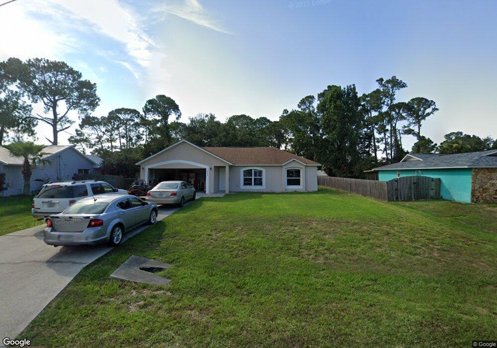
This home is located at 5520 Flint Rd, Cocoa, FL 32927 and is currently estimated at $338,956, approximately $160 per square foot. 5520 Flint Rd is a home located in Brevard County with nearby schools including Enterprise Elementary School, Space Coast Junior/Senior High School, and East Atlantic Prep of Brevard County.
Ownership History
Date
Name
Owned For
Owner Type
Purchase Details
Closed on
Apr 12, 2013
Sold by
Williams Judy Fannin and Gmac Mortgage Llc
Bought by
Ih2 Property Florida Lp
Current Estimated Value
Purchase Details
Closed on
Jul 27, 2001
Sold by
Maronda Homes Inc Fl
Bought by
Fannin Williams Jr Ronald J and Fannin Williams Judy
Home Financials for this Owner
Home Financials are based on the most recent Mortgage that was taken out on this home.
Original Mortgage
$91,248
Interest Rate
7.19%
Purchase Details
Closed on
Feb 2, 2001
Sold by
Grimm Margaret Pamela
Bought by
Maronda Homes Inc Fl
Create a Home Valuation Report for This Property
The Home Valuation Report is an in-depth analysis detailing your home's value as well as a comparison with similar homes in the area
Home Values in the Area
Average Home Value in this Area
Purchase History
| Date | Buyer | Sale Price | Title Company |
|---|---|---|---|
| Ih2 Property Florida Lp | $99,000 | None Available | |
| Fannin Williams Jr Ronald J | $92,800 | -- | |
| Maronda Homes Inc Fl | $11,500 | -- |
Source: Public Records
Mortgage History
| Date | Status | Borrower | Loan Amount |
|---|---|---|---|
| Previous Owner | Fannin Williams Jr Ronald J | $91,248 |
Source: Public Records
Tax History Compared to Growth
Tax History
| Year | Tax Paid | Tax Assessment Tax Assessment Total Assessment is a certain percentage of the fair market value that is determined by local assessors to be the total taxable value of land and additions on the property. | Land | Improvement |
|---|---|---|---|---|
| 2025 | $4,067 | $278,320 | -- | -- |
| 2024 | $3,906 | $281,680 | -- | -- |
| 2023 | $3,906 | $270,300 | $0 | $0 |
| 2022 | $3,533 | $255,160 | $0 | $0 |
| 2021 | $3,269 | $200,830 | $42,000 | $158,830 |
| 2020 | $3,042 | $183,780 | $40,000 | $143,780 |
| 2019 | $2,978 | $177,460 | $35,000 | $142,460 |
| 2018 | $2,891 | $166,540 | $27,000 | $139,540 |
| 2017 | $2,785 | $156,320 | $24,000 | $132,320 |
| 2016 | $2,628 | $136,900 | $18,000 | $118,900 |
| 2015 | $2,439 | $117,210 | $15,000 | $102,210 |
| 2014 | $2,235 | $106,560 | $11,000 | $95,560 |
Source: Public Records
Map
Nearby Homes
- 5460 Holden Rd
- 5446 Jamaica Rd
- 5275 Holden Rd
- 5997 Jenkins Ave
- 6017 Flamingo Ave
- 5940 Flamingo Ave
- 5220 Holden Rd
- 4650 N Highway 1 Hwy
- 6309 Alleghany Ave
- 5715 Fairbridge St
- 5575 Curtis Blvd
- 5946 Deer Ln
- 6003 Gilson
- 5145 Fay Blvd
- 6581 Bancroft Ave
- 6615 Dock Ave
- 00 Unknown
- 5149 Arlington Rd Unit 104
- 6643 Emil Ave
- 6061 Banbury Ave