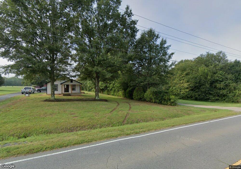
5520 Highway 73 E Concord, NC 28025
Estimated Value: $344,000 - $407,000
3
Beds
2
Baths
1,838
Sq Ft
$202/Sq Ft
Est. Value
About This Home
This home is located at 5520 Highway 73 E, Concord, NC 28025 and is currently estimated at $370,970, approximately $201 per square foot. 5520 Highway 73 E is a home located in Cabarrus County with nearby schools including W.M. Irvin Elementary School, Mount Pleasant Middle School, and Mount Pleasant High School.
Ownership History
Date
Name
Owned For
Owner Type
Purchase Details
Closed on
Oct 30, 2008
Sold by
Aurora Loan Services Llc
Bought by
Cunningham Michael L and Cunningham Sandy
Current Estimated Value
Home Financials for this Owner
Home Financials are based on the most recent Mortgage that was taken out on this home.
Original Mortgage
$91,400
Interest Rate
5.78%
Mortgage Type
Purchase Money Mortgage
Create a Home Valuation Report for This Property
The Home Valuation Report is an in-depth analysis detailing your home's value as well as a comparison with similar homes in the area
Home Values in the Area
Average Home Value in this Area
Purchase History
| Date | Buyer | Sale Price | Title Company |
|---|---|---|---|
| Cunningham Michael L | $87,000 | None Available |
Source: Public Records
Mortgage History
| Date | Status | Borrower | Loan Amount |
|---|---|---|---|
| Closed | Cunningham Michael L | $91,400 |
Source: Public Records
Tax History
| Year | Tax Paid | Tax Assessment Tax Assessment Total Assessment is a certain percentage of the fair market value that is determined by local assessors to be the total taxable value of land and additions on the property. | Land | Improvement |
|---|---|---|---|---|
| 2025 | $1,938 | $282,560 | $47,420 | $235,140 |
| 2024 | $1,938 | $282,560 | $47,420 | $235,140 |
| 2023 | $1,624 | $189,290 | $31,200 | $158,090 |
| 2022 | $1,604 | $186,960 | $31,200 | $155,760 |
| 2021 | $1,604 | $186,960 | $31,200 | $155,760 |
| 2020 | $1,604 | $186,960 | $31,200 | $155,760 |
| 2019 | $1,403 | $163,530 | $26,210 | $137,320 |
| 2018 | $1,346 | $163,530 | $26,210 | $137,320 |
| 2017 | $1,313 | $163,530 | $26,210 | $137,320 |
| 2016 | $1,313 | $157,910 | $27,460 | $130,450 |
| 2015 | $1,236 | $157,910 | $27,460 | $130,450 |
| 2014 | $1,236 | $157,910 | $27,460 | $130,450 |
Source: Public Records
Map
Nearby Homes
- 5423 Arnold Way
- 5411 Arnold Way
- The Caldwell Plan at Green Acres
- The Landen Plan at Green Acres
- 16 Wendall Ln
- The Coleman Plan at Green Acres
- The Benson II Plan at Green Acres
- The James Plan at Green Acres
- The McGinnis Plan at Green Acres
- The Harrington Plan at Green Acres
- 13 Wendall Ln
- 21 Wendall Ln
- 24 Wendall Ln
- 5543 Arnold Way
- 5105 Heron Ln Unit 31
- 1223 Walker Rd
- 6853 Glen Abbey Ln Unit 8
- 6853 Glen Abby Ln
- 622 Brennan St Unit 39
- 6907 Glen Abbey Ln Unit 9
- 5520 Nc Hwy 73 E
- 5520 E Hwy 73 None
- 5520 N Carolina 73
- 5540 Nc-73
- 5540 Nc Hwy 73 E
- 5540 Highway 73 E
- 5510 N Carolina 73
- 5500 Highway 73 E
- 5500 N Carolina 73
- 5570 Nc Hwy 73 E
- 5570 Highway 73 E
- 5580 Highway 73 E
- 5600 Highway 73 E
- 5610 Highway 73 E
- 5655 Arnold Way
- 1234 Arnold Way
- 5550 Highway 73 E
- 5601 Highway 73 E
- 5601 Nc-73
- 00 Oriole Ln