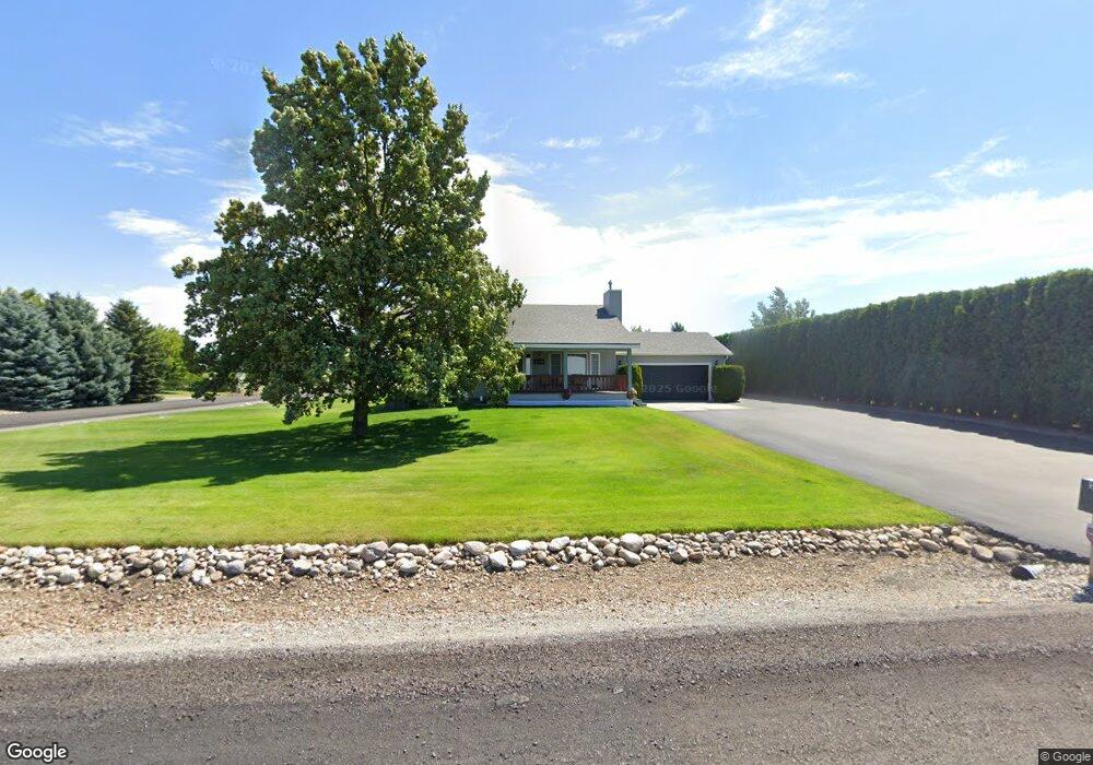
5520 N Simpson Rd Otis Orchards, WA 99027
Otis Orchards-East Farms NeighborhoodEstimated Value: $454,000 - $529,000
4
Beds
2
Baths
1,479
Sq Ft
$336/Sq Ft
Est. Value
About This Home
This home is located at 5520 N Simpson Rd, Otis Orchards, WA 99027 and is currently estimated at $496,562, approximately $335 per square foot. 5520 N Simpson Rd is a home located in Spokane County with nearby schools including East Farms School, East Valley Middle School, and East Valley High School & Extension.
Ownership History
Date
Name
Owned For
Owner Type
Purchase Details
Closed on
Nov 27, 2017
Sold by
Wright Andrea
Bought by
Wright Matthew L
Current Estimated Value
Home Financials for this Owner
Home Financials are based on the most recent Mortgage that was taken out on this home.
Original Mortgage
$202,268
Outstanding Balance
$170,160
Interest Rate
3.91%
Mortgage Type
FHA
Estimated Equity
$326,402
Purchase Details
Closed on
Aug 4, 1995
Sold by
Hansen Douglas J and Hansen Nicole S
Bought by
Wright Kelly and Wright Andrea
Home Financials for this Owner
Home Financials are based on the most recent Mortgage that was taken out on this home.
Original Mortgage
$105,000
Interest Rate
7.63%
Create a Home Valuation Report for This Property
The Home Valuation Report is an in-depth analysis detailing your home's value as well as a comparison with similar homes in the area
Home Values in the Area
Average Home Value in this Area
Purchase History
| Date | Buyer | Sale Price | Title Company |
|---|---|---|---|
| Wright Matthew L | $206,000 | None Available | |
| Wright Kelly | $124,500 | Pioneer Title Company |
Source: Public Records
Mortgage History
| Date | Status | Borrower | Loan Amount |
|---|---|---|---|
| Open | Wright Matthew L | $202,268 | |
| Previous Owner | Wright Kelly | $105,000 |
Source: Public Records
Tax History Compared to Growth
Tax History
| Year | Tax Paid | Tax Assessment Tax Assessment Total Assessment is a certain percentage of the fair market value that is determined by local assessors to be the total taxable value of land and additions on the property. | Land | Improvement |
|---|---|---|---|---|
| 2025 | $4,233 | $428,600 | $105,000 | $323,600 |
| 2024 | $4,233 | $429,300 | $95,000 | $334,300 |
| 2023 | $4,267 | $437,700 | $95,000 | $342,700 |
| 2022 | $3,827 | $437,700 | $95,000 | $342,700 |
| 2021 | $3,716 | $293,900 | $65,000 | $228,900 |
| 2020 | $3,611 | $270,700 | $66,000 | $204,700 |
| 2019 | $3,254 | $248,200 | $55,000 | $193,200 |
| 2018 | $3,253 | $231,200 | $49,500 | $181,700 |
| 2017 | $3,022 | $215,300 | $49,500 | $165,800 |
| 2016 | $2,892 | $209,000 | $44,000 | $165,000 |
| 2015 | $2,939 | $205,200 | $40,000 | $165,200 |
| 2014 | -- | $198,100 | $40,000 | $158,100 |
| 2013 | -- | $0 | $0 | $0 |
Source: Public Records
Map
Nearby Homes
- 5409 N Malvern Rd
- 99999 E Dalke Ave
- 24225 E Rosewood Ave
- 6205 N Ormond Rd
- 5718 N Martinson Rd
- 5605 N Drury Rd
- 4806 N Drury Rd
- 23007 E Sanson Ln
- 5816 N Canal Rd
- 5719 N Haye St
- 5325 N Vincent Rd
- 24005 E Garland Ave
- 22707 E Rowan Ave
- 25021 E San Carlos Ave
- 24807 E Trent Ave Unit 13
- 7211 N Starr Rd
- 5407 N Chase Rd
- 26301 E Rowan Ave
- 4907 N Chase Rd
- 6930 N Lynden Rd
- 5510 N Simpson Rd
- 24301 E Rowan Ave
- 24323 E Rowan Ave
- 24411 E Rowan Ave
- 5418 N Simpson Rd
- 5521 N Oakland Rd
- 5507 N Oakland Rd
- 5609 N Oakland Rd
- 5419 N Oakland Rd
- 5405 N Oakland Rd
- 24222 E Joseph Ave
- 24308 E Joseph Ave
- 24320 E Joseph Ave
- 24317 E Huppert Ln
- 5508 N Malvern Rd
- 24212 E Joseph Ave
- 5522 N Malvern Rd
- 5319 N Simpson Rd
- 5406 N Oakland Rd
- 5504 N Malvern Rd