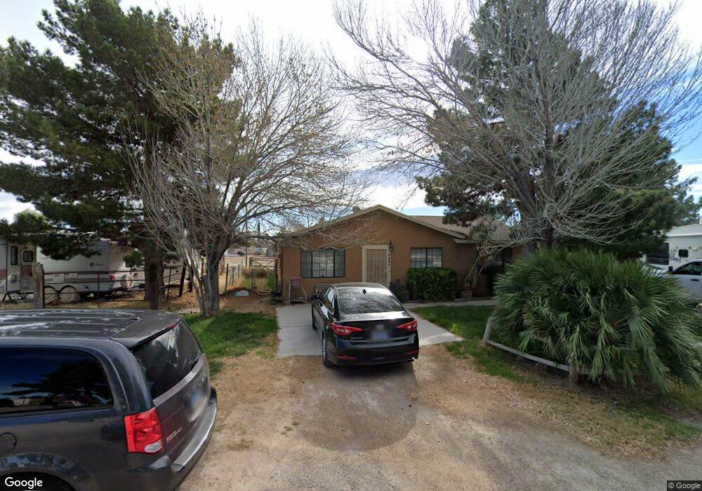
5521 Fiorinda Cir Las Vegas, NV 89130
North Cheyenne NeighborhoodEstimated Value: $375,000 - $468,000
3
Beds
2
Baths
1,338
Sq Ft
$326/Sq Ft
Est. Value
About This Home
This home is located at 5521 Fiorinda Cir, Las Vegas, NV 89130 and is currently estimated at $436,653, approximately $326 per square foot. 5521 Fiorinda Cir is a home located in Clark County with nearby schools including Ernest May Elementary School, Theron L Swainston Middle School, and Shadow Ridge High School.
Ownership History
Date
Name
Owned For
Owner Type
Purchase Details
Closed on
Oct 9, 2019
Sold by
Krein Paul L
Bought by
Krein Paul L and Caliedo Lagrimas R
Current Estimated Value
Purchase Details
Closed on
Aug 20, 2019
Sold by
Krein Paul
Bought by
Krein Paul L and Paul L Krein 2019 Living Trust
Purchase Details
Closed on
Feb 18, 1998
Sold by
Hud
Bought by
Krein Paul
Home Financials for this Owner
Home Financials are based on the most recent Mortgage that was taken out on this home.
Original Mortgage
$100,800
Outstanding Balance
$17,797
Interest Rate
6.97%
Estimated Equity
$418,856
Purchase Details
Closed on
Jul 10, 1997
Sold by
Ford David E and Ford Pamela K
Bought by
Crossland Mtg Corp
Create a Home Valuation Report for This Property
The Home Valuation Report is an in-depth analysis detailing your home's value as well as a comparison with similar homes in the area
Home Values in the Area
Average Home Value in this Area
Purchase History
| Date | Buyer | Sale Price | Title Company |
|---|---|---|---|
| Krein Paul L | -- | None Available | |
| Krein Paul L | -- | None Available | |
| Krein Paul | -- | Stewart Title | |
| Crossland Mtg Corp | $113,872 | Nevada Title Company |
Source: Public Records
Mortgage History
| Date | Status | Borrower | Loan Amount |
|---|---|---|---|
| Open | Krein Paul | $100,800 |
Source: Public Records
Tax History Compared to Growth
Tax History
| Year | Tax Paid | Tax Assessment Tax Assessment Total Assessment is a certain percentage of the fair market value that is determined by local assessors to be the total taxable value of land and additions on the property. | Land | Improvement |
|---|---|---|---|---|
| 2025 | $1,830 | $90,607 | $61,250 | $29,357 |
| 2024 | $1,695 | $90,607 | $61,250 | $29,357 |
| 2023 | $1,695 | $89,242 | $61,250 | $27,992 |
| 2022 | $1,569 | $69,644 | $43,750 | $25,894 |
| 2021 | $1,453 | $66,823 | $42,000 | $24,823 |
| 2020 | $1,347 | $63,403 | $38,500 | $24,903 |
| 2019 | $1,262 | $51,052 | $26,250 | $24,802 |
| 2018 | $1,225 | $56,131 | $32,200 | $23,931 |
| 2017 | $1,844 | $56,243 | $31,850 | $24,393 |
| 2016 | $1,161 | $44,214 | $22,750 | $21,464 |
| 2015 | $1,158 | $37,089 | $17,063 | $20,026 |
| 2014 | $1,124 | $33,272 | $18,200 | $15,072 |
Source: Public Records
Map
Nearby Homes
- 6400 W Ann Rd
- 6405 Steamship Ct
- 6345 Cinnabar Ridge Ave
- 6345 Citrine Ave
- 5635 Portage Lake Ct
- 6540 W Hammer Ln
- 6613 Sand Bench Ave
- 5329 Bright Sun Ct
- 6405 Break Point Ave
- 6620 Gray Juniper Ave
- 5508 Jasper Butte St
- 6301 Malachite Bay Ave
- 6513 Echo Crest Ave
- 5409 Flora Spray St
- 6679 Alpine Brooks Ave
- 5512 Goldbrush St
- 6129 Desert Haven Rd
- 6109 Sandstone Mesa Dr
- 5712 Grand Guiness Ct
- 6406 Veranda Falls Ct
- 5520 Fiorinda Cir
- 5540 Fiorinda Cir
- 6424 Tina Ln
- 6432 Tina Ln
- 6416 Tina Ln
- 6425 W Ann Rd
- 6417 W Ann Rd
- 5530 N Torrey Pines Dr
- 5520 N Torrey Pines Dr
- 6409 W Ann Rd
- 6440 Tina Ln
- 6433 W Ann Rd
- 5510 N Torrey Pines Dr
- 6401 W Ann Rd
- 6425 Tina Ln
- 5500 N Torrey Pines Dr
- 6441 W Ann Rd
- 6417 Tina Ln
- 6444 Tina Ln
- 6449 W Ann Rd