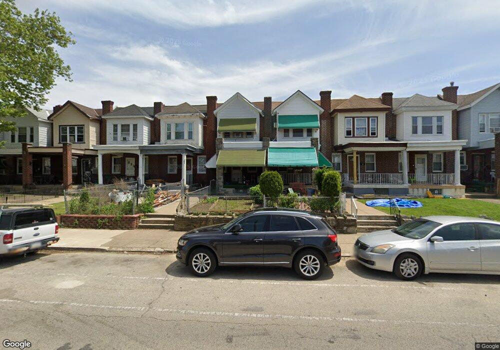
5521 Loretto Ave Philadelphia, PA 19124
Lawncrest NeighborhoodEstimated Value: $187,000 - $201,186
3
Beds
1
Bath
1,196
Sq Ft
$165/Sq Ft
Est. Value
About This Home
This home is located at 5521 Loretto Ave, Philadelphia, PA 19124 and is currently estimated at $197,047, approximately $164 per square foot. 5521 Loretto Ave is a home located in Philadelphia County with nearby schools including Laura H Carnell School, Harding Warren G Middle School, and Samuel Fels High School.
Ownership History
Date
Name
Owned For
Owner Type
Purchase Details
Closed on
Mar 16, 2012
Sold by
Parker Edward
Bought by
Parker Beula H
Current Estimated Value
Purchase Details
Closed on
Mar 27, 2001
Sold by
Wade Francis C and Wade Delores D
Bought by
Parker Edward and Parker Beulah
Home Financials for this Owner
Home Financials are based on the most recent Mortgage that was taken out on this home.
Original Mortgage
$59,428
Outstanding Balance
$21,810
Interest Rate
6.96%
Mortgage Type
FHA
Estimated Equity
$175,237
Create a Home Valuation Report for This Property
The Home Valuation Report is an in-depth analysis detailing your home's value as well as a comparison with similar homes in the area
Home Values in the Area
Average Home Value in this Area
Purchase History
| Date | Buyer | Sale Price | Title Company |
|---|---|---|---|
| Parker Beula H | -- | None Available | |
| Parker Edward | $59,900 | -- |
Source: Public Records
Mortgage History
| Date | Status | Borrower | Loan Amount |
|---|---|---|---|
| Open | Parker Edward | $59,428 |
Source: Public Records
Tax History Compared to Growth
Tax History
| Year | Tax Paid | Tax Assessment Tax Assessment Total Assessment is a certain percentage of the fair market value that is determined by local assessors to be the total taxable value of land and additions on the property. | Land | Improvement |
|---|---|---|---|---|
| 2025 | $1,972 | $180,400 | $36,080 | $144,320 |
| 2024 | $1,972 | $180,400 | $36,080 | $144,320 |
| 2023 | $1,972 | $140,900 | $28,180 | $112,720 |
| 2022 | $658 | $95,900 | $28,180 | $67,720 |
| 2021 | $1,288 | $0 | $0 | $0 |
| 2020 | $1,288 | $0 | $0 | $0 |
| 2019 | $1,236 | $0 | $0 | $0 |
| 2018 | $1,254 | $0 | $0 | $0 |
| 2017 | $1,254 | $0 | $0 | $0 |
| 2016 | $834 | $0 | $0 | $0 |
| 2015 | $799 | $0 | $0 | $0 |
| 2014 | -- | $89,600 | $18,042 | $71,558 |
| 2012 | -- | $13,184 | $2,106 | $11,078 |
Source: Public Records
Map
Nearby Homes
- 5505 Loretto Ave
- 938 Marcella St
- 972 Bridge St
- 894 Granite St
- 4046 E Roosevelt Blvd
- 951 Wakeling St
- 934 Brill St
- 5640 Miriam Rd
- 5659 Miriam Rd
- 5661 Miriam Rd
- 925 E Sanger St
- 883 Brill St
- 894 E Sanger St
- 991 Carver St
- 1048 Bridge St
- 854 E Sanger St
- 996 Anchor St
- 875 Foulkrod St
- 929 1/2 Anchor St
- 889 Anchor St
- 5523 Loretto Ave
- 5519 Loretto Ave
- 5517 Loretto Ave
- 5525 Loretto Ave
- 5527 Loretto Ave
- 5515 Loretto Ave
- 5513 Loretto Ave
- 5529 Loretto Ave
- 5511 Loretto Ave
- 5531 Loretto Ave
- 5512 Miriam Rd
- 5509 Loretto Ave
- 5516 Miriam Rd
- 5510 Miriam Rd
- 5518 Miriam Rd
- 5508 Miriam Rd
- 5520 Miriam Rd
- 5507 Loretto Ave
- 5535 Loretto Ave
- 5506 Miriam Rd