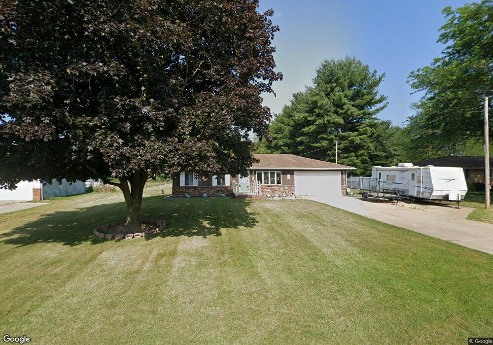
55211 Pear Rd South Bend, IN 46628
Estimated Value: $182,000 - $223,000
3
Beds
2
Baths
1,408
Sq Ft
$147/Sq Ft
Est. Value
About This Home
This home is located at 55211 Pear Rd, South Bend, IN 46628 and is currently estimated at $207,351, approximately $147 per square foot. 55211 Pear Rd is a home located in St. Joseph County with nearby schools including Paton-Churdan Elementary School, Warren Elementary School, and Clay Intermediate Center.
Ownership History
Date
Name
Owned For
Owner Type
Purchase Details
Closed on
Sep 13, 2010
Sold by
Stearns Michael A and Stearns Pamela
Bought by
Yergeau Michael D
Current Estimated Value
Home Financials for this Owner
Home Financials are based on the most recent Mortgage that was taken out on this home.
Original Mortgage
$124,821
Outstanding Balance
$82,465
Interest Rate
4.45%
Mortgage Type
FHA
Estimated Equity
$124,886
Create a Home Valuation Report for This Property
The Home Valuation Report is an in-depth analysis detailing your home's value as well as a comparison with similar homes in the area
Home Values in the Area
Average Home Value in this Area
Purchase History
| Date | Buyer | Sale Price | Title Company |
|---|---|---|---|
| Yergeau Michael D | -- | Metropolitan Title In Llc |
Source: Public Records
Mortgage History
| Date | Status | Borrower | Loan Amount |
|---|---|---|---|
| Open | Yergeau Michael D | $124,821 |
Source: Public Records
Tax History Compared to Growth
Tax History
| Year | Tax Paid | Tax Assessment Tax Assessment Total Assessment is a certain percentage of the fair market value that is determined by local assessors to be the total taxable value of land and additions on the property. | Land | Improvement |
|---|---|---|---|---|
| 2024 | $1,243 | $126,800 | $30,400 | $96,400 |
| 2023 | $1,188 | $131,500 | $30,400 | $101,100 |
| 2022 | $1,433 | $132,200 | $30,400 | $101,800 |
| 2021 | $1,181 | $110,700 | $16,100 | $94,600 |
| 2020 | $1,169 | $111,400 | $16,100 | $95,300 |
| 2019 | $1,000 | $112,100 | $16,100 | $96,000 |
| 2018 | $1,081 | $116,400 | $16,100 | $100,300 |
| 2017 | $771 | $95,000 | $16,100 | $78,900 |
| 2016 | $783 | $95,000 | $16,100 | $78,900 |
| 2014 | $750 | $93,600 | $16,100 | $77,500 |
Source: Public Records
Map
Nearby Homes
- 54962 Quince Rd
- 55629 Cardinal Dr
- 26366 Hummingbird Rd
- 54483 Whitesell Dr
- 54492 Avalon Dr
- 54520 Norwood Dr
- 26427 Evans Dr
- 0 Lakewood Dr
- 54221 Longwood Dr
- 56451 Quince Rd
- 25849 Kenwood Dr
- 54000 Block Whitesell Dr
- 26896 Mc Arthur Ct
- 26896 Mcarthur Ct
- 25700 Lakewood Dr
- 26882 Marshall Dr N
- Integrity 1605 Plan at West Pointe Estates
- Integrity 2060 Plan at West Pointe Estates
- Integrity 2280 Plan at West Pointe Estates
- Elements 1680 Plan at West Pointe Estates