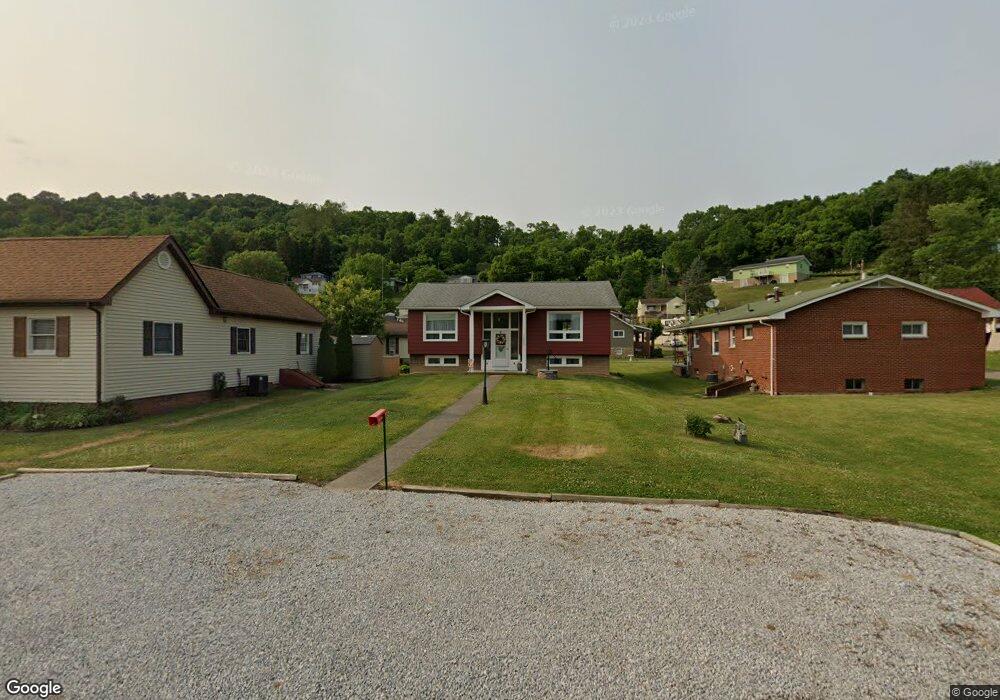
55233 Maple Ave Bridgeport, OH 43912
Lansing NeighborhoodEstimated Value: $162,283 - $201,000
4
Beds
3
Baths
1,072
Sq Ft
$170/Sq Ft
Est. Value
About This Home
This home is located at 55233 Maple Ave, Bridgeport, OH 43912 and is currently estimated at $182,571, approximately $170 per square foot. 55233 Maple Ave is a home located in Belmont County with nearby schools including Bridgeport Elementary School, Bridgeport Middle School, and Bridgeport High School.
Ownership History
Date
Name
Owned For
Owner Type
Purchase Details
Closed on
May 3, 2011
Sold by
Brubach Albert A and Brubach Dolores M
Bought by
Owings Brenda Anne and Owings William Howard
Current Estimated Value
Purchase Details
Closed on
Jan 1, 1987
Sold by
Brubach Albert A and Brubach Dolore
Bought by
Brubach Albert A and Brubach Dolore
Create a Home Valuation Report for This Property
The Home Valuation Report is an in-depth analysis detailing your home's value as well as a comparison with similar homes in the area
Home Values in the Area
Average Home Value in this Area
Purchase History
| Date | Buyer | Sale Price | Title Company |
|---|---|---|---|
| Owings Brenda Anne | -- | Attorney | |
| Brubach Albert A | -- | -- |
Source: Public Records
Tax History
| Year | Tax Paid | Tax Assessment Tax Assessment Total Assessment is a certain percentage of the fair market value that is determined by local assessors to be the total taxable value of land and additions on the property. | Land | Improvement |
|---|---|---|---|---|
| 2025 | $2,119 | $50,840 | $2,630 | $48,210 |
| 2024 | $2,077 | $50,840 | $2,630 | $48,210 |
| 2023 | $2,055 | $52,040 | $2,520 | $49,520 |
| 2022 | $2,054 | $52,038 | $2,520 | $49,518 |
| 2021 | $2,045 | $52,042 | $2,520 | $49,522 |
| 2020 | $1,823 | $43,370 | $2,100 | $41,270 |
| 2019 | $1,824 | $43,370 | $2,100 | $41,270 |
| 2018 | $1,865 | $43,370 | $2,100 | $41,270 |
| 2017 | $1,578 | $33,950 | $2,460 | $31,490 |
| 2016 | $1,582 | $33,950 | $2,460 | $31,490 |
| 2015 | $1,575 | $33,950 | $2,460 | $31,490 |
| 2014 | $1,285 | $28,050 | $2,240 | $25,810 |
| 2013 | $1,227 | $28,050 | $2,240 | $25,810 |
Source: Public Records
Map
Nearby Homes
- 55060 National Rd
- 55030 National Rd
- 55500 National Rd
- 52125 E Center St
- 55400 Wabash St
- 69142 Woods Rd
- 55935 Main St
- 56065 National Rd
- 26 Elm St
- 13 Prospect St
- 69895 Woods Rd
- 4 Walnut Ave
- 70170 Sunset Heights
- 866 Main St
- CR32 Rd
- 70540 Colerain Rd
- 836 Main St
- 53244 Barton Blaine Rd
- 44 Mann St
- 806 Howard St
- 68572 Liston Ave
- 55223 Maple Ave
- 55211 Maple Ave
- 55288 Poplar Ave
- 68590 Liston Ave
- 68563 Liston Ave
- 55205 Maple Ave
- 55220 Maple Ave
- 68578 R Maple St
- 55260 Poplar St
- 55232 Maple Ave
- 55300 Poplar Ave
- 55230 Maple Ave
- 55300 Poplar Ave
- 68579 Liston Ave
- 55212 Maple Ave
- 68559 Liston Ave
- 68590 Lansing Ln
- 68581 Liston Ave
- 68597 Liston Ave
Your Personal Tour Guide
Ask me questions while you tour the home.