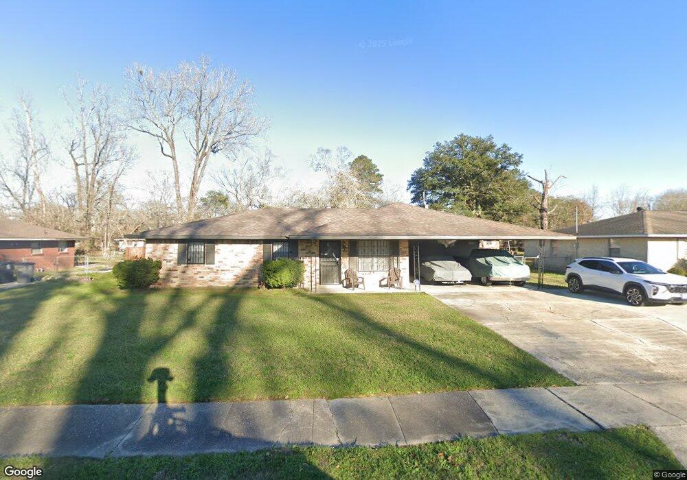
5524 Loring Dr Baton Rouge, LA 70812
Merrydale NeighborhoodEstimated Value: $120,694 - $170,000
--
Bed
--
Bath
--
Sq Ft
9,845
Sq Ft Lot
About This Home
This home is located at 5524 Loring Dr, Baton Rouge, LA 70812 and is currently estimated at $144,924. 5524 Loring Dr is a home located in East Baton Rouge Parish with nearby schools including Merrydale Elementary School, Glen Oaks Senior High School, and Celerity Lanier Charter School.
Ownership History
Date
Name
Owned For
Owner Type
Purchase Details
Closed on
Jan 11, 2024
Sold by
Walker Damon L
Bought by
Dlw Family Trust and Walker
Current Estimated Value
Purchase Details
Closed on
Feb 18, 2009
Sold by
Major Theodore
Bought by
Walker Damon L
Home Financials for this Owner
Home Financials are based on the most recent Mortgage that was taken out on this home.
Original Mortgage
$88,271
Interest Rate
4.91%
Mortgage Type
FHA
Create a Home Valuation Report for This Property
The Home Valuation Report is an in-depth analysis detailing your home's value as well as a comparison with similar homes in the area
Home Values in the Area
Average Home Value in this Area
Purchase History
| Date | Buyer | Sale Price | Title Company |
|---|---|---|---|
| Dlw Family Trust | -- | None Listed On Document | |
| Dlw Family Trust | -- | None Listed On Document | |
| Walker Damon L | $89,900 | -- |
Source: Public Records
Mortgage History
| Date | Status | Borrower | Loan Amount |
|---|---|---|---|
| Previous Owner | Walker Damon L | $88,271 |
Source: Public Records
Tax History Compared to Growth
Tax History
| Year | Tax Paid | Tax Assessment Tax Assessment Total Assessment is a certain percentage of the fair market value that is determined by local assessors to be the total taxable value of land and additions on the property. | Land | Improvement |
|---|---|---|---|---|
| 2024 | $396 | $10,180 | $610 | $9,570 |
| 2023 | $397 | $10,180 | $610 | $9,570 |
| 2022 | $1,437 | $10,180 | $610 | $9,570 |
| 2021 | $1,415 | $10,180 | $610 | $9,570 |
| 2020 | $1,430 | $10,180 | $610 | $9,570 |
| 2019 | $1,346 | $9,250 | $550 | $8,700 |
| 2018 | $1,332 | $9,250 | $550 | $8,700 |
| 2017 | $1,332 | $9,250 | $550 | $8,700 |
| 2016 | $32 | $6,205 | $550 | $5,655 |
| 2015 | $241 | $9,000 | $550 | $8,450 |
| 2014 | $240 | $9,000 | $550 | $8,450 |
| 2013 | -- | $9,000 | $550 | $8,450 |
Source: Public Records
Map
Nearby Homes
- 5723 Hartford Ave
- 5726 Matthews St
- 7341 Whitney Dr
- 7819 Greenwell St
- 5837 Denova St
- 7655 Hanks Dr
- 5965 Denova St
- 5911 Benson Dr
- 6032 Matthews St
- 7264 Hanks Dr
- 5540 Lanier Dr
- 6022 E Fairlane Ct
- 6155 Pontotoc St
- 5854 Wright Dr
- 5233 Satinwood Dr
- 6612 Merrydale Ave
- 6634 Fern Dr
- 6411 Landis Dr
- 6060 Silverleaf Ave
- 6868 Oak Glen Dr
- 5492 Loring Dr
- 5532 Loring Dr
- 5529 Clairmont Ave
- 5481 Clairmont Ave
- 5547 Clairmont Ave
- 5547 Clairmont Dr
- 5544 Loring Dr
- 5525 Loring Dr
- 5493 Loring Dr
- 5533 Loring Dr
- 5461 Clairmont Ave
- 5565 Clairmont Ave
- 5475 Loring Dr
- 5436 Loring Dr
- 5545 Loring Dr
- 7436 Greenwell St
- 7490 Greenwell St
- 5441 Clairmont Ave
- 7524 Greenwell St
- 5457 Loring Dr