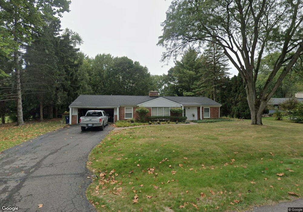
5526 Westwood Ln Bloomfield Hills, MI 48301
Estimated Value: $554,000 - $657,000
3
Beds
2
Baths
1,992
Sq Ft
$296/Sq Ft
Est. Value
About This Home
This home is located at 5526 Westwood Ln, Bloomfield Hills, MI 48301 and is currently estimated at $589,092, approximately $295 per square foot. 5526 Westwood Ln is a home located in Oakland County with nearby schools including Conant Elementary School, South Hills Middle School, and Bloomfield Hills High School.
Ownership History
Date
Name
Owned For
Owner Type
Purchase Details
Closed on
Feb 14, 2019
Sold by
Lask Robert M and Lask Glenda S
Bought by
Goodman Morgan Joann
Current Estimated Value
Home Financials for this Owner
Home Financials are based on the most recent Mortgage that was taken out on this home.
Original Mortgage
$247,435
Outstanding Balance
$216,962
Interest Rate
4.37%
Mortgage Type
FHA
Estimated Equity
$372,130
Purchase Details
Closed on
Jan 10, 2008
Sold by
Lask Robert M and Lask Glenda S
Bought by
Lask Robert M and Lask Glenda S
Create a Home Valuation Report for This Property
The Home Valuation Report is an in-depth analysis detailing your home's value as well as a comparison with similar homes in the area
Home Values in the Area
Average Home Value in this Area
Purchase History
| Date | Buyer | Sale Price | Title Company |
|---|---|---|---|
| Goodman Morgan Joann | $252,000 | Cislo Title Company | |
| Lask Robert M | -- | None Available |
Source: Public Records
Mortgage History
| Date | Status | Borrower | Loan Amount |
|---|---|---|---|
| Open | Goodman Morgan Joann | $247,435 |
Source: Public Records
Tax History Compared to Growth
Tax History
| Year | Tax Paid | Tax Assessment Tax Assessment Total Assessment is a certain percentage of the fair market value that is determined by local assessors to be the total taxable value of land and additions on the property. | Land | Improvement |
|---|---|---|---|---|
| 2024 | $4,670 | $247,930 | $0 | $0 |
| 2023 | $4,453 | $219,460 | $0 | $0 |
| 2022 | $10,132 | $191,860 | $0 | $0 |
| 2021 | $9,695 | $171,520 | $0 | $0 |
| 2020 | $3,930 | $159,760 | $0 | $0 |
| 2019 | $7,066 | $166,970 | $0 | $0 |
| 2018 | $5,307 | $173,730 | $0 | $0 |
| 2017 | $5,269 | $184,600 | $0 | $0 |
| 2016 | $5,279 | $179,210 | $0 | $0 |
| 2015 | -- | $152,360 | $0 | $0 |
| 2014 | -- | $134,190 | $0 | $0 |
| 2011 | -- | $131,110 | $0 | $0 |
Source: Public Records
Map
Nearby Homes
- 5361 Echo Rd
- 5904 Wing Lake Rd
- 5630 S Adams Way
- 5100 Kings Gate Way
- 00 Telegraph Rd
- 0 Telegraph Rd
- 5129 Woodlands Ln
- 5137 Woodlands Dr Unit 24
- 5008 Kings Gate Way
- 5340 Franklin Rd
- 5080 Tootmoor Rd
- 750 Trailwood Path Unit B
- 450 Billingsgate Ct Unit C
- 1760 Trailwood Path
- 4597 Broughton Dr
- 1462 Sodon Ct
- 5741 Snowshoe Cir
- 5148 Crest Knolls Ct
- 5190 Clarendon Crest St
- 5611 Priory Ln
- 5550 Westwood Ln
- 5516 Westwood Ln
- 5674 Westwood Ct
- 5566 Westwood Ln
- 5515 Westwood Ln
- 5681 Westwood Ct
- 5535 Westwood Ln
- 5510 Westwood Ln
- 5543 Westwood Ln
- 5666 Westwood Ct
- 5559 Westwood Ln
- 5671 Westwood Ct
- 5574 Westwood Ln
- 5551 Westwood Ln
- 5504 Westwood Ln
- 5567 Westwood Ln
- 5574 Hartford Ct
- 5544 Hartford Ct
- 5663 Westwood Ct
- 5575 Westwood Ln