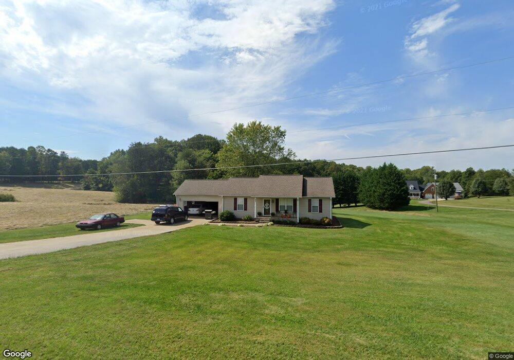
553 Carson Rd Pilot Mountain, NC 27041
Estimated Value: $233,000 - $276,000
3
Beds
2
Baths
1,092
Sq Ft
$233/Sq Ft
Est. Value
About This Home
This home is located at 553 Carson Rd, Pilot Mountain, NC 27041 and is currently estimated at $254,324, approximately $232 per square foot. 553 Carson Rd is a home with nearby schools including Pilot Mountain Elementary School, Pilot Mountain Middle School, and East Surry High School.
Ownership History
Date
Name
Owned For
Owner Type
Purchase Details
Closed on
Nov 30, 2010
Sold by
Turney Jonathan Neil and Turney Brittany H
Bought by
Campbell Josh C and Campbell Emily G
Current Estimated Value
Home Financials for this Owner
Home Financials are based on the most recent Mortgage that was taken out on this home.
Original Mortgage
$134,327
Outstanding Balance
$87,809
Interest Rate
4.32%
Mortgage Type
VA
Estimated Equity
$166,515
Purchase Details
Closed on
Aug 2, 2006
Sold by
Mauldin Timothy Mark and Mauldin Brandy Jarrell
Bought by
Turney Jonathan Neil and Hawks Brittany Jade
Home Financials for this Owner
Home Financials are based on the most recent Mortgage that was taken out on this home.
Original Mortgage
$115,000
Interest Rate
6.71%
Mortgage Type
New Conventional
Create a Home Valuation Report for This Property
The Home Valuation Report is an in-depth analysis detailing your home's value as well as a comparison with similar homes in the area
Purchase History
| Date | Buyer | Sale Price | Title Company |
|---|---|---|---|
| Campbell Josh C | $131,500 | None Available | |
| Turney Jonathan Neil | $115,000 | Chicago Title Insurance Comp |
Source: Public Records
Mortgage History
| Date | Status | Borrower | Loan Amount |
|---|---|---|---|
| Open | Campbell Josh C | $134,327 | |
| Previous Owner | Turney Jonathan Neil | $115,000 |
Source: Public Records
Tax History
| Year | Tax Paid | Tax Assessment Tax Assessment Total Assessment is a certain percentage of the fair market value that is determined by local assessors to be the total taxable value of land and additions on the property. | Land | Improvement |
|---|---|---|---|---|
| 2025 | $994 | $171,870 | $22,500 | $149,370 |
| 2024 | $883 | $141,370 | $21,000 | $120,370 |
| 2023 | $867 | $141,370 | $21,000 | $120,370 |
| 2022 | $789 | $141,370 | $21,000 | $120,370 |
| 2021 | $803 | $127,800 | $21,000 | $106,800 |
| 2020 | $779 | $118,020 | $21,000 | $97,020 |
| 2019 | $776 | $118,020 | $21,000 | $97,020 |
| 2018 | $762 | $118,020 | $0 | $0 |
| 2017 | $773 | $118,020 | $0 | $0 |
| 2016 | $773 | $118,020 | $0 | $0 |
| 2013 | -- | $118,020 | $0 | $0 |
Source: Public Records
Map
Nearby Homes
- 482 Carson Rd
- 624 E 52 Bypass
- 528 E Main St
- 812 W Main St
- 0 N Carolina 268
- 267 S Boyles St
- 260 S Boyles St
- 827 Dodson Mill Rd
- 204 Freeman Ridge Trail
- 710 Saddle Dr
- 713 Old Barn Cir
- 122 Northview Dr
- 765 Golf Course Rd
- 950 Dodson Mill Rd
- 00 Golf Course Rd
- 1591 Carson Rd
- 0 Heatherly Creek Dr
- 0 S Key St
- 4075 E Nc Highway 268
- 656 Hills Presbyterian Church Rd
- 560 Carson Rd
- 595 Carson Rd
- 540 Carson Rd
- 571 Carson Rd
- 580 Carson Rd
- 31.18 Carson Rd
- 605 Carson Rd
- 510 Carson Rd
- 598 Carson Rd
- 493 Carson Rd
- Lt 20& 21 Carson Rd
- 1-9 Crestwood Dr Unit 2903
- 00 Southwycke Ln
- 123 Wilson Farm Trail
- 1506 S Highway 52 Bypass
- 0000 Highway 52 Bypass
- 653 Carson Rd
- 650 Carson Rd
- 399 Crestwood Dr
- 145 Wilson Farm Trail
Your Personal Tour Guide
Ask me questions while you tour the home.