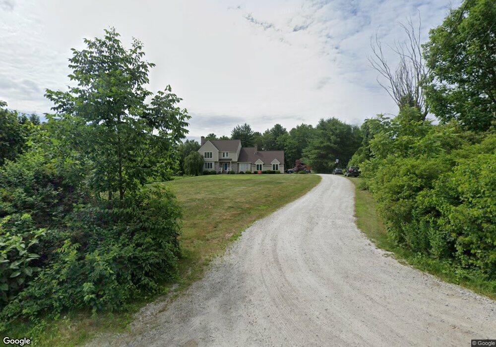
553 Forest St Dunstable, MA 01827
Estimated Value: $879,597 - $969,000
4
Beds
3
Baths
2,890
Sq Ft
$319/Sq Ft
Est. Value
About This Home
This home is located at 553 Forest St, Dunstable, MA 01827 and is currently estimated at $921,149, approximately $318 per square foot. 553 Forest St is a home located in Middlesex County with nearby schools including Groton Dunstable Regional High School.
Ownership History
Date
Name
Owned For
Owner Type
Purchase Details
Closed on
May 21, 2010
Sold by
Tucker John W
Bought by
Deloureiro Luis A and Deloureiro Kate E
Current Estimated Value
Home Financials for this Owner
Home Financials are based on the most recent Mortgage that was taken out on this home.
Original Mortgage
$481,124
Interest Rate
5.5%
Mortgage Type
FHA
Purchase Details
Closed on
Mar 25, 1994
Sold by
Hermance James A and Hermance Linda
Bought by
Tucker John W and Tucker Cynthia
Home Financials for this Owner
Home Financials are based on the most recent Mortgage that was taken out on this home.
Original Mortgage
$150,000
Interest Rate
7.15%
Mortgage Type
Purchase Money Mortgage
Create a Home Valuation Report for This Property
The Home Valuation Report is an in-depth analysis detailing your home's value as well as a comparison with similar homes in the area
Home Values in the Area
Average Home Value in this Area
Purchase History
| Date | Buyer | Sale Price | Title Company |
|---|---|---|---|
| Deloureiro Luis A | $509,900 | -- | |
| Tucker John W | $263,000 | -- |
Source: Public Records
Mortgage History
| Date | Status | Borrower | Loan Amount |
|---|---|---|---|
| Open | Tucker John W | $491,801 | |
| Closed | Deloureiro Luis A | $481,124 | |
| Previous Owner | Tucker John W | $150,000 |
Source: Public Records
Tax History Compared to Growth
Tax History
| Year | Tax Paid | Tax Assessment Tax Assessment Total Assessment is a certain percentage of the fair market value that is determined by local assessors to be the total taxable value of land and additions on the property. | Land | Improvement |
|---|---|---|---|---|
| 2025 | $10,799 | $785,400 | $222,700 | $562,700 |
| 2024 | $10,228 | $732,700 | $204,000 | $528,700 |
| 2023 | $10,136 | $677,100 | $204,000 | $473,100 |
| 2022 | $9,278 | $608,400 | $204,000 | $404,400 |
| 2021 | $9,377 | $571,400 | $186,500 | $384,900 |
| 2020 | $9,363 | $556,000 | $186,500 | $369,500 |
| 2019 | $9,107 | $533,800 | $186,500 | $347,300 |
| 2018 | $21,367 | $507,700 | $185,400 | $322,300 |
| 2017 | $8,512 | $500,100 | $185,400 | $314,700 |
| 2016 | $8,282 | $500,400 | $177,200 | $323,200 |
| 2015 | $7,997 | $478,000 | $149,500 | $328,500 |
| 2014 | $7,448 | $472,300 | $149,500 | $322,800 |
Source: Public Records
Map
Nearby Homes
- 446 Westford St
- 0 Lowell St
- 160 Westford Rd
- 11 Old Hickory Rd
- 153 Off Pond St
- 15 Stone Ridge Rd
- 22 Highland Rd
- 24 Highland Rd
- 0 Dunstable Rd
- 4 Thorndike St
- 319 Pleasant St
- 62 Brook St
- 23 Morrison Ln
- 53 Russells Way
- 660 Old Dunstable Rd
- 10 Dickens Ln
- 14 Centercrest Dr Unit 14
- 103 Pondview Place Unit 103
- 2 Wildflower Ln
- 24 Old Tyng Rd