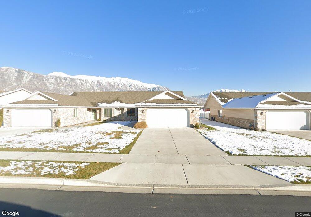
553 S 1040 E Unit 25 American Fork, UT 84003
Estimated Value: $422,000 - $464,000
3
Beds
2
Baths
1,450
Sq Ft
$303/Sq Ft
Est. Value
About This Home
This home is located at 553 S 1040 E Unit 25, American Fork, UT 84003 and is currently estimated at $439,640, approximately $303 per square foot. 553 S 1040 E Unit 25 is a home located in Utah County with nearby schools including Barratt Elementary School, American Fork Junior High School, and American Fork High School.
Ownership History
Date
Name
Owned For
Owner Type
Purchase Details
Closed on
Dec 17, 2014
Sold by
S B Smoot Construction Inc
Bought by
Megargel Monty and Megargel Esther
Current Estimated Value
Home Financials for this Owner
Home Financials are based on the most recent Mortgage that was taken out on this home.
Original Mortgage
$40,000
Outstanding Balance
$30,685
Interest Rate
3.96%
Mortgage Type
Credit Line Revolving
Estimated Equity
$408,955
Purchase Details
Closed on
Aug 14, 2008
Sold by
Edmiston Donna A
Bought by
Mira Condominiums Development Llc
Create a Home Valuation Report for This Property
The Home Valuation Report is an in-depth analysis detailing your home's value as well as a comparison with similar homes in the area
Home Values in the Area
Average Home Value in this Area
Purchase History
| Date | Buyer | Sale Price | Title Company |
|---|---|---|---|
| Megargel Monty | -- | Provo Land Title Co | |
| Mira Condominiums Development Llc | -- | Signature Title Insurance A |
Source: Public Records
Mortgage History
| Date | Status | Borrower | Loan Amount |
|---|---|---|---|
| Open | Megargel Monty | $40,000 |
Source: Public Records
Tax History Compared to Growth
Tax History
| Year | Tax Paid | Tax Assessment Tax Assessment Total Assessment is a certain percentage of the fair market value that is determined by local assessors to be the total taxable value of land and additions on the property. | Land | Improvement |
|---|---|---|---|---|
| 2025 | $902 | $222,750 | $95,600 | $309,400 |
| 2024 | $902 | $218,735 | $0 | $0 |
| 2023 | $817 | $212,740 | $0 | $0 |
| 2022 | $928 | $226,655 | $0 | $0 |
| 2021 | $945 | $317,000 | $80,000 | $237,000 |
| 2020 | $798 | $299,100 | $80,000 | $219,100 |
| 2019 | $1,524 | $277,500 | $80,000 | $197,500 |
| 2018 | $1,414 | $246,300 | $80,000 | $166,300 |
| 2017 | $1,412 | $132,715 | $0 | $0 |
| 2016 | $1,480 | $129,250 | $0 | $0 |
| 2015 | $1,560 | $129,250 | $0 | $0 |
Source: Public Records
Map
Nearby Homes
- 502 S 1040 E Unit 252
- 502 S 1040 E Unit 221
- 502 S 1040 E Unit 137
- 502 S 1040 E Unit 243
- 502 S 1040 E Unit 226
- 477 S 850 E
- 1088 E 390 S
- 29 S 2000 W
- 796 E 500 S
- 782 E 500 S
- 407 S 740 St E
- 1795 W 120 S Unit 52
- 1775 W 120 S Unit 54
- 359 S 780 E
- The Hastings Plan at Tayside Farm - Townhome
- The Henley A Plan at Tayside Farm - Single Family Home
- The Denton Plan at Tayside Farm - Townhome
- The Henley B Plan at Tayside Farm - Single Family Home
- 293 N 1630 W
- 732 E 480 S
- 551 S 1040 E Unit 24
- 565 S 1040 E Unit 26
- 567 S 1040 E Unit 27
- 549 S 1040 E
- 547 S 1040 E
- 581 S 1040 E Unit 28
- 581 S 1040 E
- 544 S 1040 E
- 544 S 1040 E Unit 61
- 552 S 1040 E Unit 56
- 583 S 1040 E
- 583 S 1040 E Unit 29
- 545 S 1040 E
- 545 S 1040 E Unit 387
- 564 S 1040 E Unit 55
- 546 S 1040 E Unit 60
- 532 S 1040 E
- 554 S 1040 E Unit 57
- 543 S 1040 E
- 543 S 1040 E Unit 19