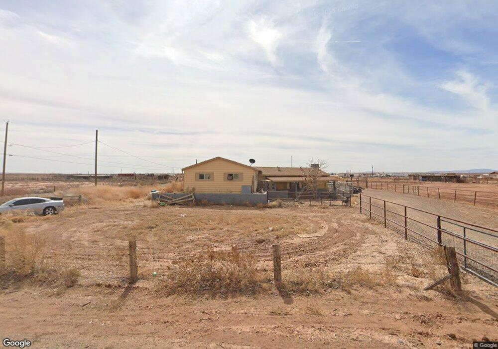
553 W McHood Rd Winslow, AZ 86047
Estimated Value: $315,329 - $338,000
2
Beds
1
Bath
149
Sq Ft
$2,173/Sq Ft
Est. Value
About This Home
This home is located at 553 W McHood Rd, Winslow, AZ 86047 and is currently estimated at $323,832, approximately $2,173 per square foot. 553 W McHood Rd is a home located in Navajo County with nearby schools including Winslow High School and Red Sands Christian School.
Ownership History
Date
Name
Owned For
Owner Type
Purchase Details
Closed on
Mar 11, 2021
Sold by
Baca Susan Ellen
Bought by
Jacobson Jenna Dawn
Current Estimated Value
Home Financials for this Owner
Home Financials are based on the most recent Mortgage that was taken out on this home.
Original Mortgage
$11,586
Outstanding Balance
$10,447
Interest Rate
3.05%
Mortgage Type
New Conventional
Estimated Equity
$313,385
Create a Home Valuation Report for This Property
The Home Valuation Report is an in-depth analysis detailing your home's value as well as a comparison with similar homes in the area
Home Values in the Area
Average Home Value in this Area
Purchase History
| Date | Buyer | Sale Price | Title Company |
|---|---|---|---|
| Jacobson Jenna Dawn | $236,000 | Pioneer Title Agency Inc |
Source: Public Records
Mortgage History
| Date | Status | Borrower | Loan Amount |
|---|---|---|---|
| Open | Jacobson Jenna Dawn | $11,586 | |
| Open | Jacobson Jenna Dawn | $231,725 |
Source: Public Records
Tax History Compared to Growth
Tax History
| Year | Tax Paid | Tax Assessment Tax Assessment Total Assessment is a certain percentage of the fair market value that is determined by local assessors to be the total taxable value of land and additions on the property. | Land | Improvement |
|---|---|---|---|---|
| 2026 | $561 | -- | -- | -- |
| 2025 | $533 | $23,527 | $666 | $22,861 |
| 2024 | $507 | $21,323 | $915 | $20,408 |
| 2023 | $533 | $15,108 | $838 | $14,270 |
| 2022 | $507 | $0 | $0 | $0 |
| 2021 | $514 | $0 | $0 | $0 |
| 2020 | $160 | $0 | $0 | $0 |
| 2019 | $144 | $0 | $0 | $0 |
| 2018 | $464 | $0 | $0 | $0 |
| 2017 | $469 | $0 | $0 | $0 |
| 2016 | $467 | $0 | $0 | $0 |
| 2015 | $447 | $4,716 | $577 | $4,140 |
Source: Public Records
Map
Nearby Homes
- 01 Santa fe Dr
- 02 Santa fe Dr
- 03 Santa fe Dr
- 1012 W Willmae St
- 132 Papago Blvd
- 1496 French Rd
- 124 Papago Blvd
- 806 W Henderson St
- 253 Papago Blvd
- 2080 Round House Dr
- 1200 N Apache Ave
- 1001 N Winslow Ave
- 901 N Prairie Ave
- 1498 N Prairie Ave
- 219 W Elm St
- 722 N Warren Ave
- 1950 W 3rd St
- 1105 W 3rd St
- 601 N Berry Ave
- 1980 W Third St
- 648 W McHood Rd
- 478 W McHood Rd
- 552 W Mountain View St
- 550 W McHood Rd
- 522 W Mountain View St
- 430 W McHood Rd
- 746 W McHood Rd
- 452 W Mountain View St
- 553 W Mountain View St
- 5156 N Williamson Ave
- 353 W McHood Rd
- 352 W McHood Rd
- 5069 N Williamson Ave
- 828 W McHood Rd
- 353 W Mountain View St
- 253 McHood Rd
- 453 Mountain View St
- 5056 N Williamson Ave
- 152 E Mountain View Rd
- 152 W McHood Rd