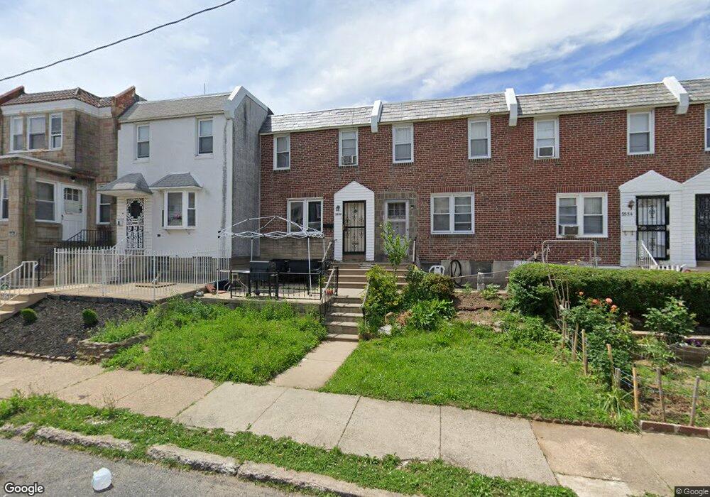
5530 Westford Rd Philadelphia, PA 19120
Olney NeighborhoodEstimated Value: $190,000 - $201,000
3
Beds
2
Baths
1,088
Sq Ft
$180/Sq Ft
Est. Value
About This Home
This home is located at 5530 Westford Rd, Philadelphia, PA 19120 and is currently estimated at $196,000, approximately $180 per square foot. 5530 Westford Rd is a home located in Philadelphia County with nearby schools including Olney Elementary School, Olney Charter High School, and Olney Christian School.
Ownership History
Date
Name
Owned For
Owner Type
Purchase Details
Closed on
Feb 22, 2013
Sold by
Head Sharlene and Head Nathaniel
Bought by
Weaver Alexa P
Current Estimated Value
Purchase Details
Closed on
Jul 20, 2006
Sold by
Head Sharlene and Estate Of Walter Saunders Jr
Bought by
Head Nathaniel and Head Sharlene
Purchase Details
Closed on
Dec 4, 2003
Sold by
Hud
Bought by
Sanders Walter
Purchase Details
Closed on
Sep 23, 2002
Sold by
Lyles Ronald and Midfirst Bank
Bought by
Hud
Create a Home Valuation Report for This Property
The Home Valuation Report is an in-depth analysis detailing your home's value as well as a comparison with similar homes in the area
Home Values in the Area
Average Home Value in this Area
Purchase History
| Date | Buyer | Sale Price | Title Company |
|---|---|---|---|
| Weaver Alexa P | -- | None Available | |
| Head Nathaniel | -- | I Abstract & Title Agency Ll | |
| Sanders Walter | $42,600 | -- | |
| Hud | $15,000 | -- |
Source: Public Records
Tax History Compared to Growth
Tax History
| Year | Tax Paid | Tax Assessment Tax Assessment Total Assessment is a certain percentage of the fair market value that is determined by local assessors to be the total taxable value of land and additions on the property. | Land | Improvement |
|---|---|---|---|---|
| 2025 | $1,761 | $173,400 | $34,680 | $138,720 |
| 2024 | $1,761 | $173,400 | $34,680 | $138,720 |
| 2023 | $1,761 | $125,800 | $25,160 | $100,640 |
| 2022 | $1,356 | $125,800 | $25,160 | $100,640 |
| 2021 | $1,356 | $0 | $0 | $0 |
| 2020 | $1,356 | $0 | $0 | $0 |
| 2019 | $1,261 | $0 | $0 | $0 |
| 2018 | $1,436 | $0 | $0 | $0 |
| 2017 | $1,436 | $0 | $0 | $0 |
| 2016 | $1,016 | $0 | $0 | $0 |
| 2015 | $973 | $0 | $0 | $0 |
| 2014 | -- | $102,600 | $9,318 | $93,282 |
| 2012 | -- | $11,072 | $690 | $10,382 |
Source: Public Records
Map
Nearby Homes
- 5516 Westford Rd
- 5600 Arbor St
- 5441 Westford Rd
- 318 E Gale St
- 5539 B St
- 316 R E Clarkson Ave Unit 4
- 565 E Tabor Rd
- 5212 D St
- 220 E Tabor Rd
- 5413 N Front St
- 678 Adams Ave
- 5157 C St
- 5331 E Tabor Rd
- 136 W Clarkson Ave
- 5815 N Front St
- 734 Landis St
- 736 Landis St
- 728 Mayfair St
- 342 E Sheldon St
- 5166 Monturs St
- 5528 Westford Rd
- 5532 Westford Rd
- 5534 Westford Rd
- 5526 Westford Rd
- 5524 Westford Rd
- 5536 Westford Rd
- 5522 Westford Rd
- 5538 Westford Rd
- 5520 Westford Rd
- 5540 Westford Rd
- 5533 Rising Sun Ave
- 5531 Rising Sun Ave
- 5535 Rising Sun Ave
- 5529 Rising Sun Ave
- 5537 Rising Sun Ave
- 5518 Westford Rd
- 5542 Westford Rd
- 5527 Rising Sun Ave
- 5539 Rising Sun Ave
- 5541 Rising Sun Ave