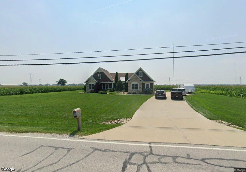
5532 Cedar Point Rd Oregon, OH 43616
Estimated Value: $319,000 - $474,000
3
Beds
2
Baths
2,076
Sq Ft
$197/Sq Ft
Est. Value
About This Home
This home is located at 5532 Cedar Point Rd, Oregon, OH 43616 and is currently estimated at $409,428, approximately $197 per square foot. 5532 Cedar Point Rd is a home located in Lucas County.
Ownership History
Date
Name
Owned For
Owner Type
Purchase Details
Closed on
Apr 19, 2019
Sold by
Stout David E and Stout Cherie L
Bought by
Brummett Roseanne L and Brummett Troy J
Current Estimated Value
Home Financials for this Owner
Home Financials are based on the most recent Mortgage that was taken out on this home.
Original Mortgage
$248,000
Outstanding Balance
$218,707
Interest Rate
4.25%
Mortgage Type
Adjustable Rate Mortgage/ARM
Estimated Equity
$172,450
Purchase Details
Closed on
Mar 5, 2014
Sold by
Stout David and Stout Cherie L
Bought by
Stout David E and Stout Cherie L
Purchase Details
Closed on
Jun 29, 2009
Sold by
Wilson Pamela
Bought by
Stout David and Stout Cherie L
Purchase Details
Closed on
Nov 4, 2004
Sold by
Warnke Earl R and Warnke Shirley M
Bought by
Wilson Peter A
Create a Home Valuation Report for This Property
The Home Valuation Report is an in-depth analysis detailing your home's value as well as a comparison with similar homes in the area
Home Values in the Area
Average Home Value in this Area
Purchase History
| Date | Buyer | Sale Price | Title Company |
|---|---|---|---|
| Brummett Roseanne L | $310,000 | None Available | |
| Stout David E | -- | None Available | |
| Stout David | $28,300 | Chicago Title Insurance Co | |
| Wilson Peter A | $27,000 | -- |
Source: Public Records
Mortgage History
| Date | Status | Borrower | Loan Amount |
|---|---|---|---|
| Open | Brummett Roseanne L | $248,000 |
Source: Public Records
Tax History Compared to Growth
Tax History
| Year | Tax Paid | Tax Assessment Tax Assessment Total Assessment is a certain percentage of the fair market value that is determined by local assessors to be the total taxable value of land and additions on the property. | Land | Improvement |
|---|---|---|---|---|
| 2024 | $2,454 | $104,230 | $13,335 | $90,895 |
| 2023 | $5,347 | $96,740 | $8,190 | $88,550 |
| 2022 | $5,388 | $96,740 | $8,190 | $88,550 |
| 2021 | $5,432 | $96,740 | $8,190 | $88,550 |
| 2020 | $5,042 | $79,800 | $6,685 | $73,115 |
| 2019 | $5,000 | $79,800 | $6,685 | $73,115 |
| 2018 | $4,932 | $79,800 | $6,685 | $73,115 |
| 2017 | $5,090 | $77,980 | $6,545 | $71,435 |
| 2016 | $5,023 | $222,800 | $18,700 | $204,100 |
| 2015 | $4,989 | $222,800 | $18,700 | $204,100 |
| 2014 | $4,669 | $76,450 | $6,410 | $70,040 |
| 2013 | $4,669 | $76,450 | $6,410 | $70,040 |
Source: Public Records
Map
Nearby Homes
- 5243 Eagles Landing Dr
- 1633 Grand Bay Dr
- 5102 Bay Ridge Ct
- 5911 Plympton Cir
- 1830 Lilias Dr
- 1862 Lilias Dr
- 140 N Wynn Rd
- 234 Avilyn Ln
- 4263 Corduroy Rd
- 5065 Magnolia Dr
- 5071 Magnolia Dr
- 5047 Noah Ln
- 5037 Easton Dr
- 5033 Easton Dr
- 5029 Easton Dr
- 5025 Easton Dr
- 5021 Easton Dr
- 5040 Easton Dr
- 5036 Easton Dr
- 5032 Easton Dr
- 5604 Cedar Point Rd
- 5444 Cedar Point Rd
- 5603 Cedar Point Rd
- 5605 Cedar Point Rd
- 5617 Cedar Point Rd
- 5415 Cedar Point Rd
- 5412 Cedar Point Rd
- 5420 Cedar Point Rd
- 5700 Cedar Point Rd
- 5365 Cedar Point Rd
- 5390 Cedar Point Rd
- 5353 Cedar Point Rd
- 5710 Cedar Point Rd
- 5331 Cedar Point Rd
- 5730 Cedar Point Rd
- 5306 Cedar Point Rd
- 6419,6423,6427 Lakeway Dr
- 5740 Cedar Point Rd
- 5305 Cedar Point Rd
- 5303 Cedar Point Rd