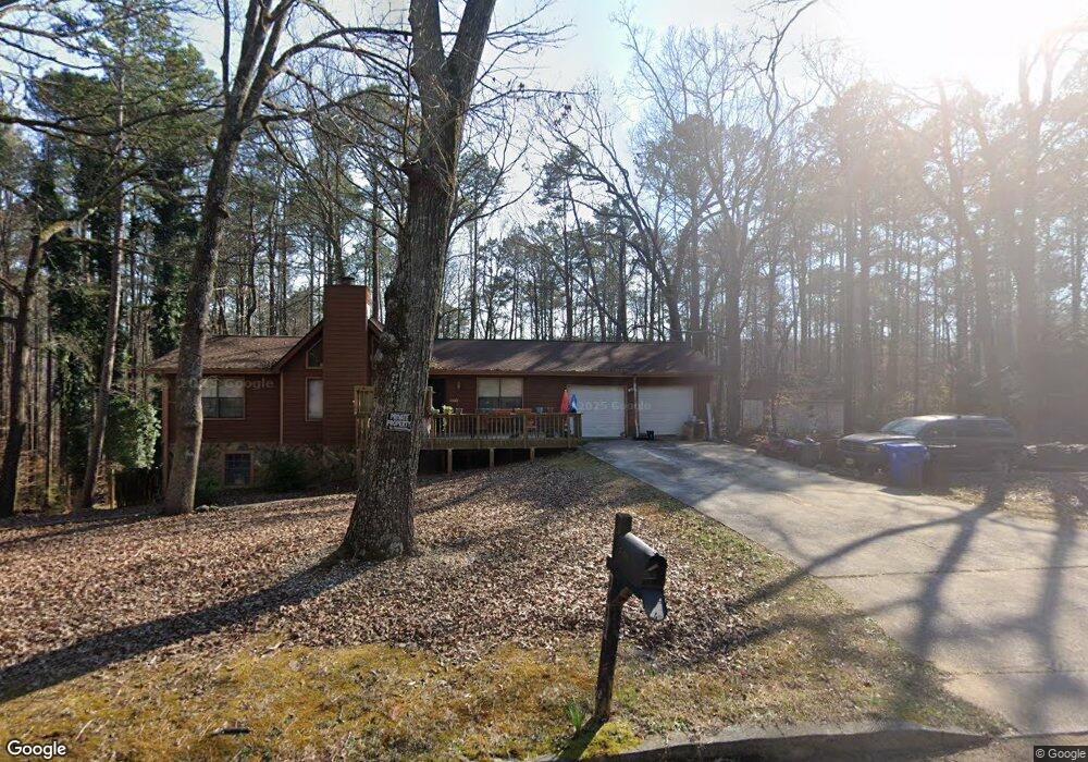
5532 Hall Cir Union City, GA 30291
Estimated Value: $202,000 - $263,000
3
Beds
2
Baths
1,334
Sq Ft
$172/Sq Ft
Est. Value
About This Home
This home is located at 5532 Hall Cir, Union City, GA 30291 and is currently estimated at $229,122, approximately $171 per square foot. 5532 Hall Cir is a home located in Fulton County with nearby schools including Liberty Point Elementary School, Camp Creek Middle School, and Langston Hughes High School.
Ownership History
Date
Name
Owned For
Owner Type
Purchase Details
Closed on
May 19, 2000
Sold by
Pure Goodness Inc
Bought by
Bush Oscar and Bush Debra
Current Estimated Value
Home Financials for this Owner
Home Financials are based on the most recent Mortgage that was taken out on this home.
Original Mortgage
$4,995
Interest Rate
8.14%
Mortgage Type
New Conventional
Purchase Details
Closed on
Dec 1, 1998
Sold by
Bank United
Bought by
Sec Of Hud
Create a Home Valuation Report for This Property
The Home Valuation Report is an in-depth analysis detailing your home's value as well as a comparison with similar homes in the area
Home Values in the Area
Average Home Value in this Area
Purchase History
| Date | Buyer | Sale Price | Title Company |
|---|---|---|---|
| Bush Oscar | $99,900 | -- | |
| Sec Of Hud | -- | -- | |
| Bank United | $78,313 | -- |
Source: Public Records
Mortgage History
| Date | Status | Borrower | Loan Amount |
|---|---|---|---|
| Closed | Bush Oscar | $4,995 |
Source: Public Records
Tax History Compared to Growth
Tax History
| Year | Tax Paid | Tax Assessment Tax Assessment Total Assessment is a certain percentage of the fair market value that is determined by local assessors to be the total taxable value of land and additions on the property. | Land | Improvement |
|---|---|---|---|---|
| 2025 | $1,005 | $67,440 | $18,400 | $49,040 |
| 2023 | $2,015 | $71,400 | $21,520 | $49,880 |
| 2022 | $565 | $49,480 | $13,880 | $35,600 |
| 2021 | $455 | $37,360 | $8,640 | $28,720 |
| 2020 | $453 | $36,880 | $8,520 | $28,360 |
| 2019 | $773 | $27,680 | $6,120 | $21,560 |
| 2018 | $359 | $21,880 | $3,320 | $18,560 |
| 2017 | $374 | $21,880 | $3,320 | $18,560 |
| 2016 | $440 | $25,480 | $5,360 | $20,120 |
| 2015 | $842 | $25,480 | $5,360 | $20,120 |
| 2014 | $251 | $15,280 | $2,160 | $13,120 |
Source: Public Records
Map
Nearby Homes
- 0 Lakeside Dr Unit 22475152
- 0 Lakeside Dr Unit 7515650
- 0 Lower Dixie Lake Rd Unit 22475153
- 0 Lower Dixie Lake Rd Unit 7515143
- 5910 Rock Rd
- 5856 Rock Rd
- 0 Highpoint Rd Unit 10553938
- 3227 Diamond Bluff
- 5900 Union Woods Way
- 6200 Ward Rd
- 6024 Diamond Ln
- 6000 Diamond Ln
- 000 Highpoint Rd
- 99 Highpoint Rd
- 5135 Hilltop Dr
- 4695 Ravenwood Loop
- 0 Ward Rd Unit 7174145
- 0 Ward Rd Unit 20102427
- 0 Simpson Ave Unit 10470974
- 0 Simpson Ave Unit 7532980
- 5520 Hall Cir
- 5544 Hall Cir
- 5539 Hall Cir
- 5525 Hall Cir
- 0 Hall Cir Unit 7217665
- 0 Hall Cir Unit 8844276
- 0 Hall Cir Unit 8263335
- 0 Hall Cir Unit 7639567
- 0 Hall Cir Unit 8127268
- 0 Hall Cir Unit 7555681
- 0 Hall Cir
- 5556 Liberty Rd
- 5556 Liberty Rd Unit 1
- 5508 Hall Cir
- 5540 Liberty Rd Unit 1
- 5515 Hall Cir
- 0 Lakeside Dr
- 0 Lakeside Dr Unit 10448310
- 0 Lakeside Dr Unit 10448305
- 0 Lakeside Dr Unit 10264980