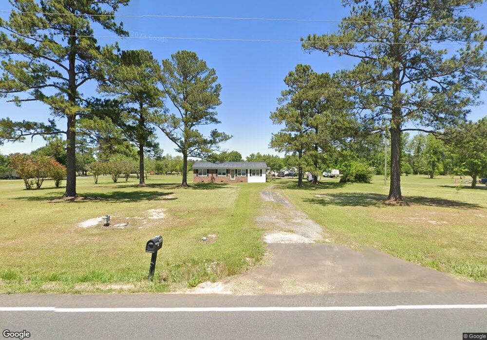
5536 Kates Bay Hwy Conway, SC 29527
Estimated Value: $258,000 - $295,000
3
Beds
2
Baths
1,358
Sq Ft
$209/Sq Ft
Est. Value
About This Home
This home is located at 5536 Kates Bay Hwy, Conway, SC 29527 and is currently estimated at $283,791, approximately $208 per square foot. 5536 Kates Bay Hwy is a home located in Horry County with nearby schools including Pee Dee Elementary School, Whittemore Park Middle School, and Conway High School.
Ownership History
Date
Name
Owned For
Owner Type
Purchase Details
Closed on
Jun 26, 2020
Sold by
Barnhill Shirley A
Bought by
Barnhill Michael P and Barnhill Jennifer M
Current Estimated Value
Home Financials for this Owner
Home Financials are based on the most recent Mortgage that was taken out on this home.
Original Mortgage
$135,200
Outstanding Balance
$119,886
Interest Rate
3.1%
Mortgage Type
VA
Estimated Equity
$163,905
Purchase Details
Closed on
Apr 16, 2009
Sold by
Barnhill Phillip L
Bought by
Barnhill Shirley A
Create a Home Valuation Report for This Property
The Home Valuation Report is an in-depth analysis detailing your home's value as well as a comparison with similar homes in the area
Home Values in the Area
Average Home Value in this Area
Purchase History
| Date | Buyer | Sale Price | Title Company |
|---|---|---|---|
| Barnhill Michael P | $135,200 | -- | |
| Barnhill Shirley A | -- | -- |
Source: Public Records
Mortgage History
| Date | Status | Borrower | Loan Amount |
|---|---|---|---|
| Open | Barnhill Michael P | $135,200 |
Source: Public Records
Tax History Compared to Growth
Tax History
| Year | Tax Paid | Tax Assessment Tax Assessment Total Assessment is a certain percentage of the fair market value that is determined by local assessors to be the total taxable value of land and additions on the property. | Land | Improvement |
|---|---|---|---|---|
| 2024 | $661 | $10,972 | $3,846 | $7,126 |
| 2023 | $661 | $5,406 | $1,282 | $4,124 |
| 2021 | $601 | $5,406 | $1,282 | $4,124 |
| 2020 | $722 | $6,818 | $1,282 | $5,536 |
| 2019 | $461 | $9,654 | $1,350 | $8,304 |
| 2018 | $418 | $4,168 | $740 | $3,428 |
| 2017 | $0 | $4,168 | $740 | $3,428 |
| 2016 | $0 | $4,168 | $740 | $3,428 |
| 2015 | -- | $4,168 | $740 | $3,428 |
| 2014 | $373 | $4,168 | $740 | $3,428 |
Source: Public Records
Map
Nearby Homes
- 121 Keithland Dr
- 125 Keithland Dr
- 129 Keithland Dr
- 117 Keithland Dr
- 113 Keithland Dr
- 133 Keithland Dr
- 137 Keithland Dr
- 141 Keithland Dr
- 161 Keithland Dr
- DARBY Plan at Coastal Farms
- EATON Plan at Coastal Farms
- BELFORT Plan at Coastal Farms
- HARBOR OAK Plan at Coastal Farms
- LITCHFIELD Plan at Coastal Farms
- FORRESTER Plan at Coastal Farms
- TILLMAN Plan at Coastal Farms
- 5858 Bluewater Rd
- 6049 Hodges Rd
- 345 Carolina Springs Ct
- 333 Carolina Springs Ct
- 5500 Kates Bay Hwy
- 5540 Kates Bay Hwy
- 0 Cates Bay Hwy
- 5563 Kates Bay Hwy
- 5471 Cates Bay Hwy
- 5465 Kates Bay Hwy
- 5595 Cates Bay Hwy
- 5448 Cates Bay Hwy Unit The Santee
- 5448 Cates Bay Hwy
- 5601 Cates Bay Hwy
- 5601 Cates Bay Hwy
- 5459 Kates Bay Hwy
- 5459 Cates Bay Hwy
- 5610 Kates Bay Hwy
- 5619 Cates Bay Hwy
- 5453 Cates Bay Hwy
- 5436 Cates Bay Hwy Unit The Santee
- 5436 Cates Bay Hwy
- 5435 Cates Bay Hwy
- 5430 Cates Bay Hwy Unit The Santee