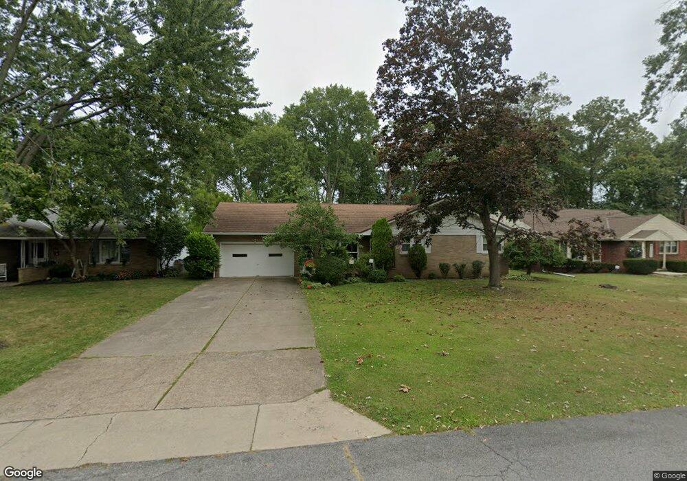
5536 Martin Ave Vermilion, OH 44089
Estimated Value: $243,711 - $282,000
3
Beds
2
Baths
1,699
Sq Ft
$155/Sq Ft
Est. Value
About This Home
This home is located at 5536 Martin Ave, Vermilion, OH 44089 and is currently estimated at $263,428, approximately $155 per square foot. 5536 Martin Ave is a home located in Erie County with nearby schools including Vermilion Elementary School, Sailorway Middle School, and Vermilion High School.
Ownership History
Date
Name
Owned For
Owner Type
Purchase Details
Closed on
Mar 5, 2009
Sold by
Parsons Donald W and Parsons Karen Rae
Bought by
Parsons Donald W and Parsons Karen Rae
Current Estimated Value
Purchase Details
Closed on
Jun 13, 2001
Sold by
Schwensen Arlys J
Bought by
Donald & Karen Parsons Trst
Create a Home Valuation Report for This Property
The Home Valuation Report is an in-depth analysis detailing your home's value as well as a comparison with similar homes in the area
Home Values in the Area
Average Home Value in this Area
Purchase History
| Date | Buyer | Sale Price | Title Company |
|---|---|---|---|
| Parsons Donald W | -- | Attorney | |
| Donald & Karen Parsons Trst | $157,000 | -- |
Source: Public Records
Mortgage History
| Date | Status | Borrower | Loan Amount |
|---|---|---|---|
| Open | Parsons Donald W | $85,000 | |
| Closed | Parsons Donald W | $100,000 |
Source: Public Records
Tax History Compared to Growth
Tax History
| Year | Tax Paid | Tax Assessment Tax Assessment Total Assessment is a certain percentage of the fair market value that is determined by local assessors to be the total taxable value of land and additions on the property. | Land | Improvement |
|---|---|---|---|---|
| 2024 | $2,212 | $61,228 | $10,811 | $50,417 |
| 2023 | $2,212 | $54,659 | $9,828 | $44,831 |
| 2022 | $2,258 | $54,663 | $9,828 | $44,835 |
| 2021 | $2,137 | $54,670 | $9,830 | $44,840 |
| 2020 | $1,788 | $46,340 | $9,830 | $36,510 |
| 2019 | $1,853 | $46,340 | $9,830 | $36,510 |
| 2018 | $1,856 | $46,340 | $9,830 | $36,510 |
| 2017 | $1,967 | $48,150 | $12,530 | $35,620 |
| 2016 | $1,955 | $48,150 | $12,530 | $35,620 |
| 2015 | $1,925 | $48,150 | $12,530 | $35,620 |
| 2014 | $2,324 | $55,980 | $12,530 | $43,450 |
| 2013 | $2,294 | $55,980 | $12,530 | $43,450 |
Source: Public Records
Map
Nearby Homes
- 1106 State St
- 1020 Sweetbriar Dr
- 880 Exchange St
- 1419 Sanford St
- 5539 South St
- 6044 Conneaut Light Dr
- 5164 Langfitt St
- 6041 Conneaut Light Dr
- 6039 Conneaut Light Dr
- Adriatic Plan at Aspire at Lighthouse Estates
- Oleander Plan at Aspire at Lighthouse Estates
- Sweet Pea Plan at Aspire at Lighthouse Estates
- Water Lily Plan at Aspire at Lighthouse Estates
- 5945 Cape Hatteras
- 5939 Cape Hatteras
- 5001 Hollyview Dr
- 1123 Adams St
- 6113 Edson St
- 5993 Montauk Point
- 4861 Woodview Dr
- 5548 Martin Ave
- 5524 Martin Ave
- 5500 Martin Ave
- 5523 Martin Ave
- 5547 Martin Ave
- 1257 State St
- 5561 Martin Ave
- 1245 State St
- 5476 Martin Ave
- 5573 Martin Ave
- 5513 Martin Ave
- 1299 State Rd
- 5481 Martin Ave
- 1299 State St
- 1215 State St
- 1256 State St
- 1260 State St
- 1250 State St
- 5525 Ingleside Ave
- 1270 State St