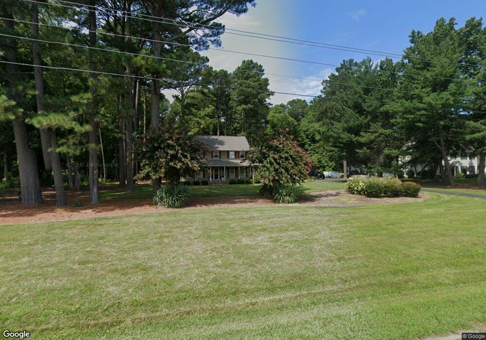
5538 N Upper Ferry Rd Salisbury, MD 21801
South Salisbury NeighborhoodEstimated Value: $438,000 - $559,000
Studio
3
Baths
2,831
Sq Ft
$174/Sq Ft
Est. Value
About This Home
This home is located at 5538 N Upper Ferry Rd, Salisbury, MD 21801 and is currently estimated at $492,980, approximately $174 per square foot. 5538 N Upper Ferry Rd is a home located in Wicomico County with nearby schools including Westside Primary School, Westside Intermediate School, and Salisbury Middle School.
Ownership History
Date
Name
Owned For
Owner Type
Purchase Details
Closed on
Aug 22, 1979
Sold by
Edwards Alice Malkus
Bought by
Laws Ronald L and Laws Cynthia B
Current Estimated Value
Home Financials for this Owner
Home Financials are based on the most recent Mortgage that was taken out on this home.
Original Mortgage
$3,727
Interest Rate
11.08%
Create a Home Valuation Report for This Property
The Home Valuation Report is an in-depth analysis detailing your home's value as well as a comparison with similar homes in the area
Home Values in the Area
Average Home Value in this Area
Purchase History
| Date | Buyer | Sale Price | Title Company |
|---|---|---|---|
| Laws Ronald L | $5,300 | -- |
Source: Public Records
Mortgage History
| Date | Status | Borrower | Loan Amount |
|---|---|---|---|
| Closed | Laws Ronald L | $3,727 |
Source: Public Records
Tax History
| Year | Tax Paid | Tax Assessment Tax Assessment Total Assessment is a certain percentage of the fair market value that is determined by local assessors to be the total taxable value of land and additions on the property. | Land | Improvement |
|---|---|---|---|---|
| 2025 | $3,391 | $385,967 | $0 | $0 |
| 2024 | $3,375 | $356,933 | $0 | $0 |
| 2023 | $3,302 | $327,900 | $52,000 | $275,900 |
| 2022 | $3,350 | $322,833 | $0 | $0 |
| 2021 | $3,131 | $317,767 | $0 | $0 |
| 2020 | $3,131 | $312,700 | $52,000 | $260,700 |
| 2019 | $3,024 | $293,700 | $0 | $0 |
| 2018 | $2,891 | $274,700 | $0 | $0 |
| 2017 | $2,749 | $255,700 | $0 | $0 |
| 2016 | $2,900 | $255,700 | $0 | $0 |
| 2015 | $2,900 | $255,700 | $0 | $0 |
| 2014 | $2,900 | $259,300 | $0 | $0 |
Source: Public Records
Map
Nearby Homes
- 5520 Cedarcrest Rd
- 26188 High Banks Dr
- 26694 Pemberton Dr
- 5814 Homestead St
- 5850 Brook St
- 5461 Loch Ness Terrace
- 5709 Royal Mile Blvd
- 26294 Evesboro Ln
- 5991 Hounds Bay Cir
- 5437 Nithsdale Dr
- 4958 Lords Creek Dr
- 26882 Pratt Rd
- 5485 Saint Andrews Dr
- 26581 Siloam Rd
- 27160 Scotland Pkwy
- 5686 N Nithsdale Dr Unit N
- 27018 Pratt Rd
- 5541 E Nithsdale Dr
- 26924 Black Horse Run
- 6229 Ayrshire Dr
- 26479 Pemberton Dr
- 5508 N Upper Ferry Rd
- 5525 N Upper Ferry Rd
- 5541 N Upper Ferry Rd
- 26503 Pemberton Dr
- 5515 N Upper Ferry Rd
- 26515 Pemberton Dr
- 26478 Pemberton Dr
- 5503 N Upper Ferry Rd
- 5536 Cedarcrest Rd
- 26454 Pemberton Dr
- 26521 Pemberton Dr
- 5508 Cedarcrest Rd
- 26490 Riverbank Rd
- 5494 Cedarcrest Rd
- 26440 Pemberton Dr
- 26434 High Banks Dr
- 26434 High Banks Dr
- 26434 High Banks Dr
- 26512 Riverbank Rd