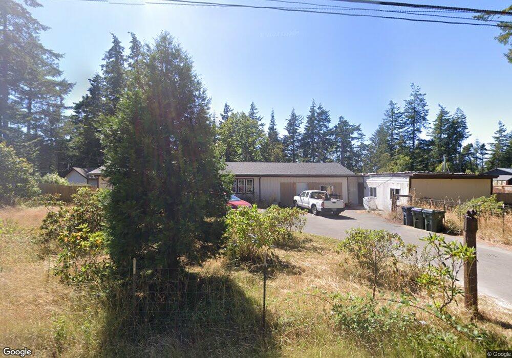
55382 Bates Rd Bandon, OR 97411
Estimated Value: $400,920 - $469,000
3
Beds
2
Baths
1,200
Sq Ft
$362/Sq Ft
Est. Value
About This Home
This home is located at 55382 Bates Rd, Bandon, OR 97411 and is currently estimated at $434,960, approximately $362 per square foot. 55382 Bates Rd is a home located in Coos County with nearby schools including Ocean Crest Elementary School, Harbor Lights Middle School, and Bandon Senior High School.
Ownership History
Date
Name
Owned For
Owner Type
Purchase Details
Closed on
Aug 11, 2014
Sold by
Thomas Harold W and Thomas Debra J
Bought by
Davasher Harold and Davasher Janet M
Current Estimated Value
Home Financials for this Owner
Home Financials are based on the most recent Mortgage that was taken out on this home.
Original Mortgage
$210,000
Outstanding Balance
$160,124
Interest Rate
4.11%
Mortgage Type
VA
Estimated Equity
$274,836
Purchase Details
Closed on
Apr 22, 2014
Sold by
Thomas Harold and Thomas Debra
Bought by
Thomas Harold and Thomas Debra
Purchase Details
Closed on
Dec 9, 2009
Sold by
Kinkead Phil
Bought by
Thomas Harold W and Thomas Debra J
Create a Home Valuation Report for This Property
The Home Valuation Report is an in-depth analysis detailing your home's value as well as a comparison with similar homes in the area
Home Values in the Area
Average Home Value in this Area
Purchase History
| Date | Buyer | Sale Price | Title Company |
|---|---|---|---|
| Davasher Harold | $225,000 | First American | |
| Thomas Harold | -- | None Available | |
| Thomas Harold W | $150,000 | Ticor Title Insurance |
Source: Public Records
Mortgage History
| Date | Status | Borrower | Loan Amount |
|---|---|---|---|
| Open | Davasher Harold | $210,000 |
Source: Public Records
Tax History Compared to Growth
Tax History
| Year | Tax Paid | Tax Assessment Tax Assessment Total Assessment is a certain percentage of the fair market value that is determined by local assessors to be the total taxable value of land and additions on the property. | Land | Improvement |
|---|---|---|---|---|
| 2024 | $1,544 | $185,970 | -- | -- |
| 2023 | $1,503 | $180,560 | $0 | $0 |
| 2022 | $1,493 | $175,310 | $0 | $0 |
| 2021 | $1,453 | $170,210 | $0 | $0 |
| 2020 | $1,381 | $170,210 | $0 | $0 |
| 2019 | $1,315 | $160,450 | $0 | $0 |
| 2018 | $1,267 | $155,780 | $0 | $0 |
| 2017 | $1,236 | $151,250 | $0 | $0 |
| 2016 | $1,433 | $146,850 | $0 | $0 |
| 2015 | $1,664 | $134,840 | $0 | $0 |
| 2014 | $1,266 | $123,063 | $0 | $0 |
Source: Public Records
Map
Nearby Homes
- 1135 1st St NE
- 1113 1st St SE
- 1105 1st St NE
- 501 North Ave
- 705 Ohio Ave NE
- 89 Michigan Ave NE
- 0 28s-14w-19dd 2200 Unit 779404816
- 88579 Highway 42 S
- 454 Michigan Ave NE
- 0 1st St SE Unit 7801 24397077
- 0 1st St SE Unit 7800 24079518
- 0 1st St SE Unit 7800,01 24310339
- 0 28s-14w-19dd 2000 Unit 186087382
- 950 1st St NE
- 925 1st St NE
- 576 Klamath Ave NE Unit 1101
- 890 2nd St SE
- 0 9th St NE Unit 7-10 24484508
- 0 12th Ct SE Unit 106410149
- 830 3rd St SE
- 55402 Bates Rd
- 55370 Bates Rd
- 55423 Bates Rd
- 88211 Highway 42 S
- 88347 Highway 42 S
- 88347 Highway 42 S
- 55319 Bates Rd
- 55460 Bates Rd
- 55474 Bates Rd
- 88304 Highway 42 S
- 55476 Bates Rd
- 88216 Highway 42 S
- 88326 Highway 42 S
- 88312 Highway 42 S
- 88360 Highway 42 S
- 55478 Bates Rd
- 1190 Division St SE
- 1197 1st St SE
- 88400 Highway 42 S